- Home
- Contest 2021
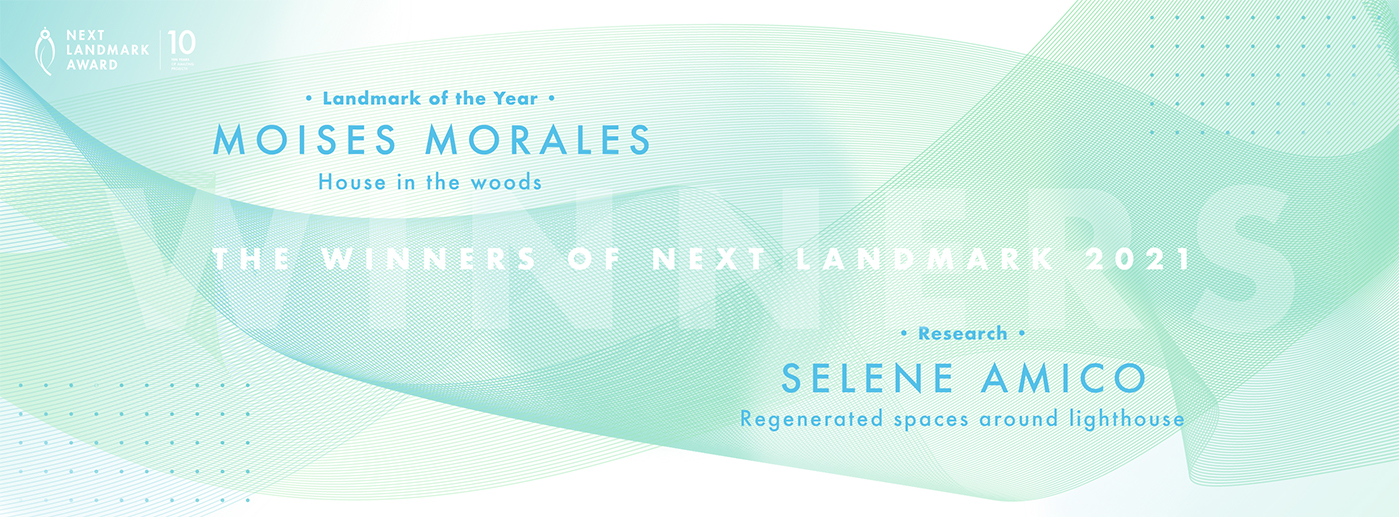
- Winners 2021
WINNER OF LANDMARK OF THE YEAR
Moises Morales
Name / Surname: Moises Morales
Country:
Team:
Company: W.E.Y.E.S Estudio
Project Description:
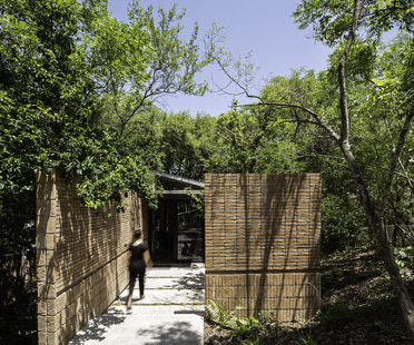
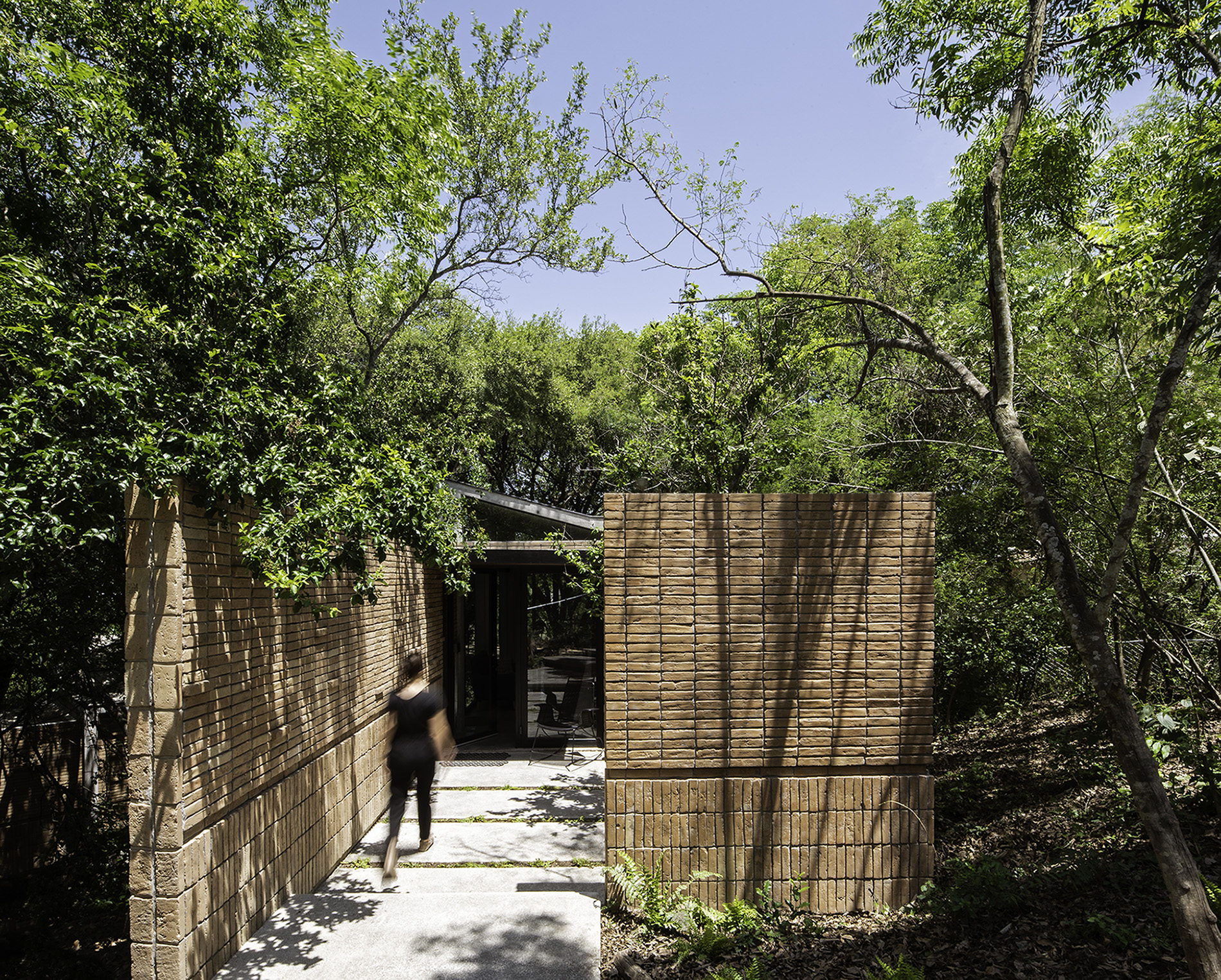
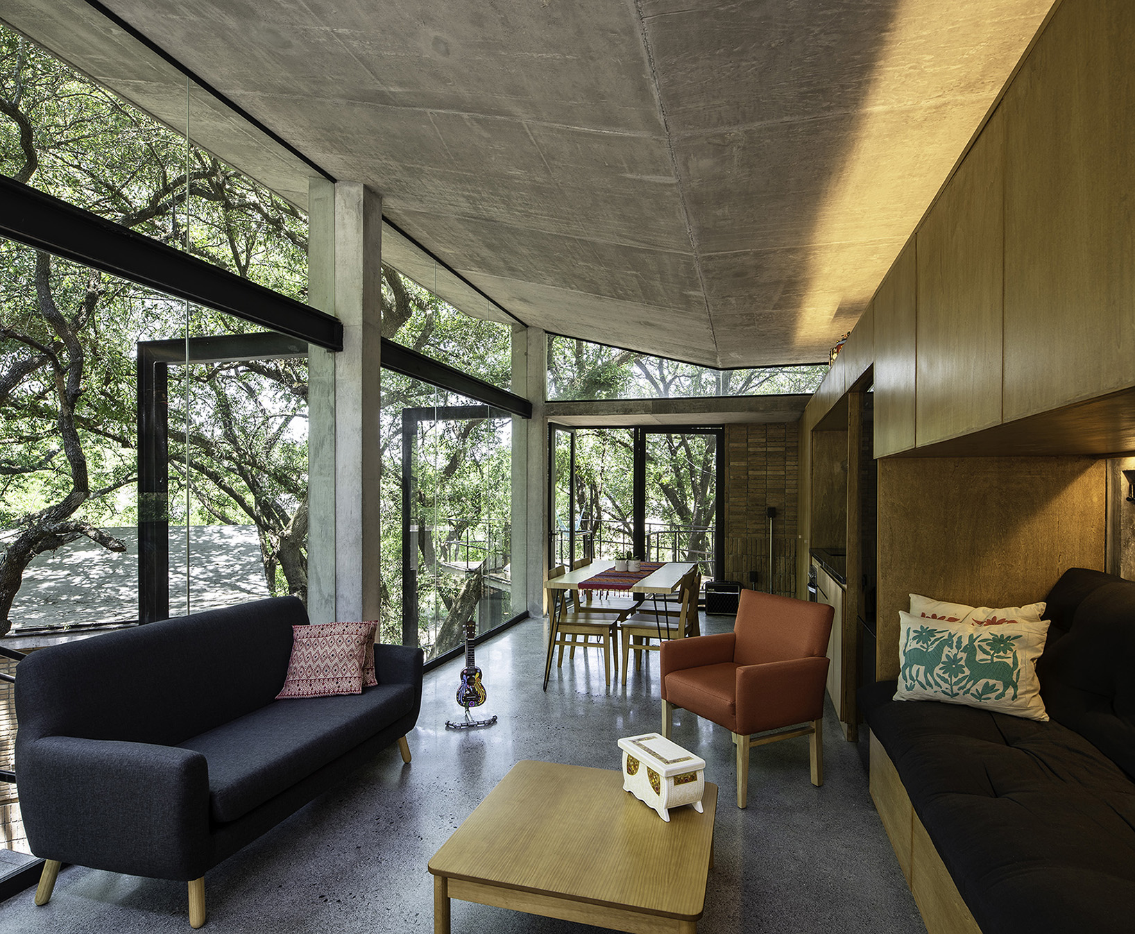
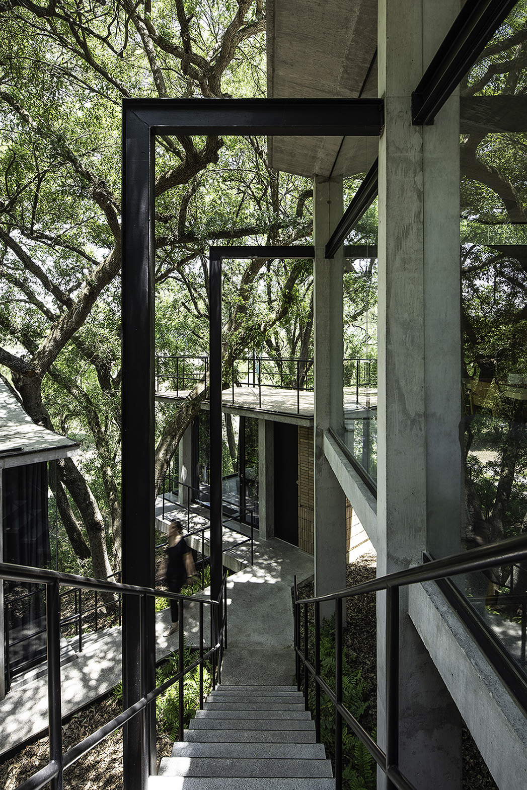
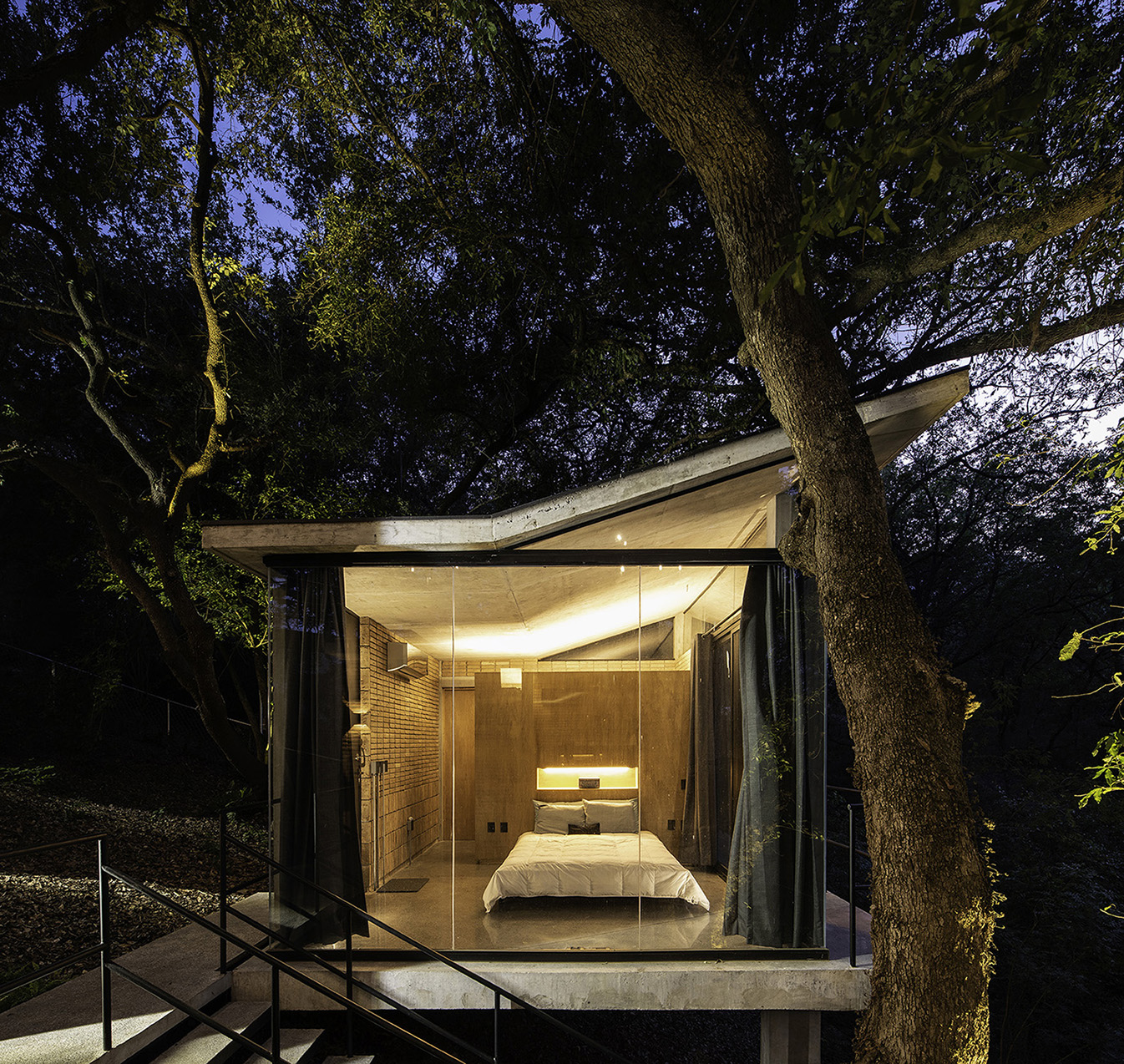
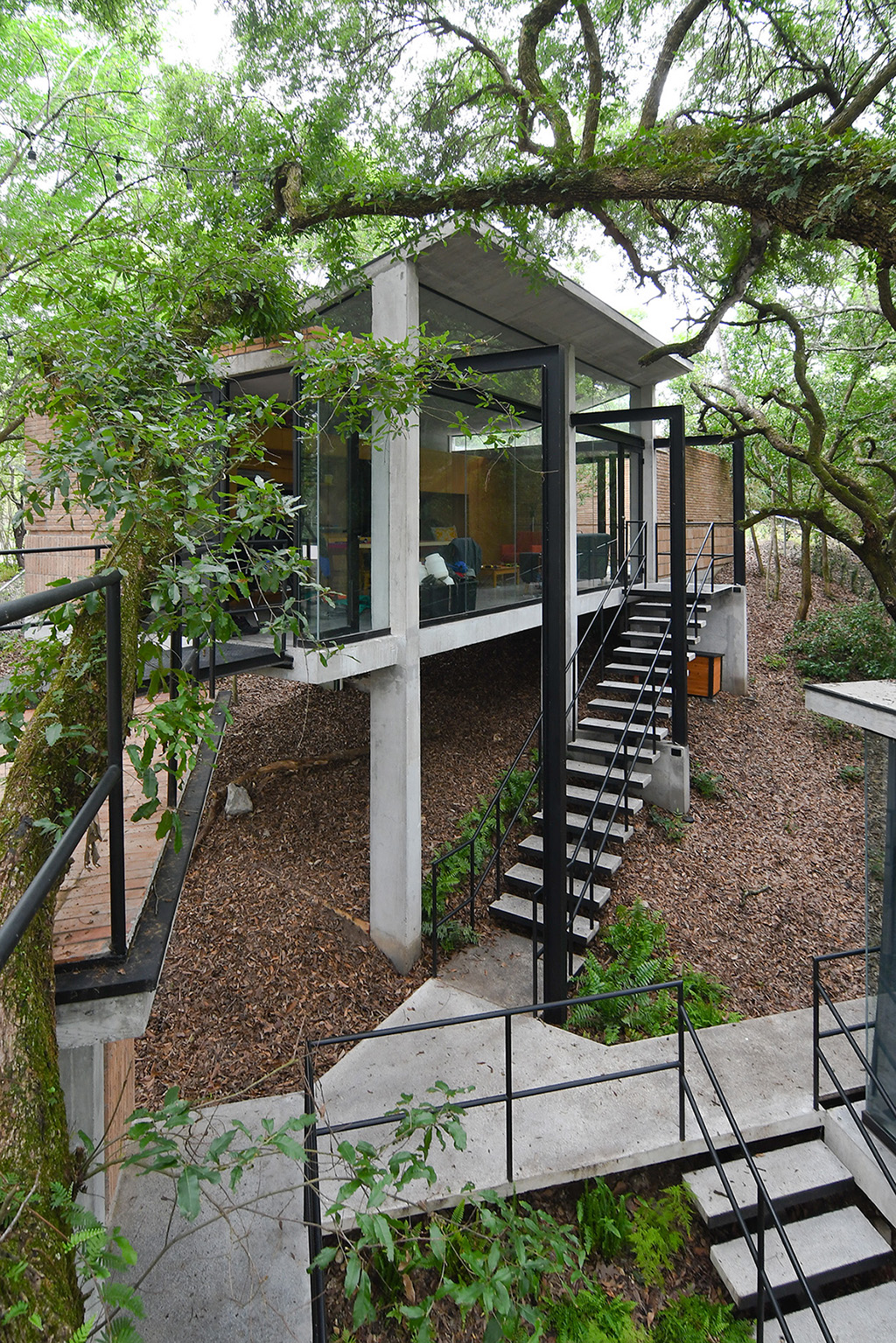
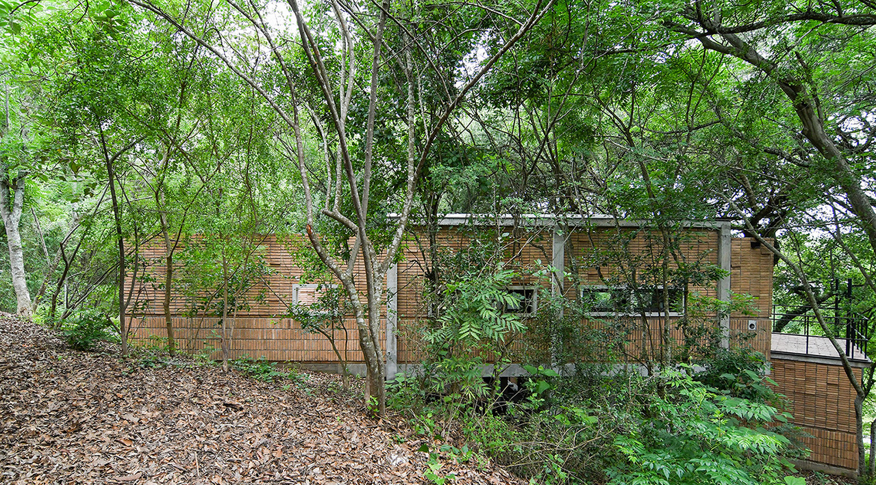
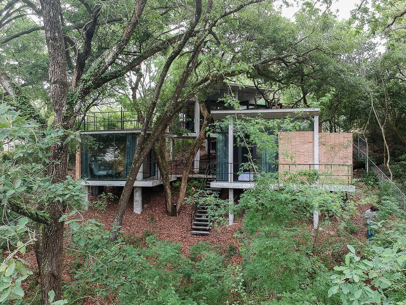
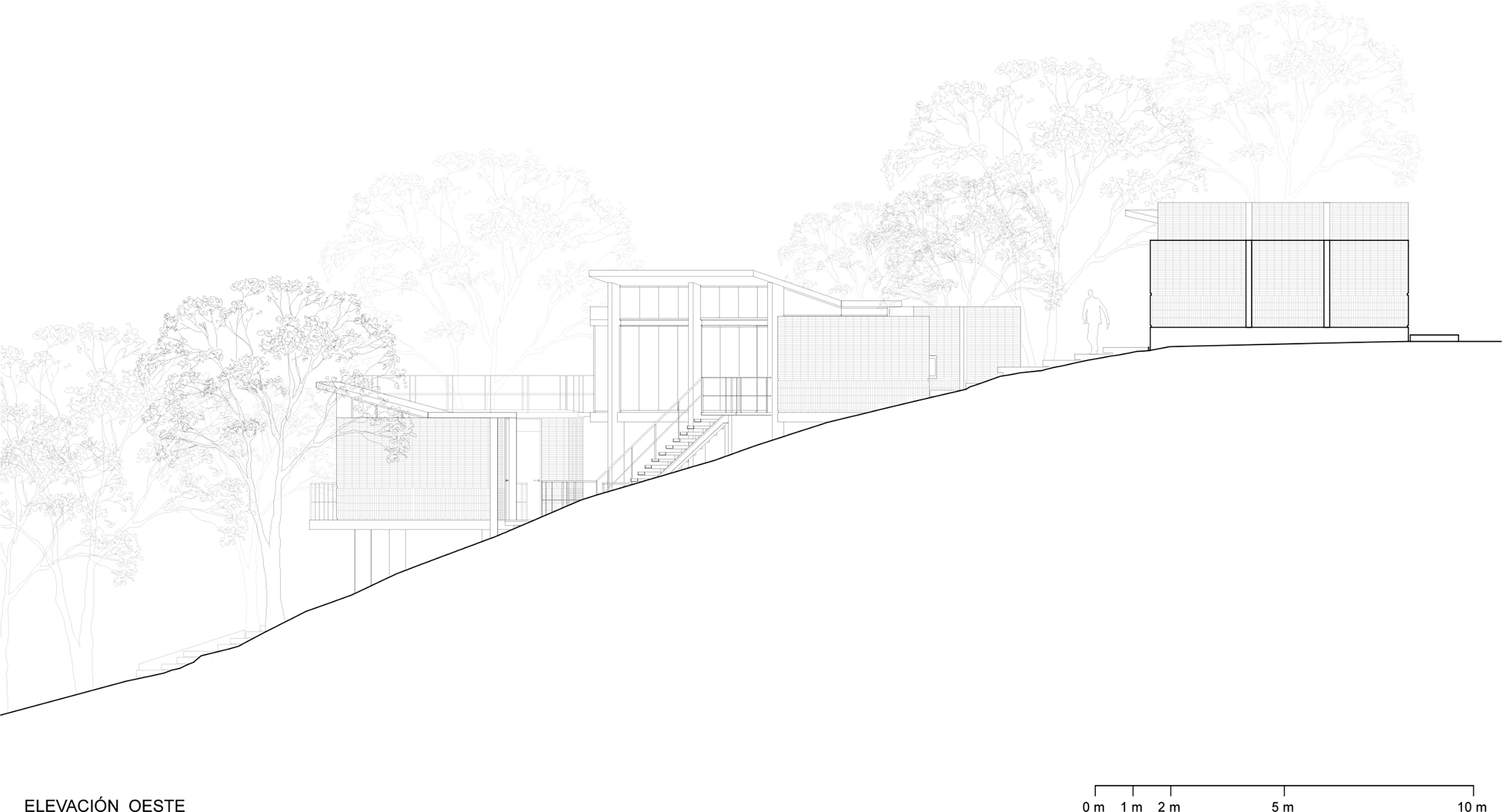
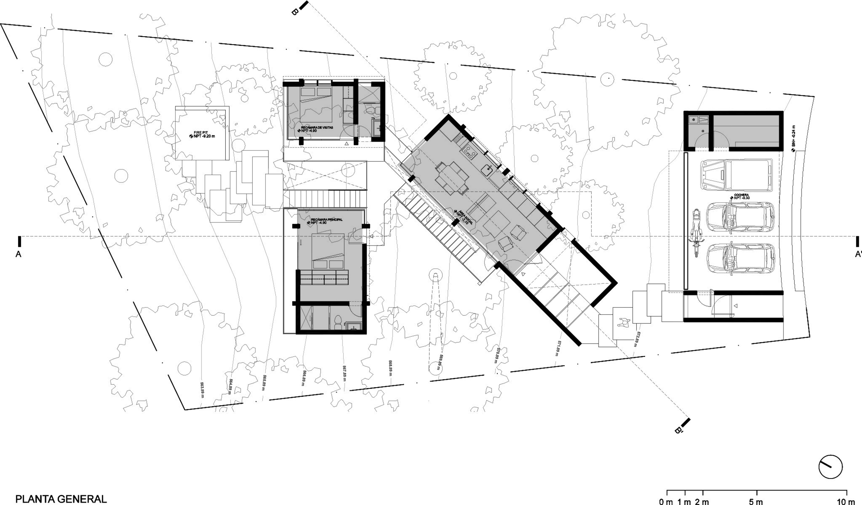
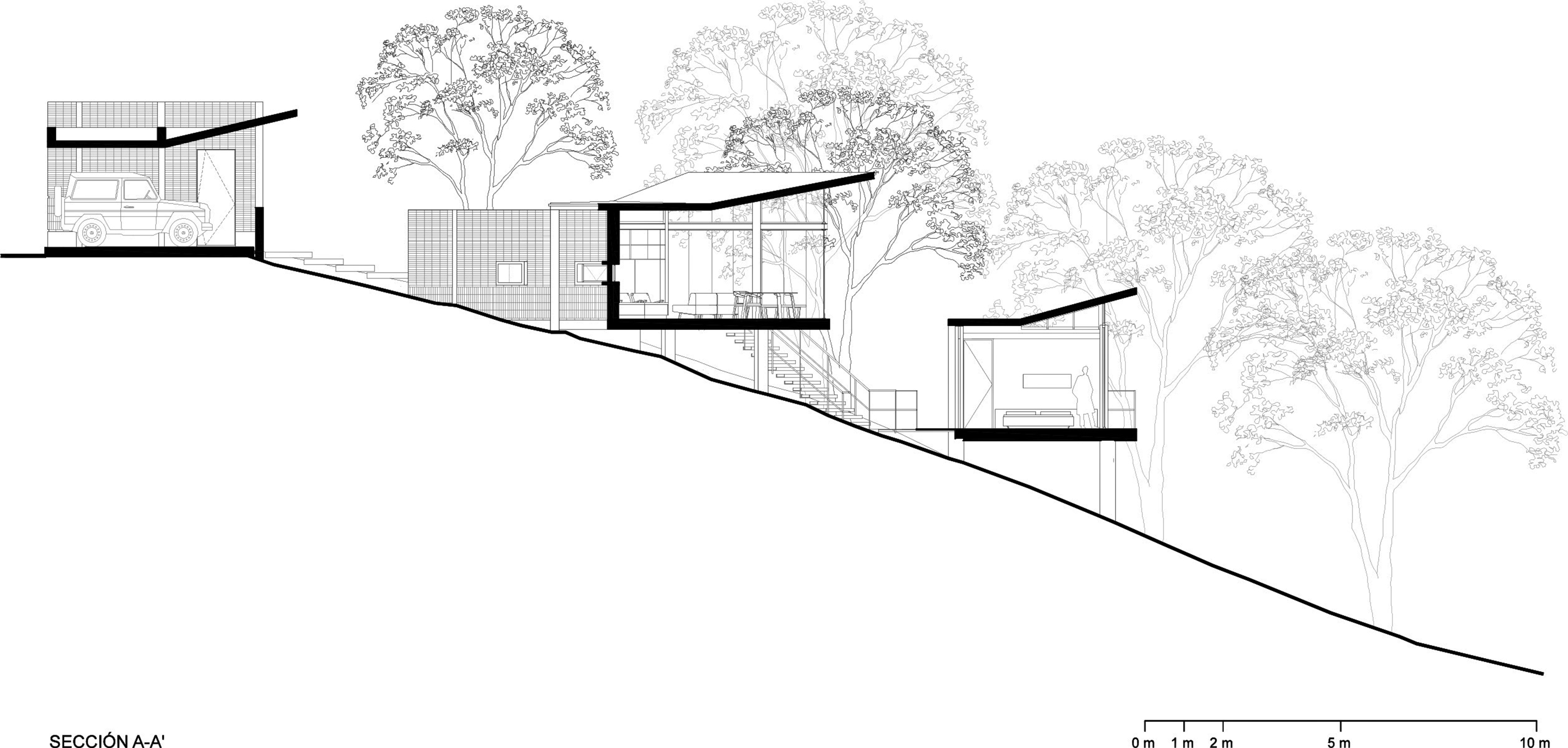
Casa en el Bosque is single family house, indeed, not the traditional family home. Physically the program is fragmented in pavilions, linked by exterior walkways, blended with the forest, covered by the treetops and floated off the ground.
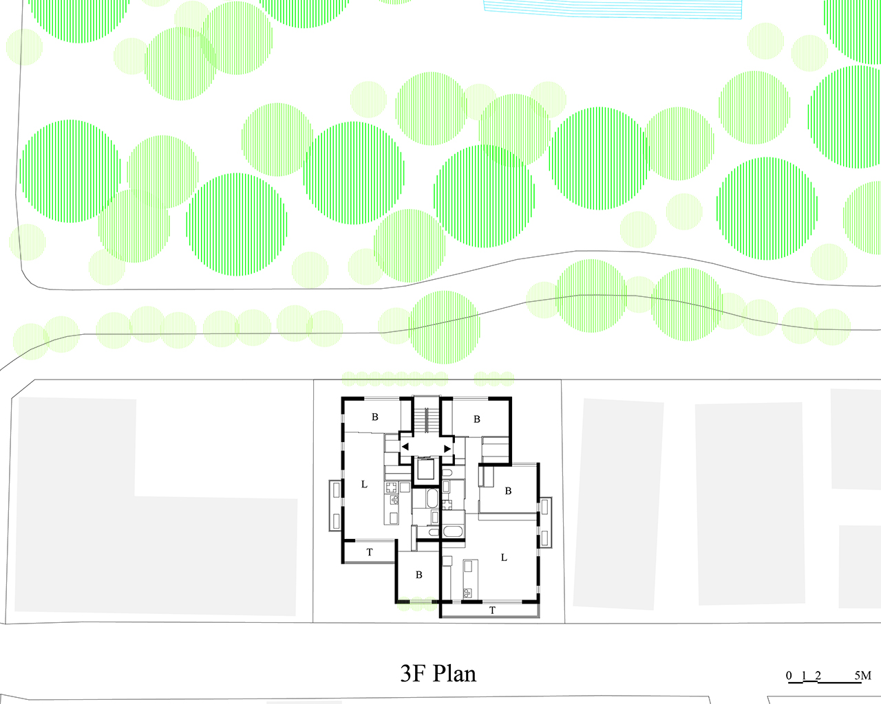
Located in a residential area in the municipality of Santiago, Nuevo León. Casa en el Bosque is a home that dialogues, blends with and interacts in symbiosis alongside its natural environment. Placed on a plot of 690.38 m2, with a slope of 28% to 35%, is distributed in a program of four high volumes connected by stairs, corridors and exterior bridges that respect the topography and original vegetation of the site.
In order to interact naturally with the environment and work with the slope of the terrain the layout was broken down distributing the square meters in independent pavilions. The location of the volumes was guided by trees and roots, each one was located to safeguard the seventeen trees that inhabited the site originally. The outer connectors release square meters, leaving more free area to the vegetation, and encourage the user's continued interaction with the outdoors. There are four pavilions that accommodate: a garage and storage; a social pavilion with a terrace and an interior patio; a private resting pavilion and a private pavilion for visits.
The project has as a principle to achieve the MINIMUM FOOTPRINT, understanding that the forest is one of the main sources of air purification and water filtration that contributes to the water reservoirs of the region.
In the project from concept to the final design we want to transform the status quo and became the turning point for an alternative independent way of life.
Name / Surname: Moises Morales
Country:
Team:
Company: W.E.Y.E.S Estudio
Project Description:
Casa en el Bosque is single family house, indeed, not the traditional family home. Physically the program is fragmented in pavilions, linked by exterior walkways, blended with the forest, covered by the treetops and floated off the ground.
Located in a residential area in the municipality of Santiago, Nuevo León. Casa en el Bosque is a home that dialogues, blends with and interacts in symbiosis alongside its natural environment. Placed on a plot of 690.38 m2, with a slope of 28% to 35%, is distributed in a program of four high volumes connected by stairs, corridors and exterior bridges that respect the topography and original vegetation of the site.
In order to interact naturally with the environment and work with the slope of the terrain the layout was broken down distributing the square meters in independent pavilions. The location of the volumes was guided by trees and roots, each one was located to safeguard the seventeen trees that inhabited the site originally. The outer connectors release square meters, leaving more free area to the vegetation, and encourage the user's continued interaction with the outdoors. There are four pavilions that accommodate: a garage and storage; a social pavilion with a terrace and an interior patio; a private resting pavilion and a private pavilion for visits.
The project has as a principle to achieve the MINIMUM FOOTPRINT, understanding that the forest is one of the main sources of air purification and water filtration that contributes to the water reservoirs of the region.
In the project from concept to the final design we want to transform the status quo and became the turning point for an alternative independent way of life.
Comment Floornature editorial staff:
“A project demonstrating symbiosis and respect for nature, taking an innovative approach to spatial composition in its construction. Four volumes isolated from the ground and connected by outdoor stairways, corridors and bridges, without altering the topography or vegetation of the site. An open home based on the philosophy of nature-based solutions (NBS), in which functions are perfectly integrated into the natural element. The project report clearly reveals the architect’s intention of making a minimal footprint, because the forest in which Casa en el Bosque stands is one of the most important sources for purification of the air and filtering of the water that goes into the region’s reservoirs. A responsibly and sustainably managed project that rethinks both private space and consolidation of the environment belonging to the community”
WINNER OF RESEARCH
Selene Amico
Name / Surname: Selene Amico
Country:
Team:
Company:
Project Description:
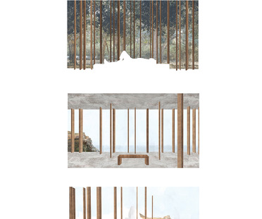
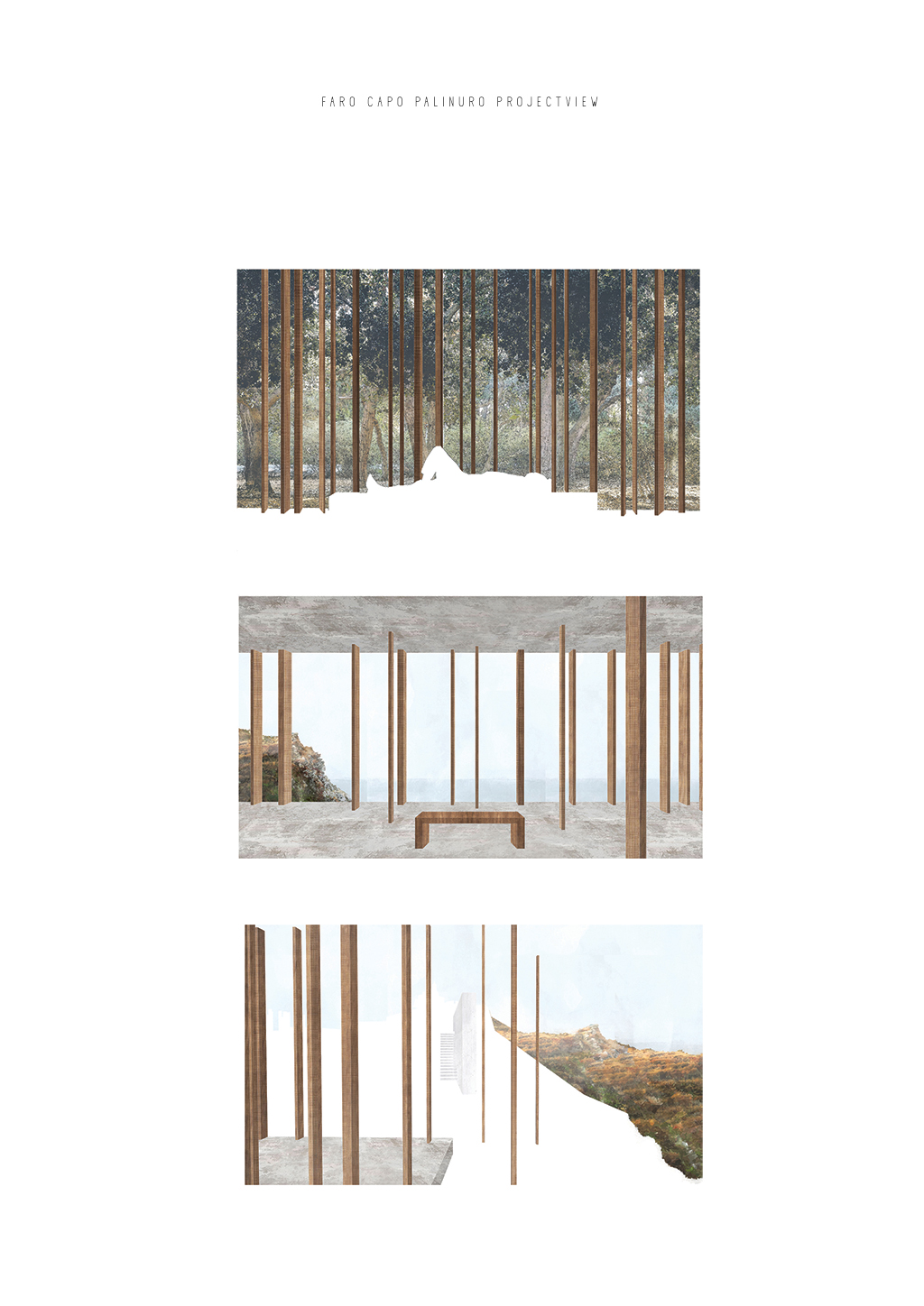
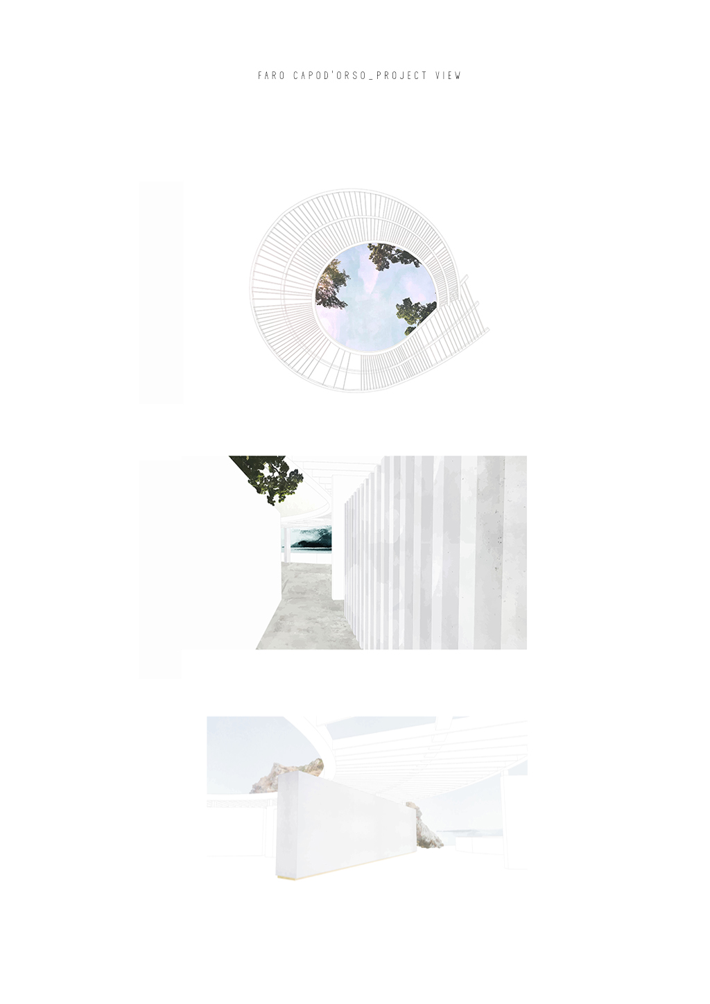
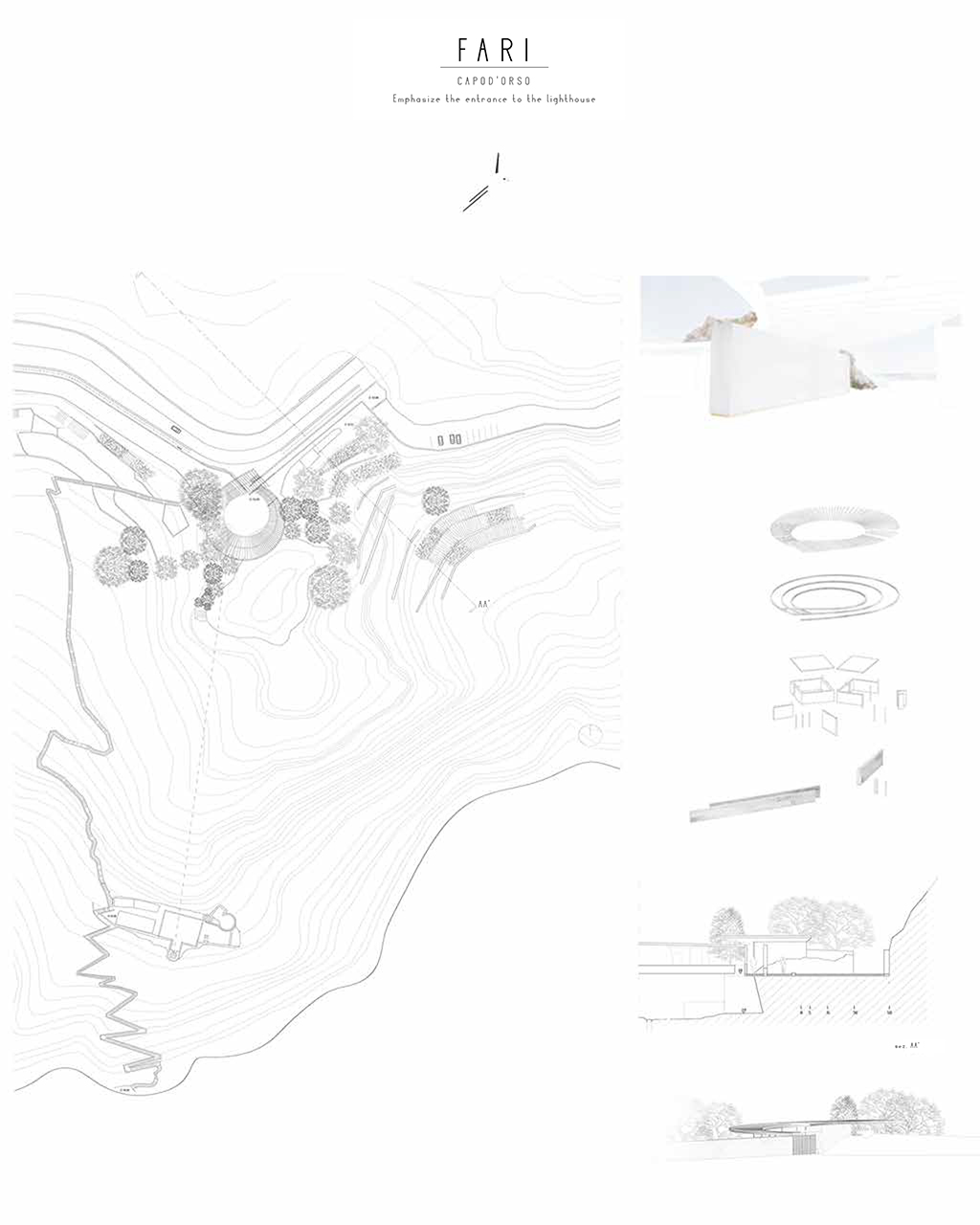
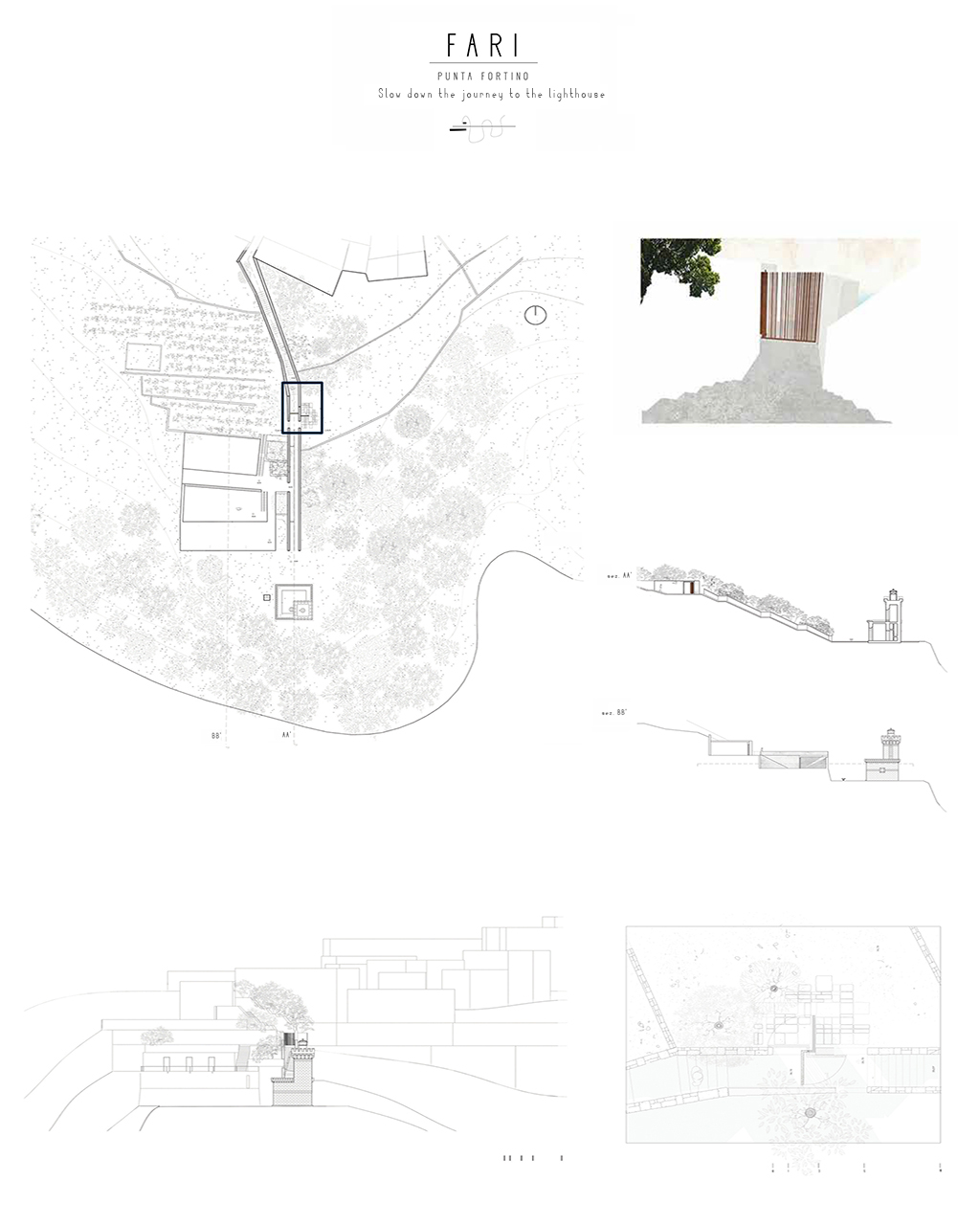
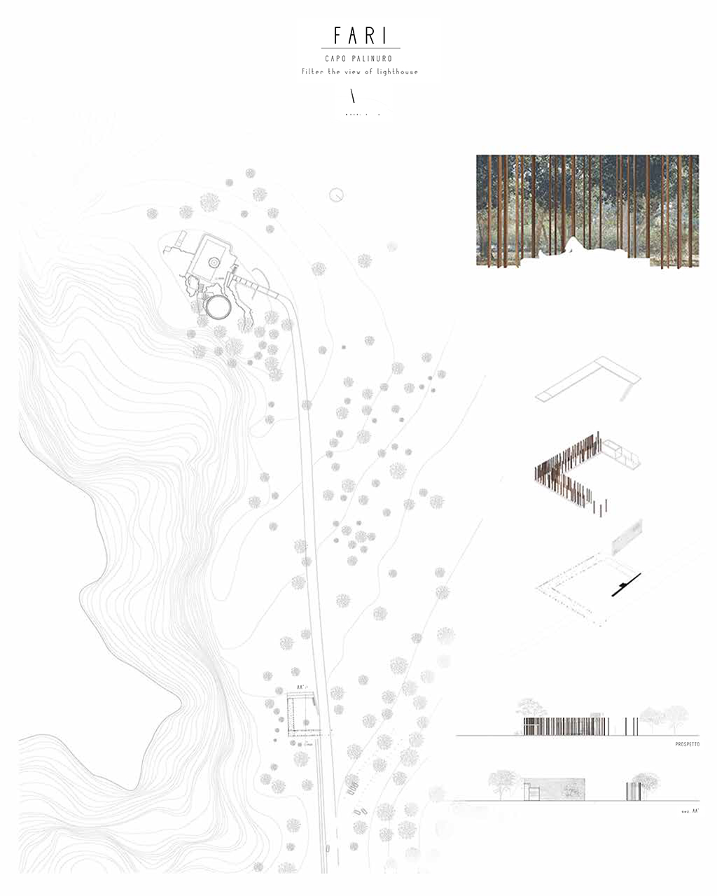
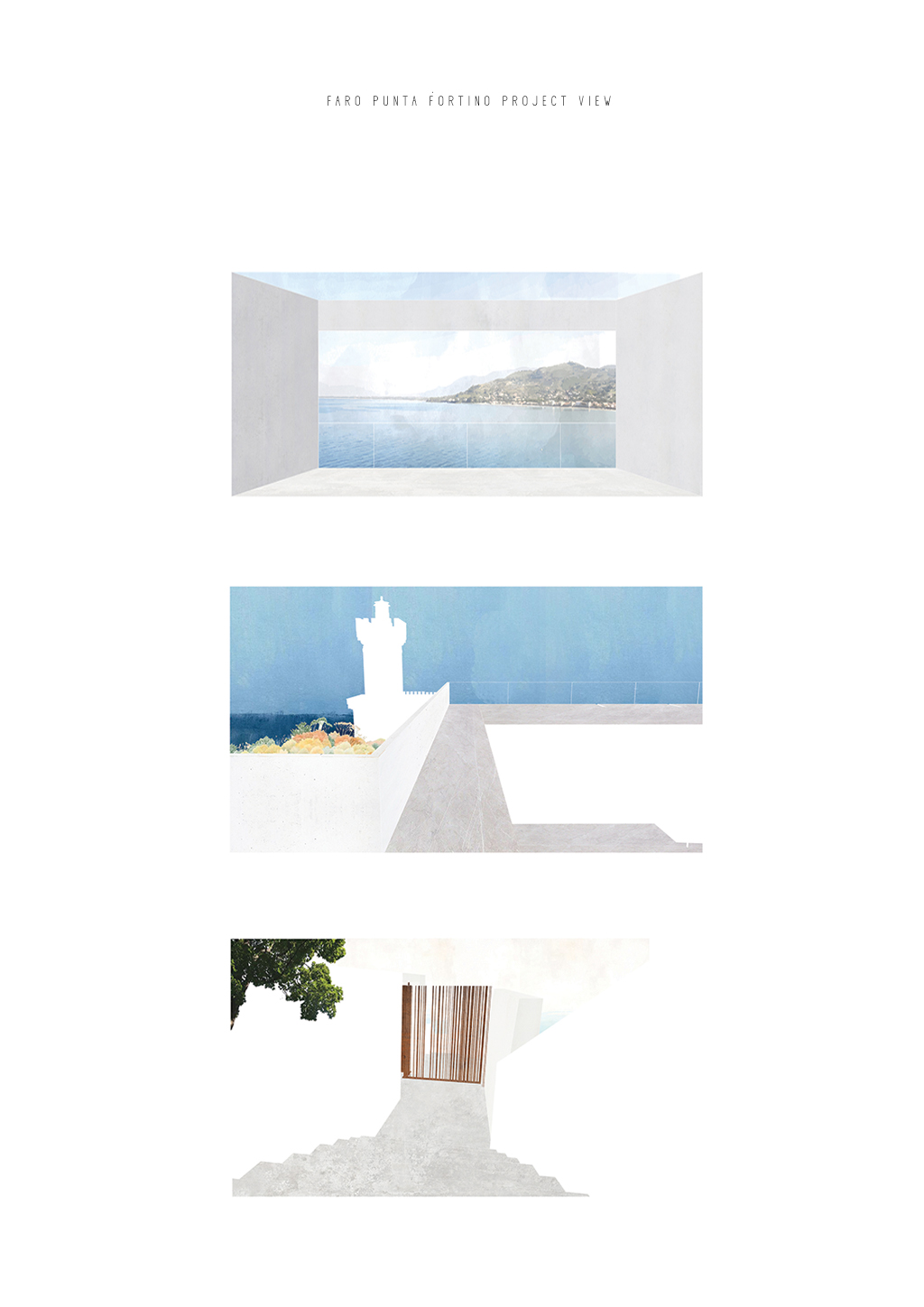
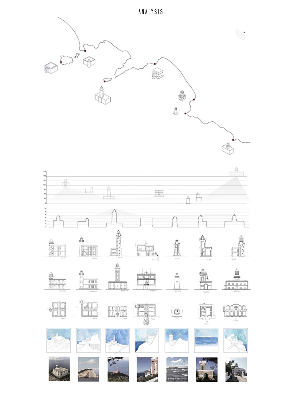
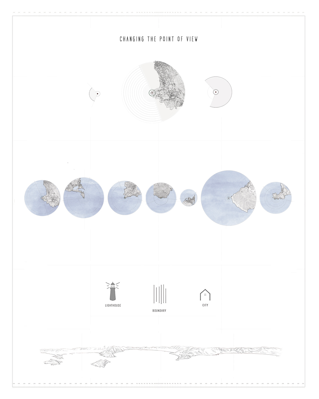
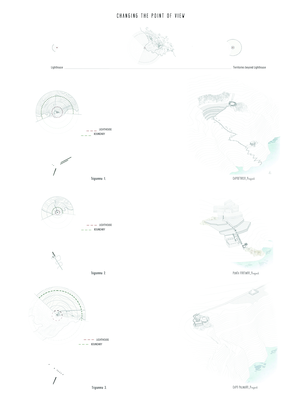
Generated by the high maintenance costs and the growing use of electronic navigation systems, the decrease in the number of functioning lighthouses is likely to undermine the centrality of an architectural element that has always contributed to the identity of coastal areas, symbol of collective memory. In this study we present a scenario in which the role of the lighthouse element is empowered, focusing both on the enhancement of the unexpressed resources of lighthouse territories and on their potential to generate local economies as part of transnational networks. We classify the lighthouses in the Campania region, exploring the architectural element and their technological functioning, as well as the system of relations with the territory. Future perspectives are identified investigating both the landscape scale of the mutual relationship between lighthouse and territory and the architectural scale of reading the available materials. The existence of a lighthouse territory, concealed but present in every case study, becomes the assumption of the project. The analysis in the architectural project is aimed to recognize and highlight these territories and their boundaries, which can represent an essential trigger for a new lighthouse economy. On the geographical areas in which the different lighthouses and headlands exist, we witness an assonance of meanings, exemplified in the pursuit of the oriental concept of MA (間), pause.Three case studies, chosen as examples of different conditions, in which the MA has been experimented through precise declinations, show that the project of the threshold spaces of the headlands is instrumental to the recognition of local specificities and to the subsequent sourcing of opportunities in economies based on cultural experiences.
Name / Surname: Selene Amico
Country:
Team:
Company:
Project Description:
Generated by the high maintenance costs and the growing use of electronic navigation systems, the decrease in the number of functioning lighthouses is likely to undermine the centrality of an architectural element that has always contributed to the identity of coastal areas, symbol of collective memory. In this study we present a scenario in which the role of the lighthouse element is empowered, focusing both on the enhancement of the unexpressed resources of lighthouse territories and on their potential to generate local economies as part of transnational networks. We classify the lighthouses in the Campania region, exploring the architectural element and their technological functioning, as well as the system of relations with the territory. Future perspectives are identified investigating both the landscape scale of the mutual relationship between lighthouse and territory and the architectural scale of reading the available materials. The existence of a lighthouse territory, concealed but present in every case study, becomes the assumption of the project. The analysis in the architectural project is aimed to recognize and highlight these territories and their boundaries, which can represent an essential trigger for a new lighthouse economy. On the geographical areas in which the different lighthouses and headlands exist, we witness an assonance of meanings, exemplified in the pursuit of the oriental concept of MA (間), pause.Three case studies, chosen as examples of different conditions, in which the MA has been experimented through precise declinations, show that the project of the threshold spaces of the headlands is instrumental to the recognition of local specificities and to the subsequent sourcing of opportunities in economies based on cultural experiences.
Comment Floornature editorial staff:
“A project, supported by a wide-ranging analysis, for reclamation of the architecture and landscape of a form of architecture seemingly in decline: the lighthouse. The study focuses on the region of Campania, in Italy, redeveloping and rethinking the territorial and cultural footprint of these symbols of collective memory and identity in coastal areas. A regeneration project that supports the landscape with new ways of using the existing built heritage, on an urban and architectural scale, to give form to a new or restored network of proximity serving the community. Three case studies demonstrating how important the design of spaces on the threshold of promontories, such as lighthouses, can be for recognition of specific local features and for the subsequent response to opportunities in economies based on the experience of culture and landscape
LANDMARK OF THE YEAR FINALIST PROJECTS
Cesar Heredia
Name / Surname: Cesar Heredia
Country:
Team:
Company: Transversal
Project Description:
Urban Agriculture Laboratory – Chihuahua, México
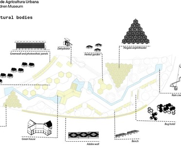
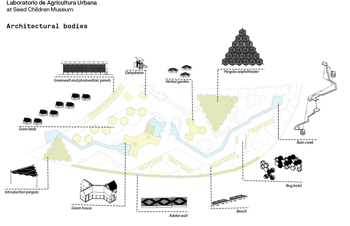
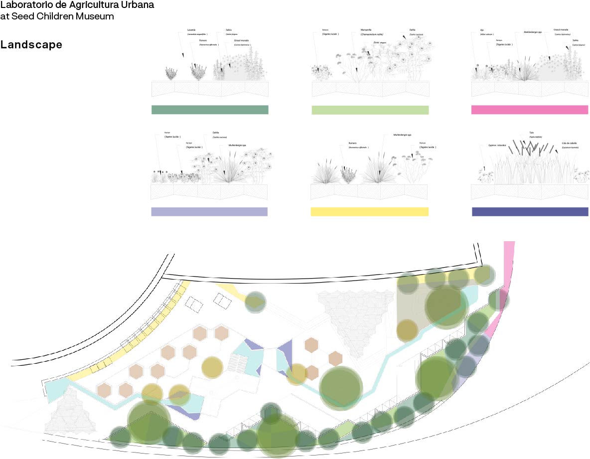
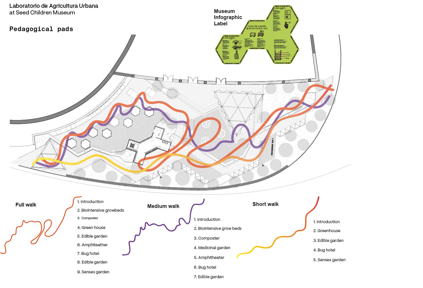
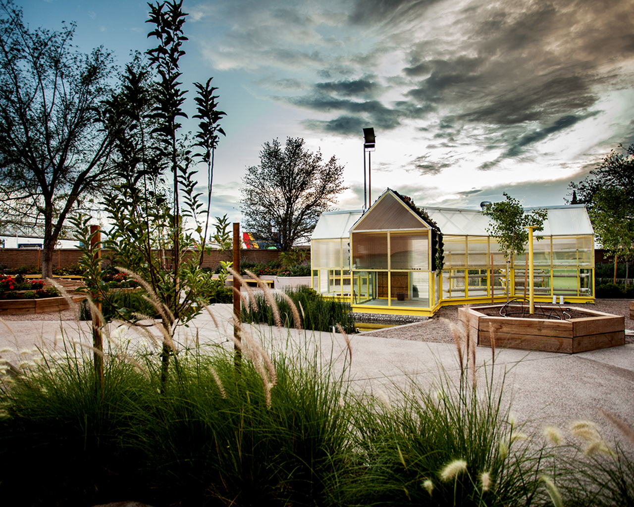
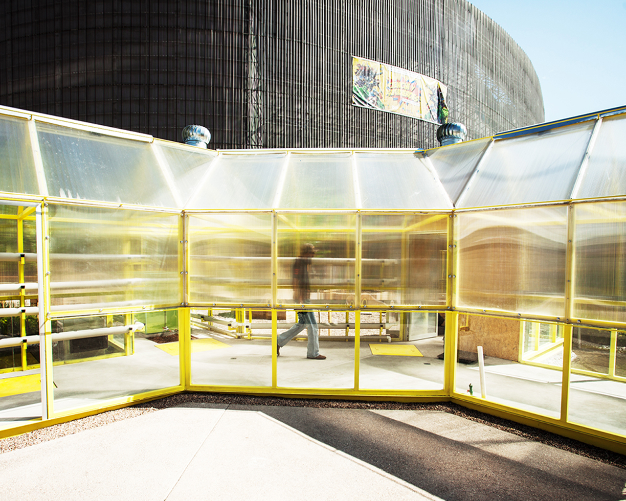
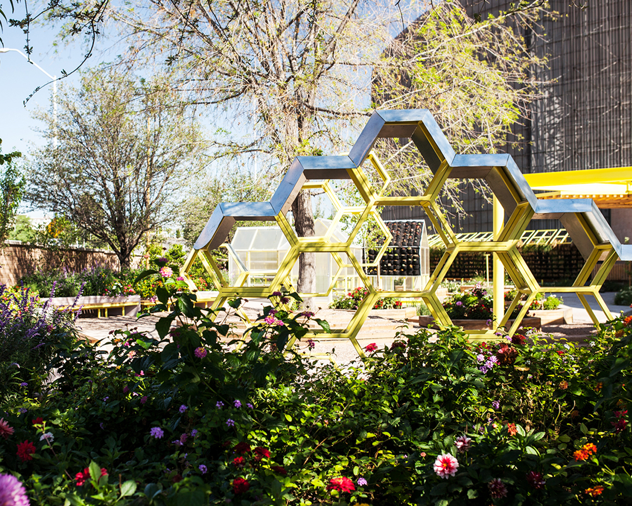
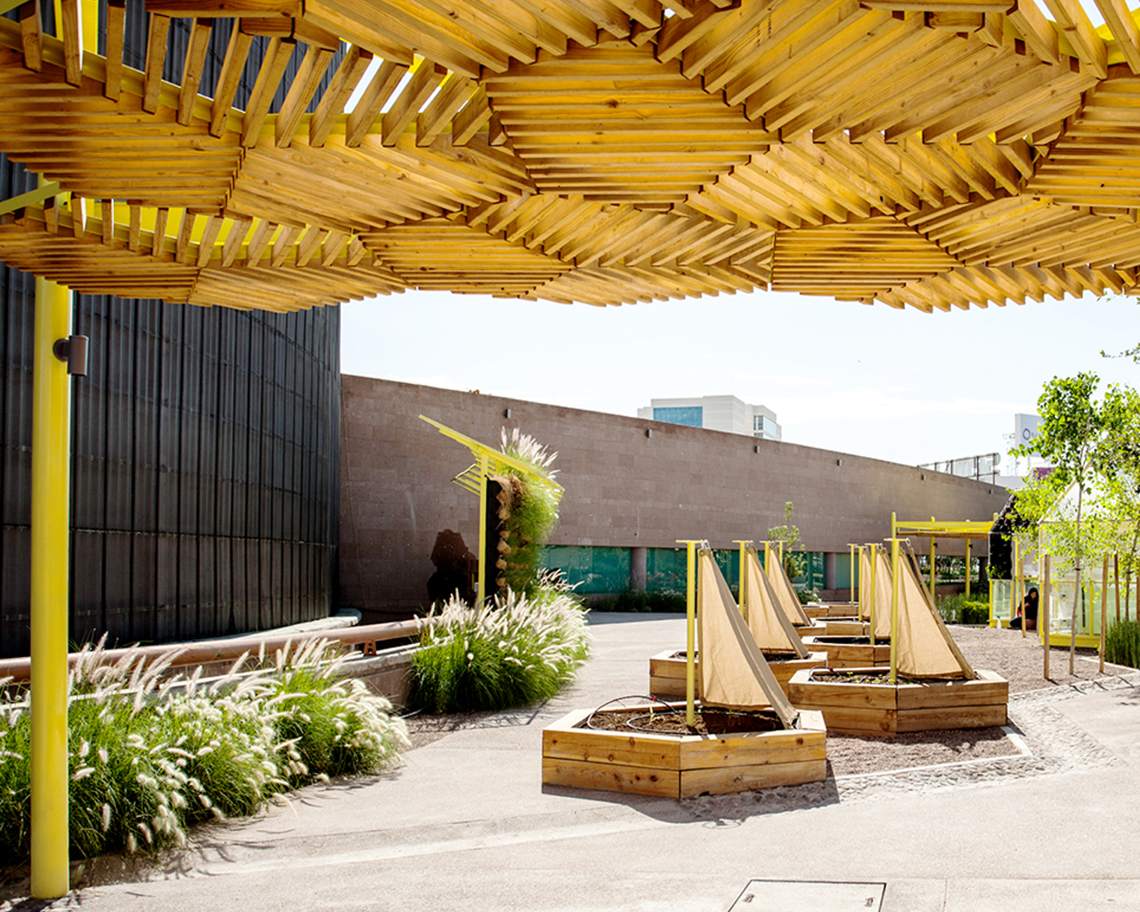
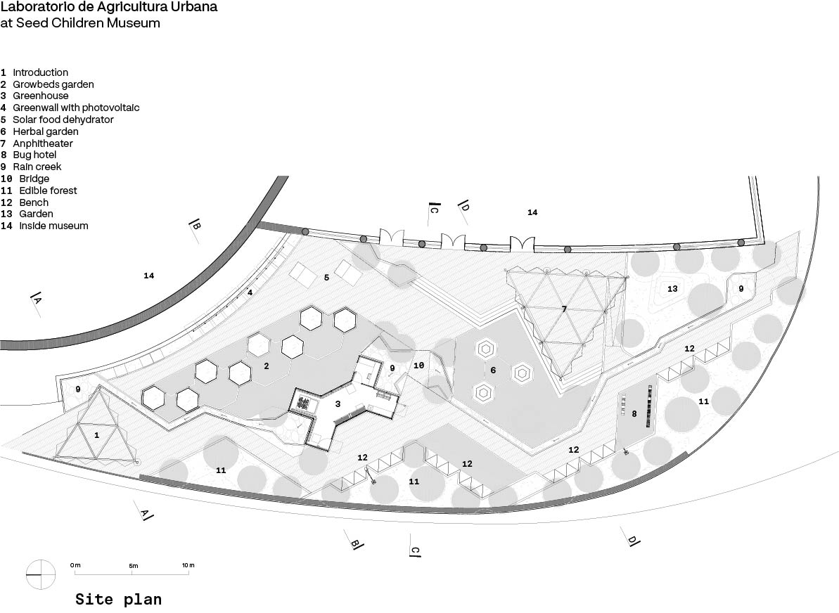
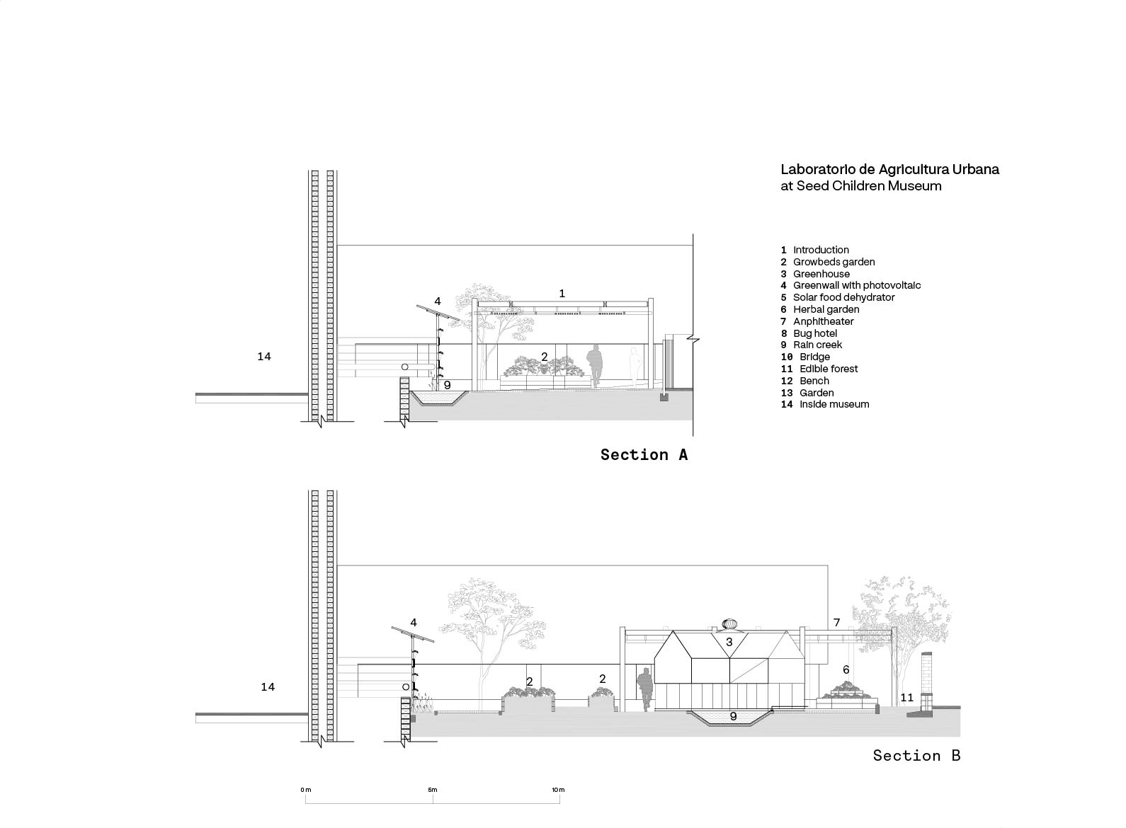
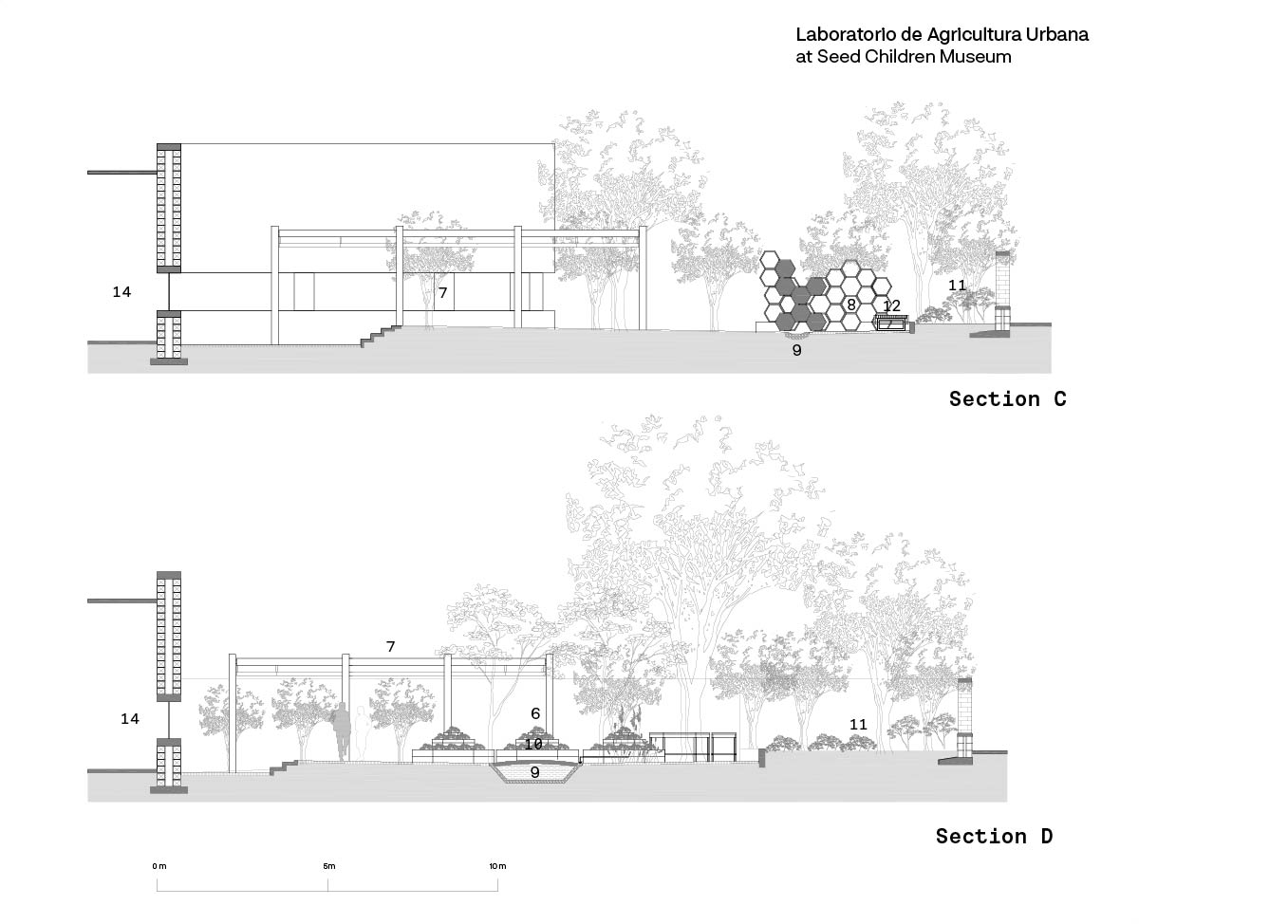
Located at the Children's Museum “Semilla” (seed) in Chihuahua City (MX) downtown area and next to Chuvíscar River, the project proposes the transformation of the traditional “white box” museum gallery into a place for experimentation and collective appropriation: a pedagogical and civic encounter space around urban agriculture, permaculture and the observation of natural phenomena. The project sought to recognize the urban context by integrating several elements such as an adobe wall that reinforces the local character and a stone-made seasonal stream (that works with rain water) that emulates the nowadays-piped Río Chuvíscar. On this new territory the natural element stands out: 38 different plant species carefully selected and 6 previously existing trees. In the middle of this “green mass” a collection of succinct architectural bodies fabricated in yellow metal and pine wood appear: the plaza and access pergola, the biointensive cultivation orchards, the green wall with photovoltaic cells, dehydrators and compost bins area; the aromatic and medicinal herb garden, the multifunctional forum, rest /gather areas, the fruit orchard and the insect hotel. At the heart of the laboratory is the greenhouse that shelters hydroponics and aquaponics system inside including a large fish tank. A series of large bed/benches on the edge of the fruit orchard complete the laboratory areas. Each possible learning-teaching activity around urban agriculture and natural phenomena observation has been imagined during the design process, hence the openness of the structures and forms. We believe this project is a device for provocation, to trigger imagination and the deployment of the transformation of the urban space beyond the adobe wall.
Name / Surname: Cesar Heredia
Country:
Team:
Company: Transversal
Project Description:
Urban Agriculture Laboratory – Chihuahua, México
Located at the Children's Museum “Semilla” (seed) in Chihuahua City (MX) downtown area and next to Chuvíscar River, the project proposes the transformation of the traditional “white box” museum gallery into a place for experimentation and collective appropriation: a pedagogical and civic encounter space around urban agriculture, permaculture and the observation of natural phenomena. The project sought to recognize the urban context by integrating several elements such as an adobe wall that reinforces the local character and a stone-made seasonal stream (that works with rain water) that emulates the nowadays-piped Río Chuvíscar. On this new territory the natural element stands out: 38 different plant species carefully selected and 6 previously existing trees. In the middle of this “green mass” a collection of succinct architectural bodies fabricated in yellow metal and pine wood appear: the plaza and access pergola, the biointensive cultivation orchards, the green wall with photovoltaic cells, dehydrators and compost bins area; the aromatic and medicinal herb garden, the multifunctional forum, rest /gather areas, the fruit orchard and the insect hotel. At the heart of the laboratory is the greenhouse that shelters hydroponics and aquaponics system inside including a large fish tank. A series of large bed/benches on the edge of the fruit orchard complete the laboratory areas. Each possible learning-teaching activity around urban agriculture and natural phenomena observation has been imagined during the design process, hence the openness of the structures and forms. We believe this project is a device for provocation, to trigger imagination and the deployment of the transformation of the urban space beyond the adobe wall.
LANDMARK OF THE YEAR FINALIST PROJECTS

Yoshitaka Uchino
Name / Surname: Yoshitaka Uchino
Country:
Team:
Company: YDS
Project Description:
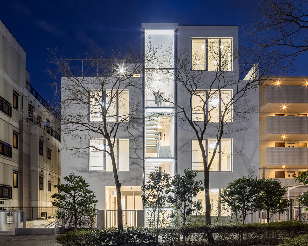
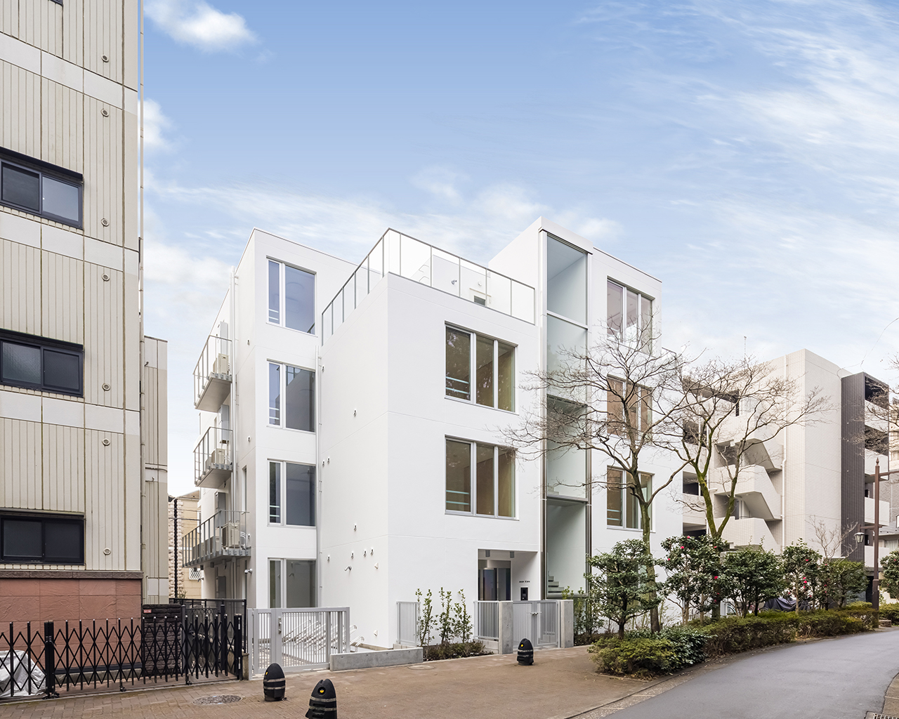
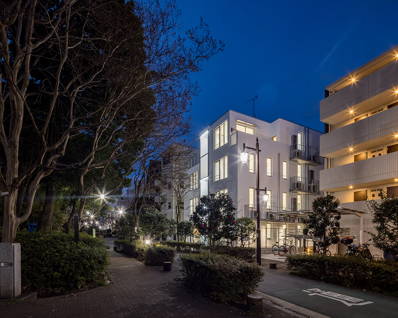
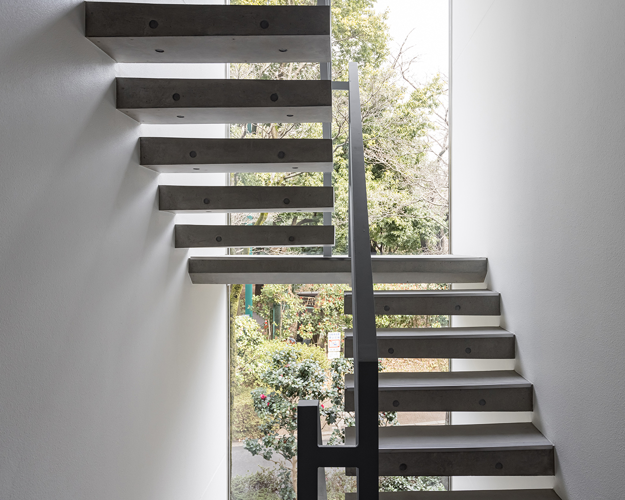
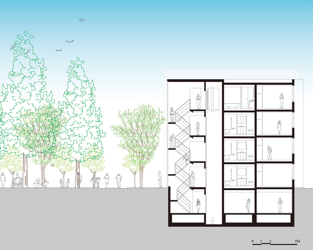
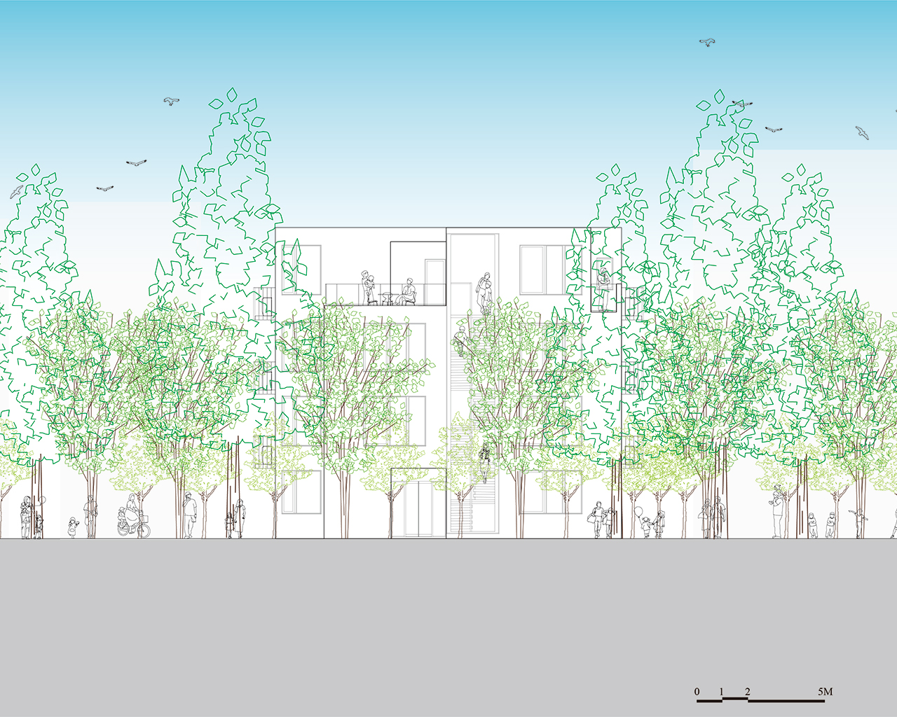
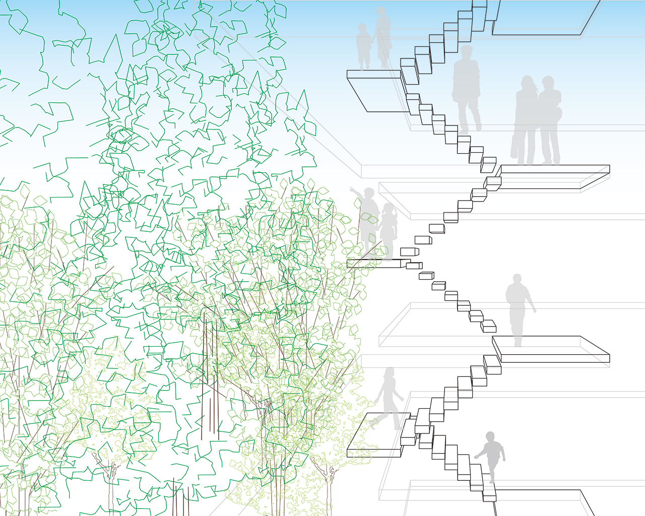
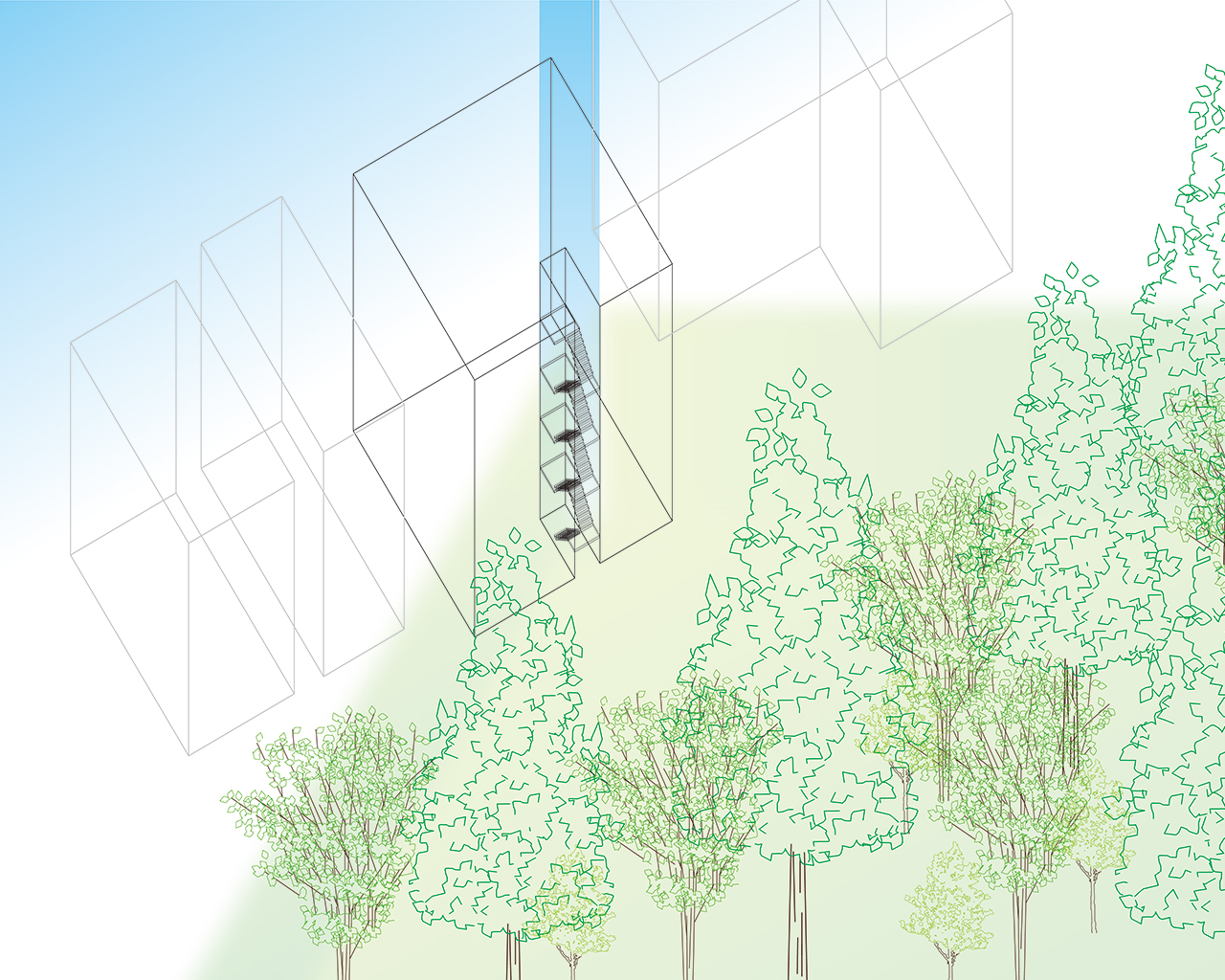
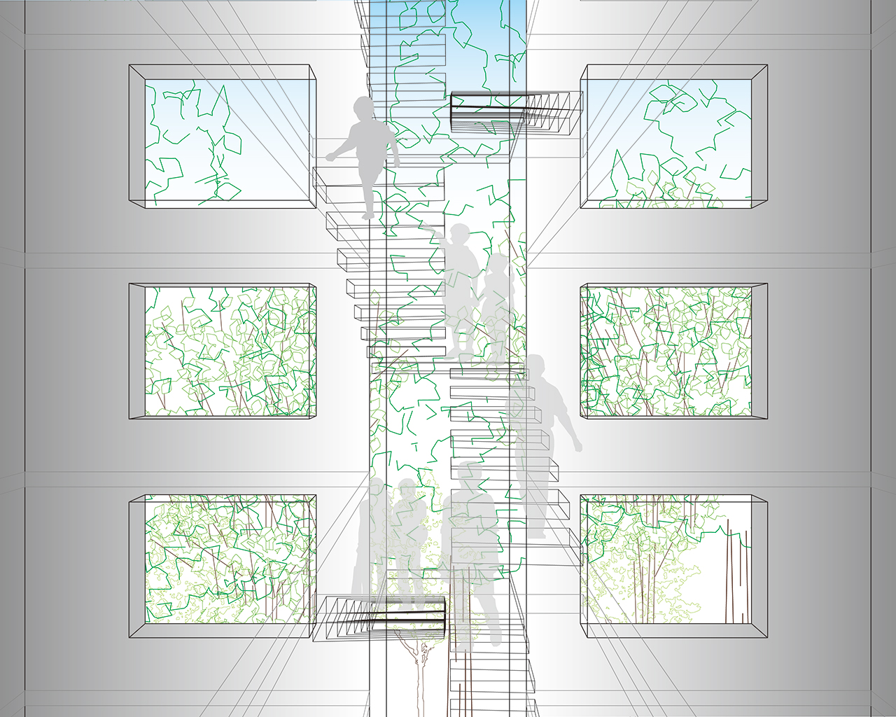
Located in front of a large park, the space of stairs projects images of people who go up and down there, adding vital public space to the city.
Climbing up and down the stairs is like walking above the park, the space is like “Floating Promenades”. It is “Void of the Light” where one feels nature including light, wind, rain, and clouds.
Made by cantilevered exposed concretes, it would cast shadows which change every moment. Transitional beauty of light and shadows would be expected.
Since scenes would change according to the season and time, residents enjoy various views of the sky and the forests.
Detached from the city when one enters it in most apartments, the spaces of promenades still continue in the space of the stairs in this apartment, rather, spaces of promenades last till one reaches their housing units. Furthermore, the space provides urban square by taking in vast spaces of park and city, offering splendid views which one can enjoy only there.
The void is stretched out to the city, it works as a node between the city and the architecture. Contrary to our daily life in which we see the sky from a distance, one sees and feels the sky with the whole body.
Looking the sky from stairs in daytime reminds us the profound beauty of wildlife nature including light, air, wind, cloud, and rain. Seeing the night sky from there make us aware of great existence of the cosmos.
At night, the stairs float and shine in the dark, and illuminate the city, thus, “Void of the Light” is transformed into “Tower of the Light”.
It would add distinctive scenery to the existing city day and night. Simple silhouette envisions small universe which demonstrates new public spaces, symbolizing new symbiosis between buildings and city, yet giving birth special experience of nature.
Name / Surname: Yoshitaka Uchino
Country:
Team:
Company: YDS
Project Description:
Located in front of a large park, the space of stairs projects images of people who go up and down there, adding vital public space to the city.
Climbing up and down the stairs is like walking above the park, the space is like “Floating Promenades”. It is “Void of the Light” where one feels nature including light, wind, rain, and clouds.
Made by cantilevered exposed concretes, it would cast shadows which change every moment. Transitional beauty of light and shadows would be expected.
Since scenes would change according to the season and time, residents enjoy various views of the sky and the forests.
Detached from the city when one enters it in most apartments, the spaces of promenades still continue in the space of the stairs in this apartment, rather, spaces of promenades last till one reaches their housing units. Furthermore, the space provides urban square by taking in vast spaces of park and city, offering splendid views which one can enjoy only there.
The void is stretched out to the city, it works as a node between the city and the architecture. Contrary to our daily life in which we see the sky from a distance, one sees and feels the sky with the whole body.
Looking the sky from stairs in daytime reminds us the profound beauty of wildlife nature including light, air, wind, cloud, and rain. Seeing the night sky from there make us aware of great existence of the cosmos.
At night, the stairs float and shine in the dark, and illuminate the city, thus, “Void of the Light” is transformed into “Tower of the Light”.
It would add distinctive scenery to the existing city day and night. Simple silhouette envisions small universe which demonstrates new public spaces, symbolizing new symbiosis between buildings and city, yet giving birth special experience of nature.
LANDMARK OF THE YEAR FINALIST PROJECTS
Susana López

Name / Surname: Susana López
Country:
Team:
Company: RED Arquitectos
Project Description:
Casa Numa is a home for personal use and vacation rental on Holbox Island, Quintana Roo. It gradually reveals its essence through a frontal lattice that allows the eyes of the observer to pass through, in an intimate reserved tour and in a playful way, the discovery of spaces and voids enriched by the personality of the honest material takes place. At night that sobriety is transformed into a play of reflections and light through the lattice that undoubtedly makes it a visually striking object, the building as a lantern in context. That together, the dark skies of the island make it part of its nature. Casa Numa becomes an integrated sculptural object rooted in the Island through its materiality and in the repetition of vertical elements it alludes to the formality of the essence of the tree of life.
Casa Numa it is made up of two levels, on the first level there is a small dining room with a full bathroom and the master bedroom with a terrace and poo. On the second floor we find two bedrooms with a full bathroom connected with an exterior staircase, it is also provided with a terrace on the top floor.
The house it’s built entirely of coconut palm wood over 50 years old supported on sapote tree piles that come from the jungle of the area so as not to impact the sandy soil of the island. The palm is considered the tree of life, since human existence could be sustained with everything that is profitable from it, as it has been popularly named. It is a natural insulating material that offers a pleasant climate due to its thermal inertia, allowing less energy consumption due to cooling.
The time taken to build a wooden house is less than that of a house of the same size with a traditional construction system. Casa Numa was structurally built in three months, taking anoth
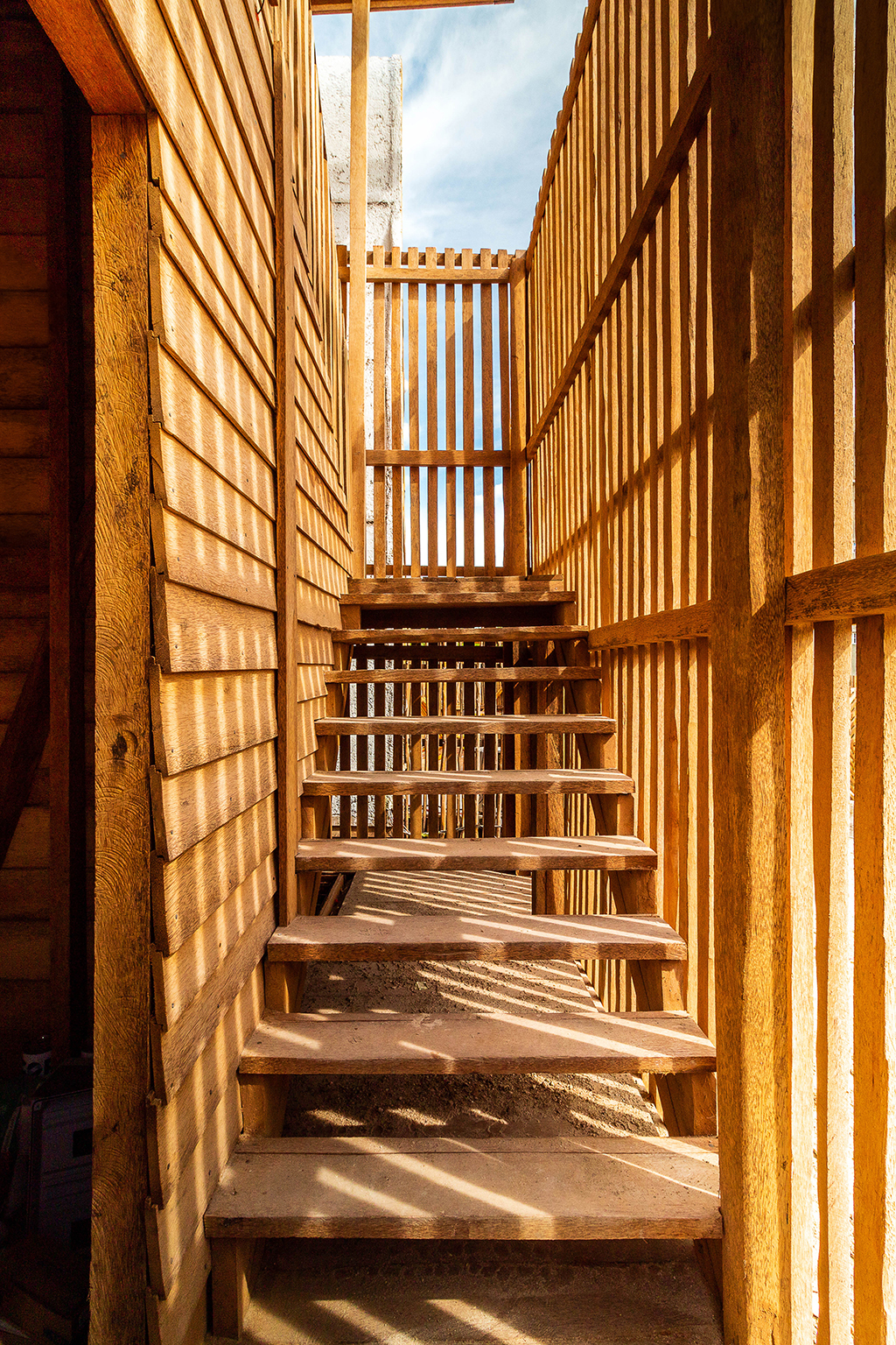
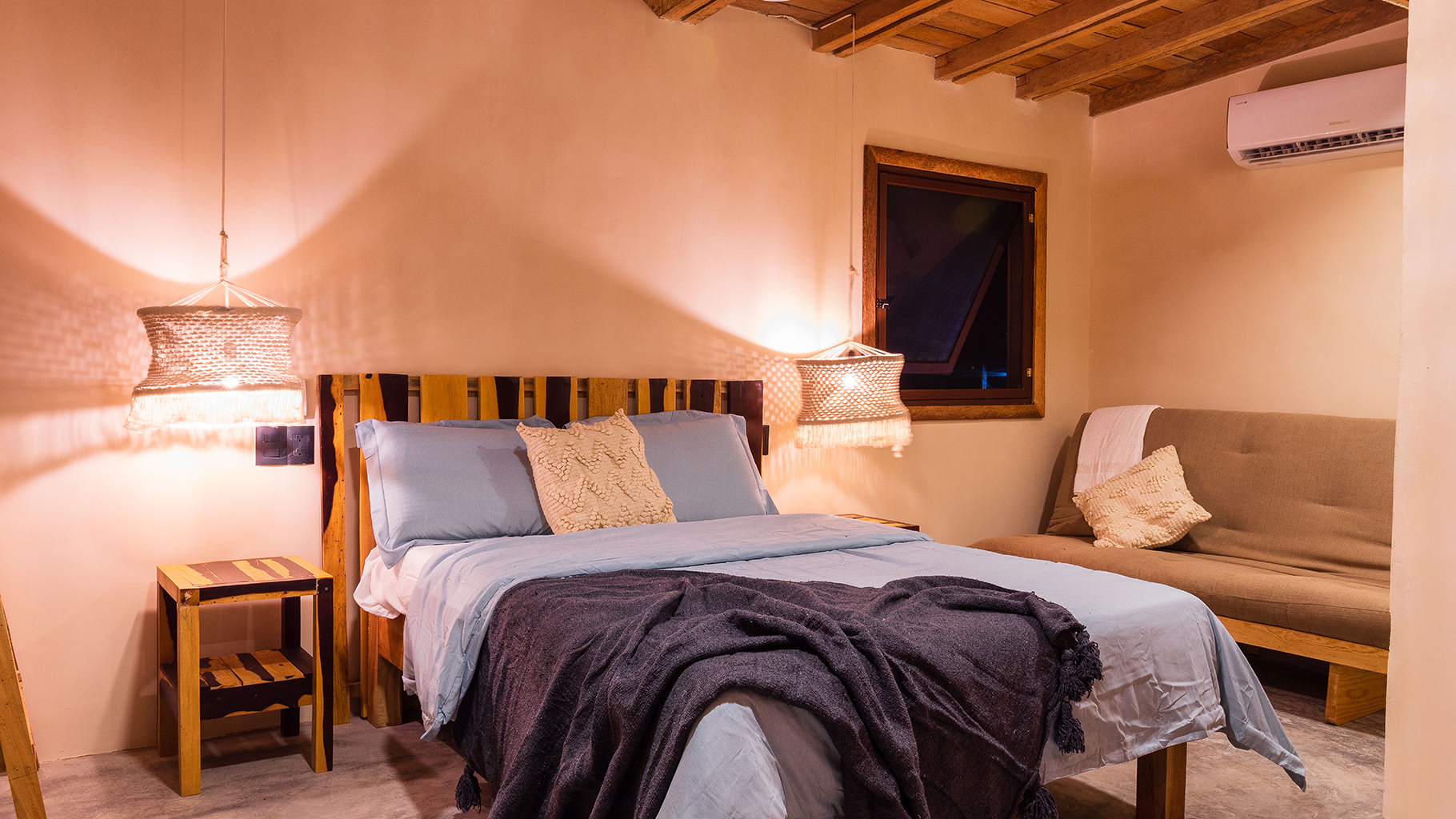
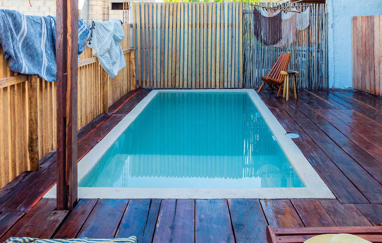
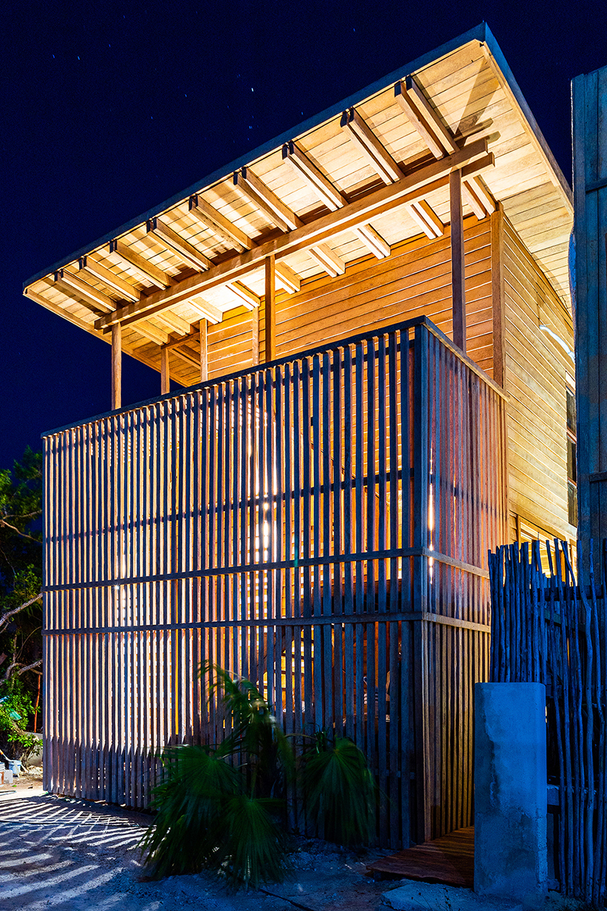
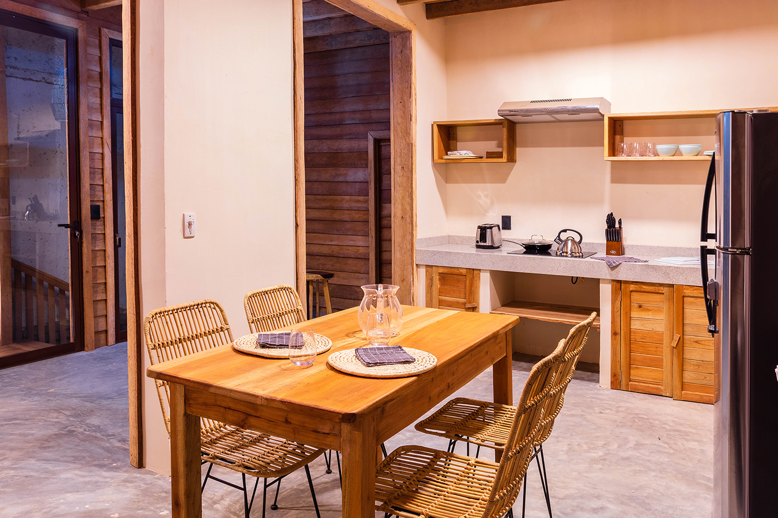
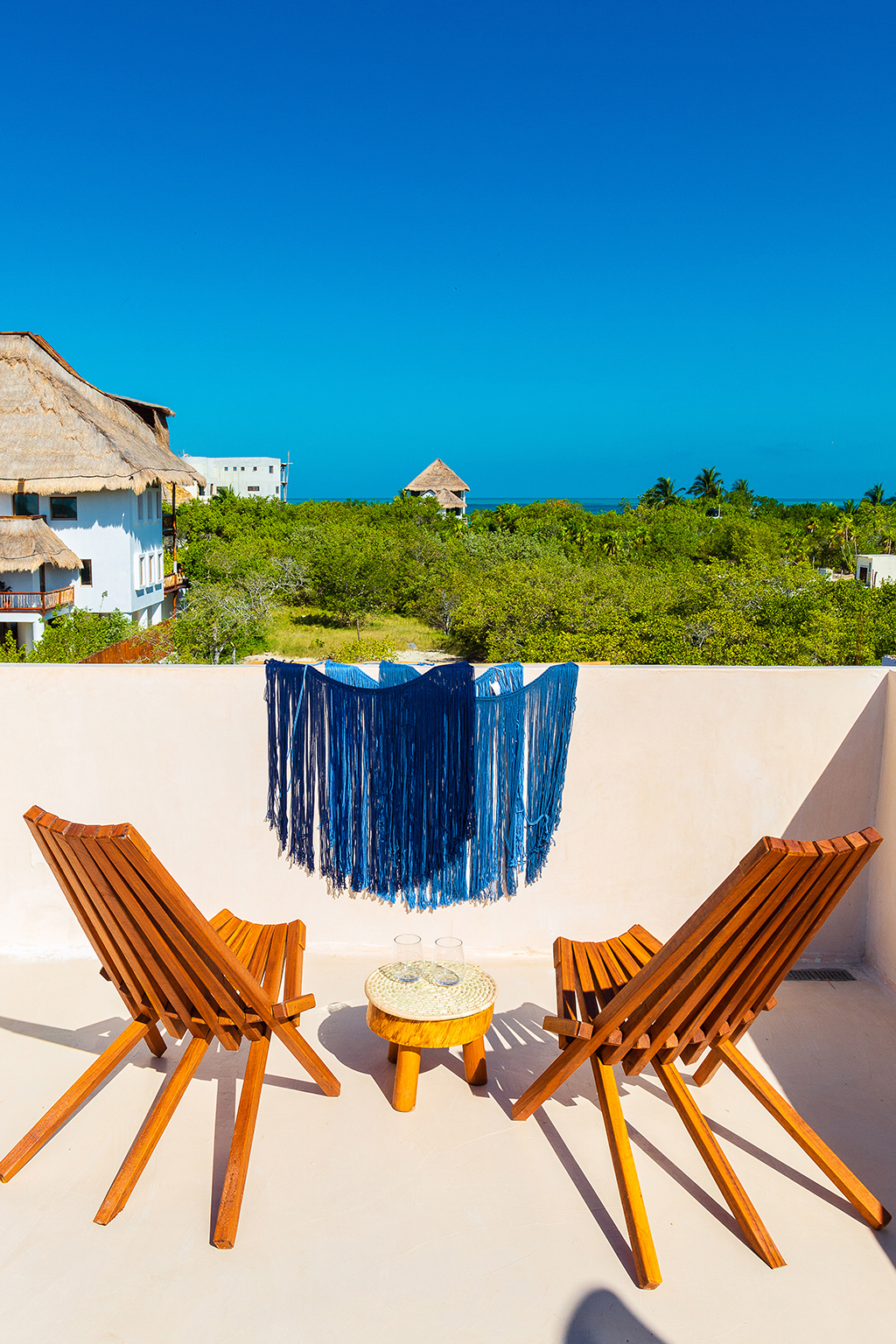
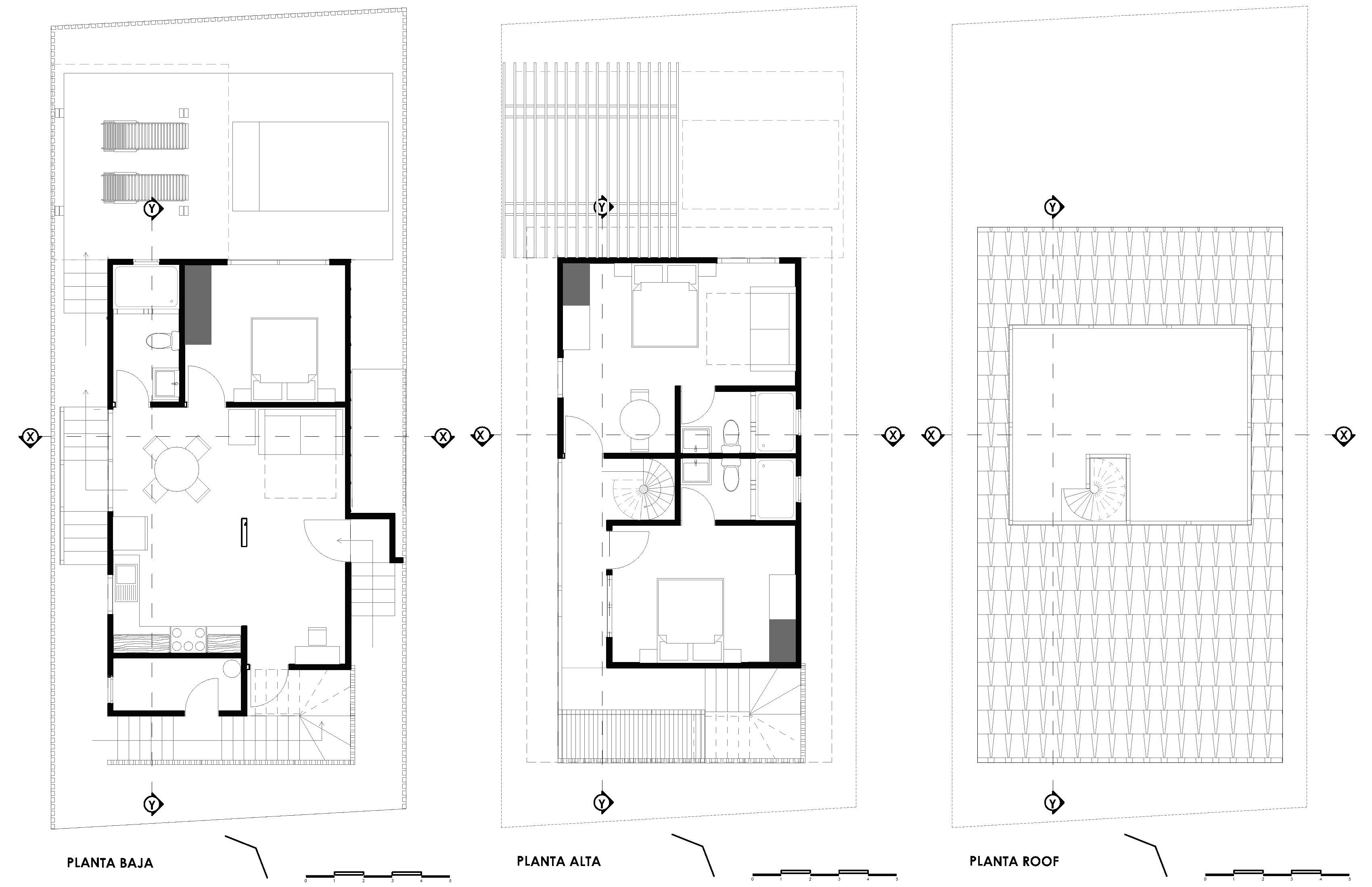
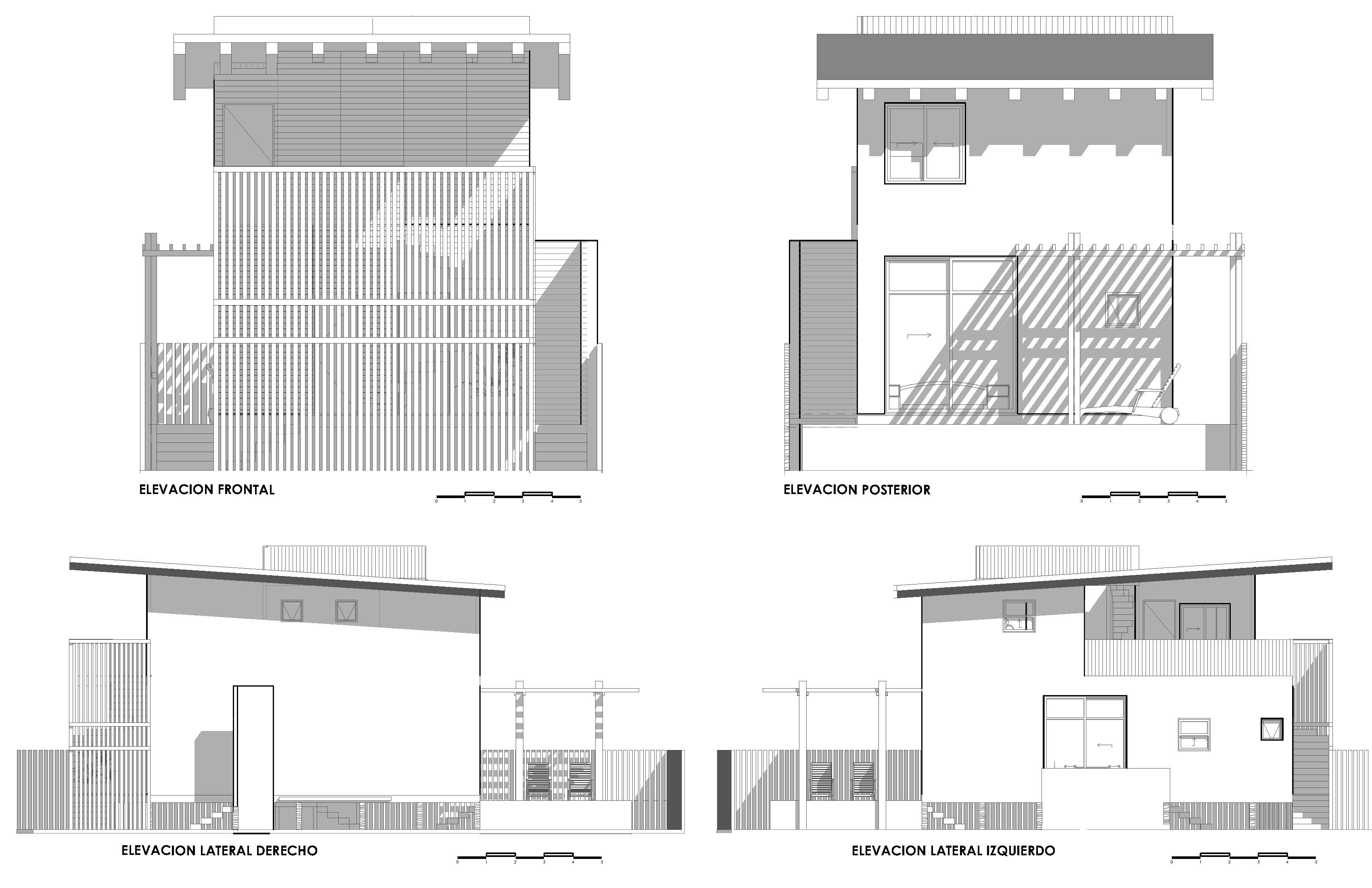
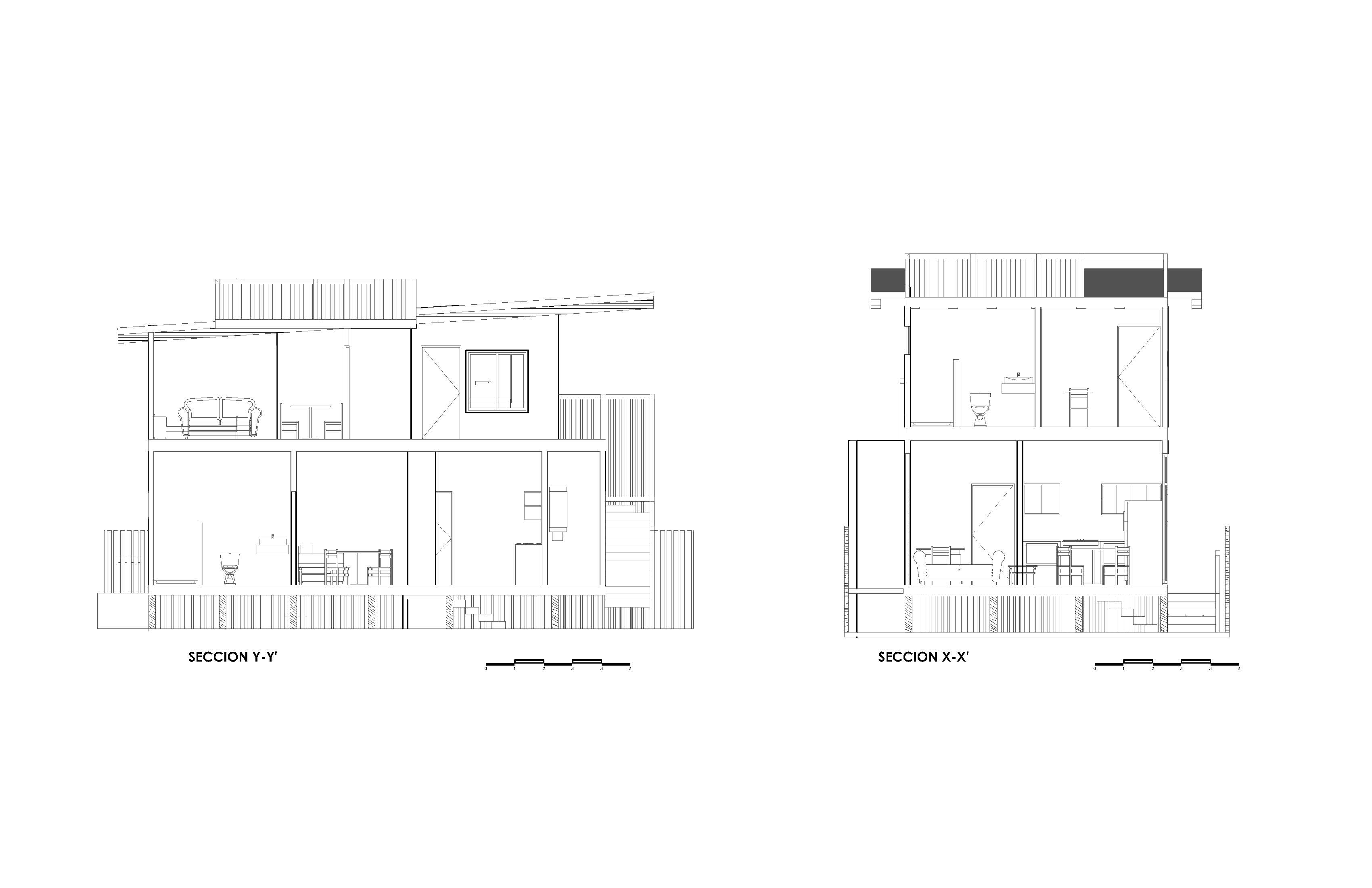
RESEARCH FINALIST PROJECTS
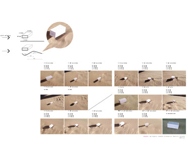
Yinghao Lin
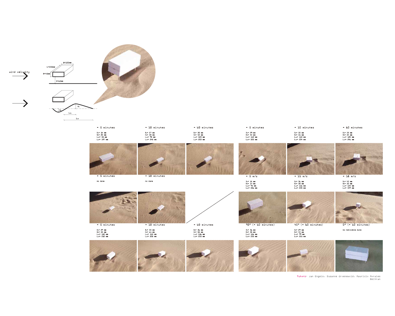
Name / Surname: Yinghao Lin
Country:
Team:
Company: Ying+Shuxi
Project Description:
DUNES - A VITAL DUTCH LANDSCAPE
For a long time, the Dutch people have been fighting for survival against the sea with artificial dikes. The natural coastal dunes, which run along most of the west coast of the country, are vital to the Dutch. However, due to many factors, these natural guardians are being washed away.
AN EXPERIMENTAL INSTALLATION THAT MAKES DUNES
When the wind carrying sand meets obstacles it slows down and sand particles accumulate and form dunes. Building shapes would greatly affect the wind field around them. It is possible that a building can control wind speed to trigger sand accumulation and form dunes. We carried out various experiments on the beach and succeeded to generate dunes with models of various shapes.
To avoid storm tides, the building is elevated. The minimum vertical structure allows maximum wind pass. A long-span cable beam structure is introduced. Also, cables are introduced to resist horizontal wind load.
A SHIFTING SHAPE
A lightweight membrane system is wrapped around the building to smooth wind pass. The membrane can shift shape and affect wind speed and therefore the shape and scale of the dune formed behind.
The building would house a flexible space for social activities, such as fundraising, exhibitions, weddings, etc. The changing shape of the building creates a forever-changing dune landscape on the beach, providing a site of excitement. As the new dunes are formed, volunteers would come and plant beach grass to reinforce them. The building would become a social magnet in the local area.
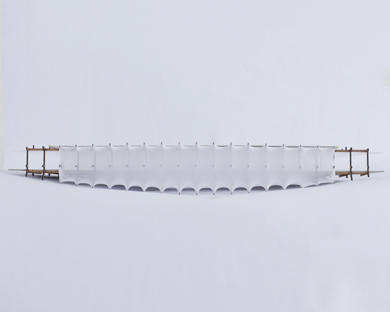
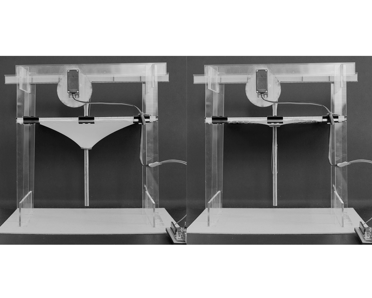
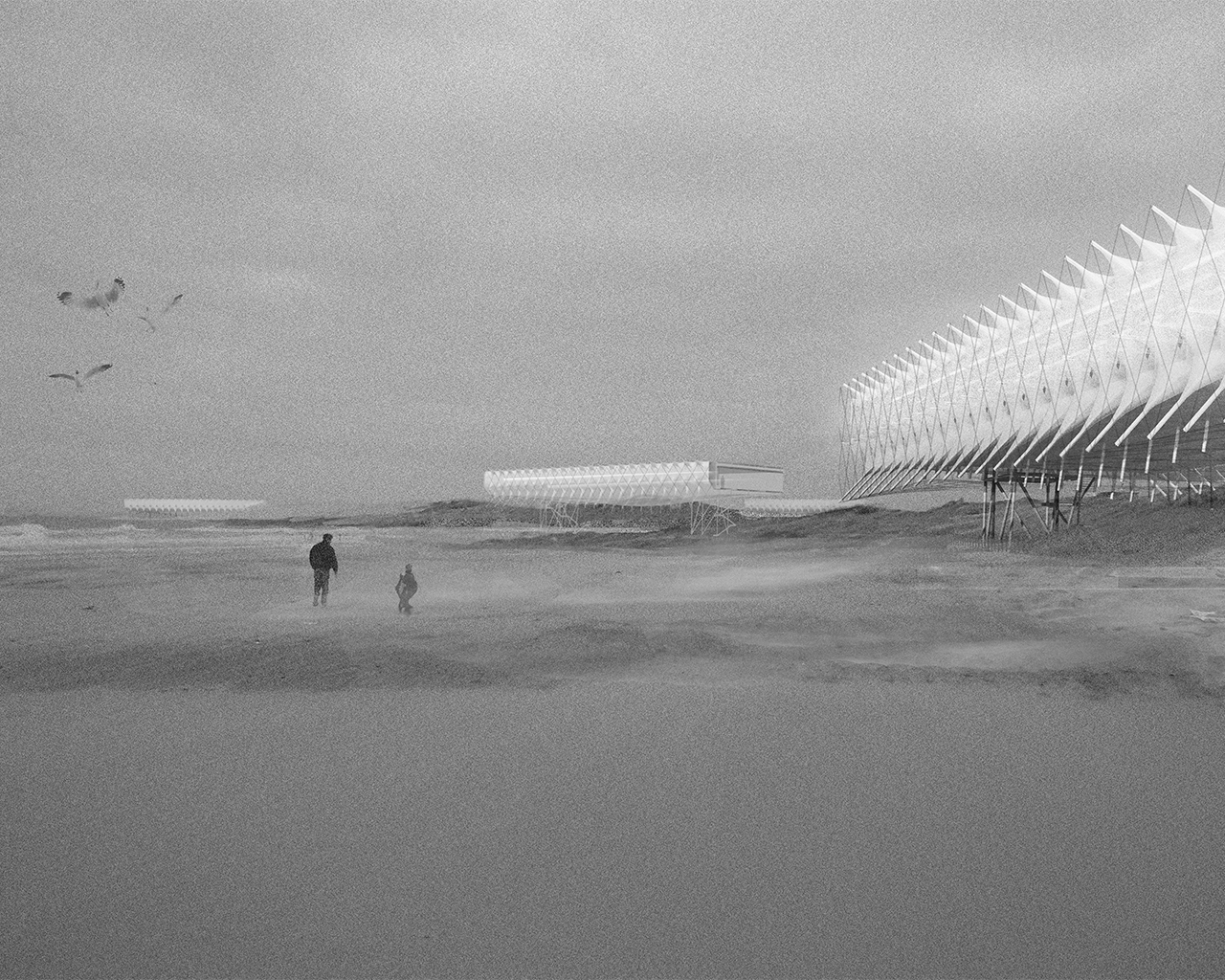
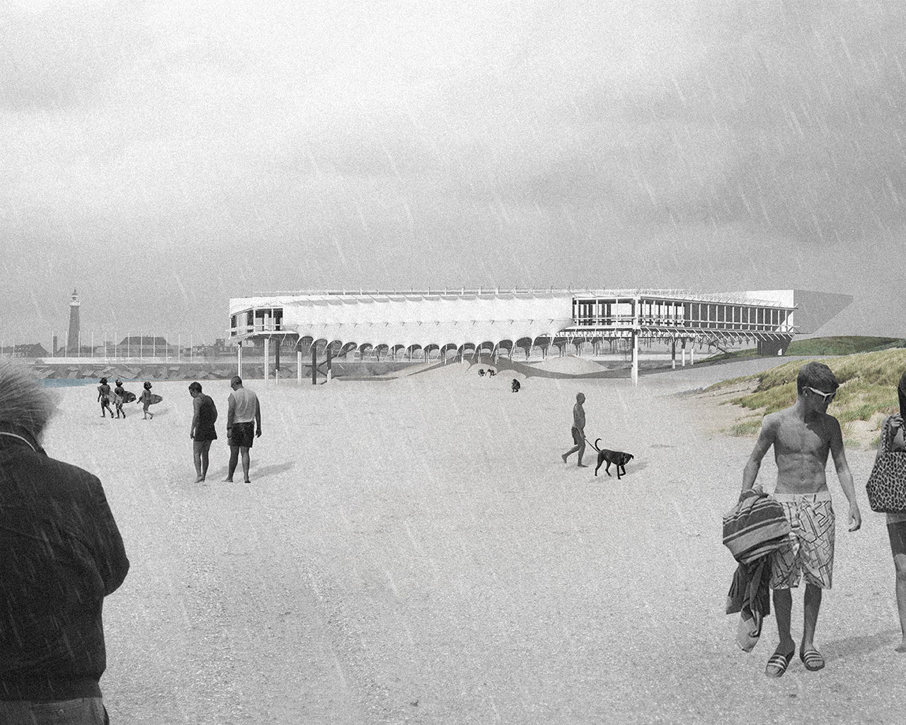
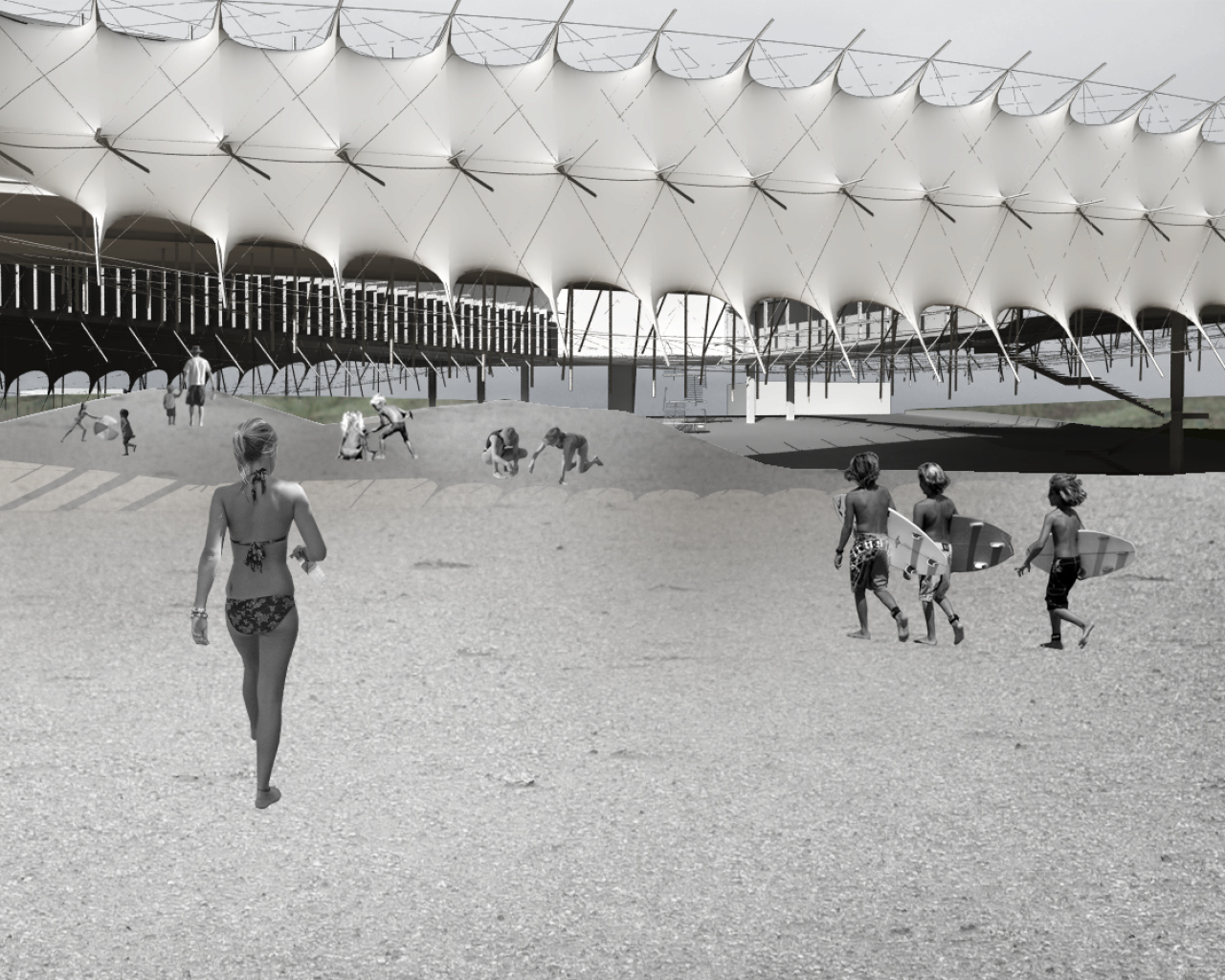
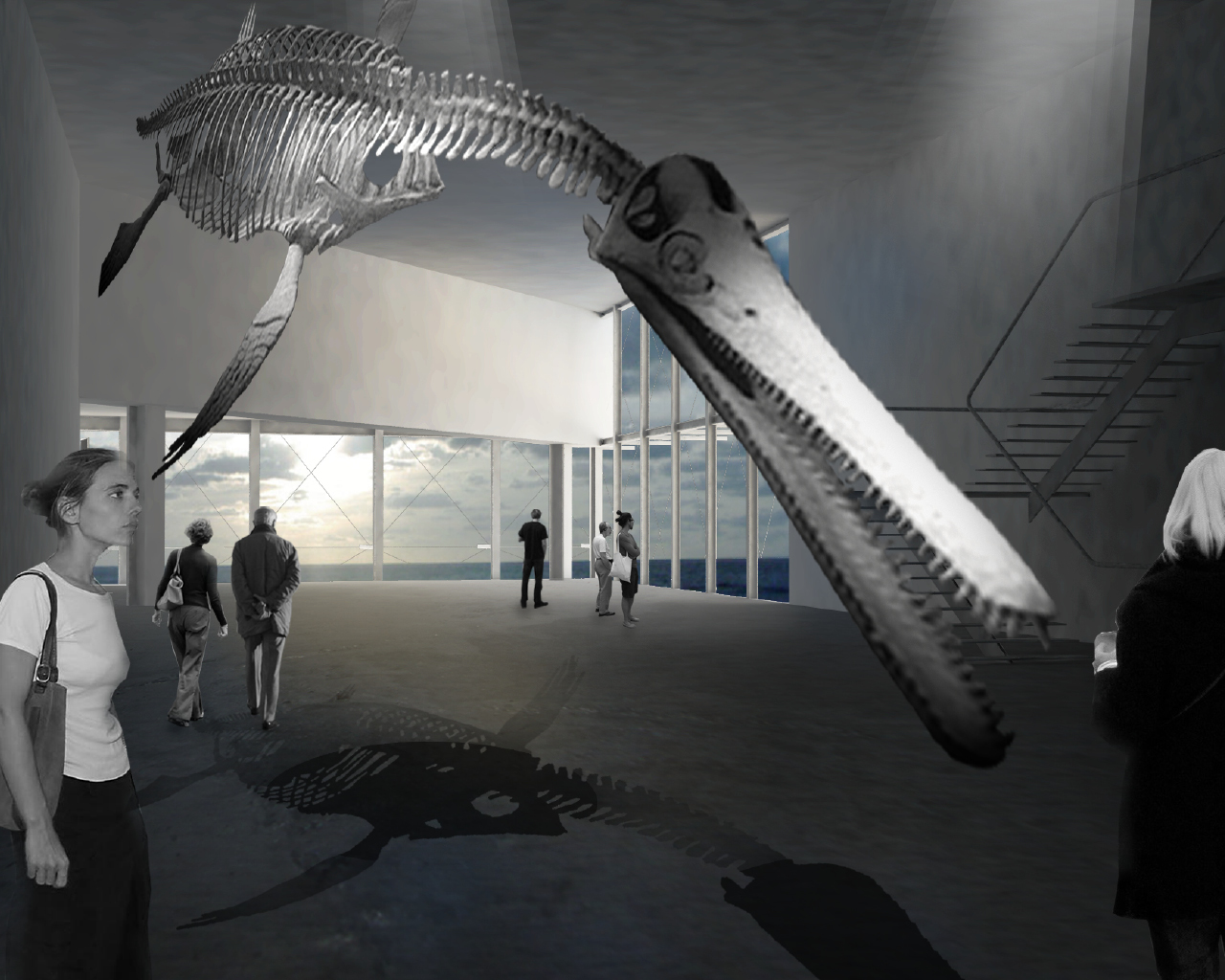
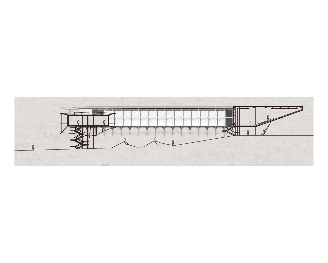
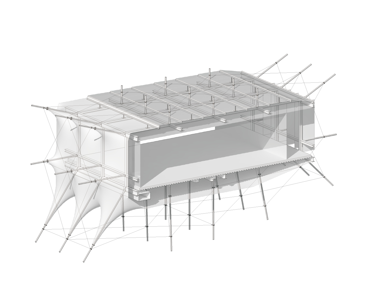
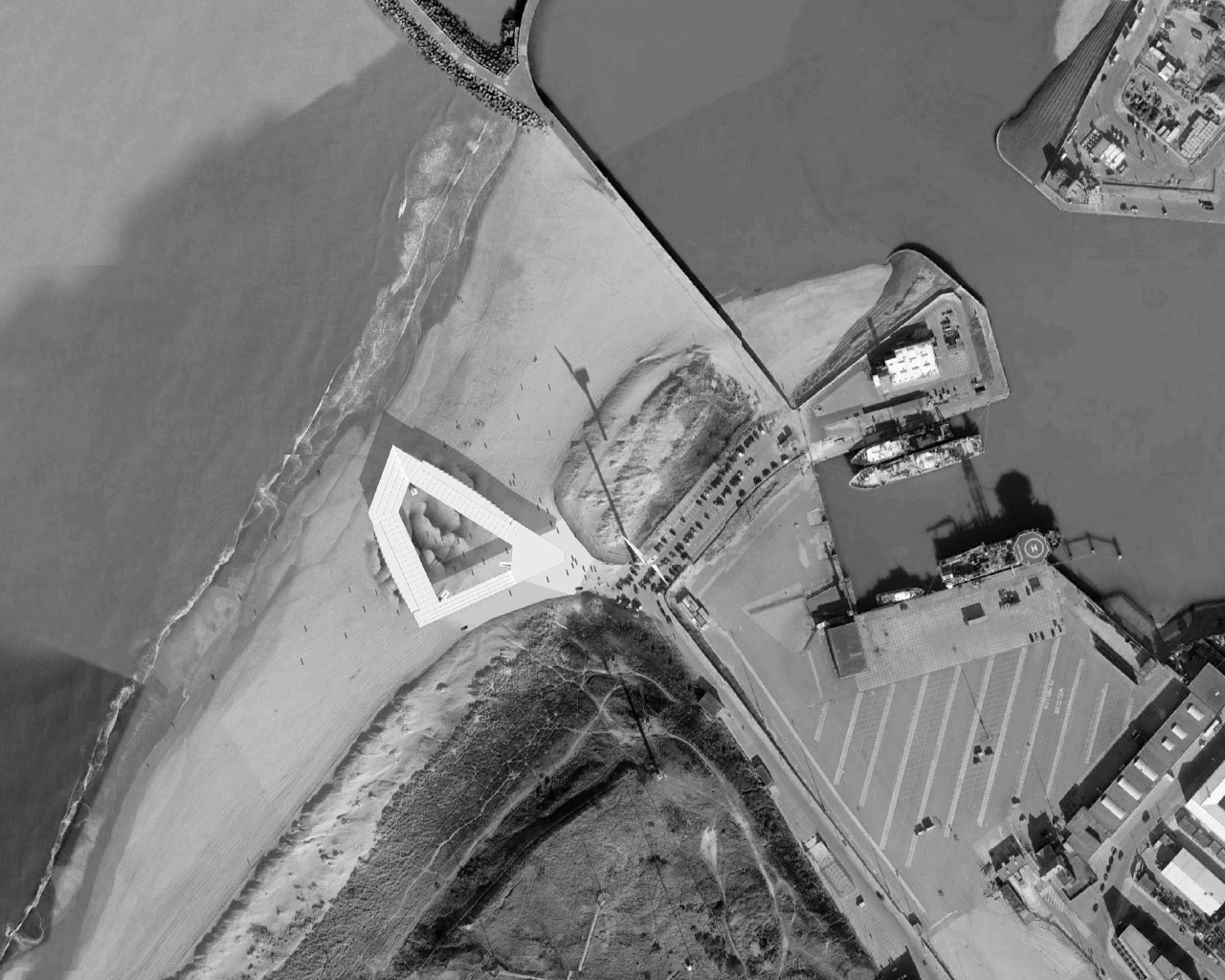
REASEARCH FINALIST PROJECTS
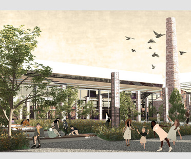
Olgerta Furramani
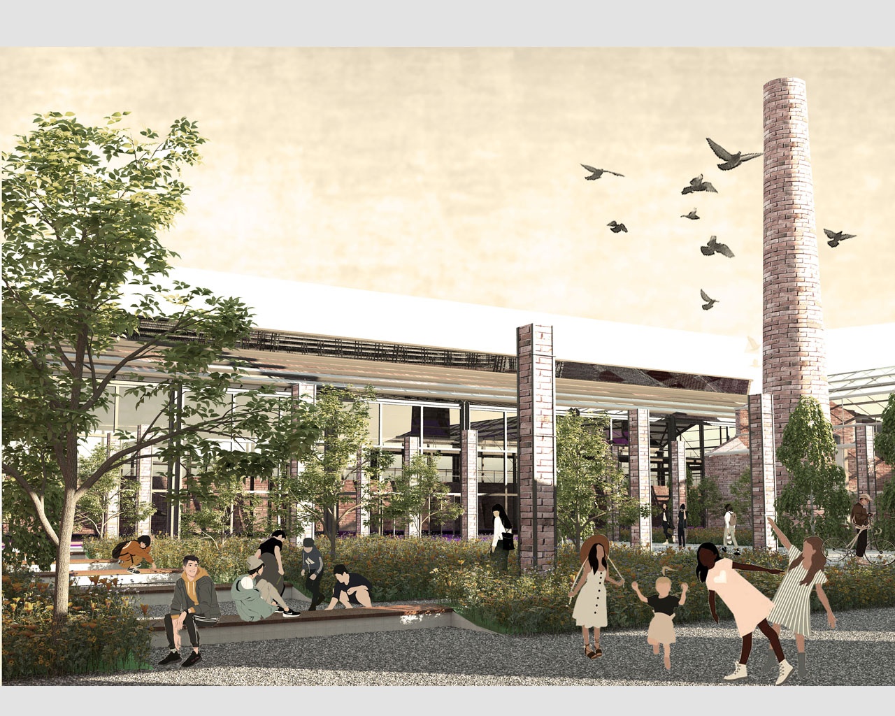
Name / Surname: Olgerta Furramani
Country:
Team:
Company:
Project Description:
The city of monterotondo was born at the foot of the city of Rome. With the industrial revolution in 1800 we find the first industrial settlements, which were precisely the furnaces. The municipality of Monterotondo faces an area of great housing development, an uncontrolled urban sproll, surrounded by these huge establishments that were the former furnaces, now abandoned to themselves, which create enormous voids. We are faced with a series of issues concerning the;- urban decay; lack of main services; lack of green areasinhabitants., a fundamental element. The increase in housing developments has eliminated green spaces, making the land less permeable. Another problematic element is the presence of the railway which divides 2 urban areas creating a discontinuity for the people who live in it. The urban regeneration project has as its main objective that of improving social life by demolishing physical barriers and redeveloping abandoned industrial areas. After a detailed analysis of the state of affairs, the strengths, weaknesses and opportunities on the urban environment and on the socio-economic fabric of the area were compared.One of the main strategies for the recovery of the Monterotondo scalo area is the intervention on the green infrastructure, which aims at the redevelopment of existing green spaces.The idea is to create a continuity of the existing ecological system. In addition to the green infrastructure, architectural redevelopment interventions were carried out, for the former furnaces transformed into new urban nodes.Another important element is the sustainable management of rainwater, transforming the city into a sponge city.
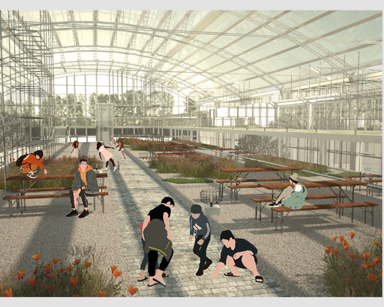
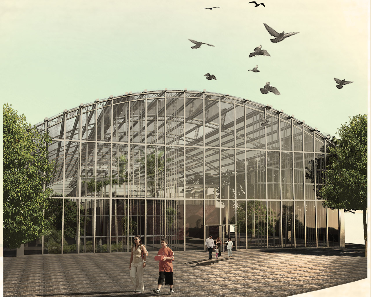
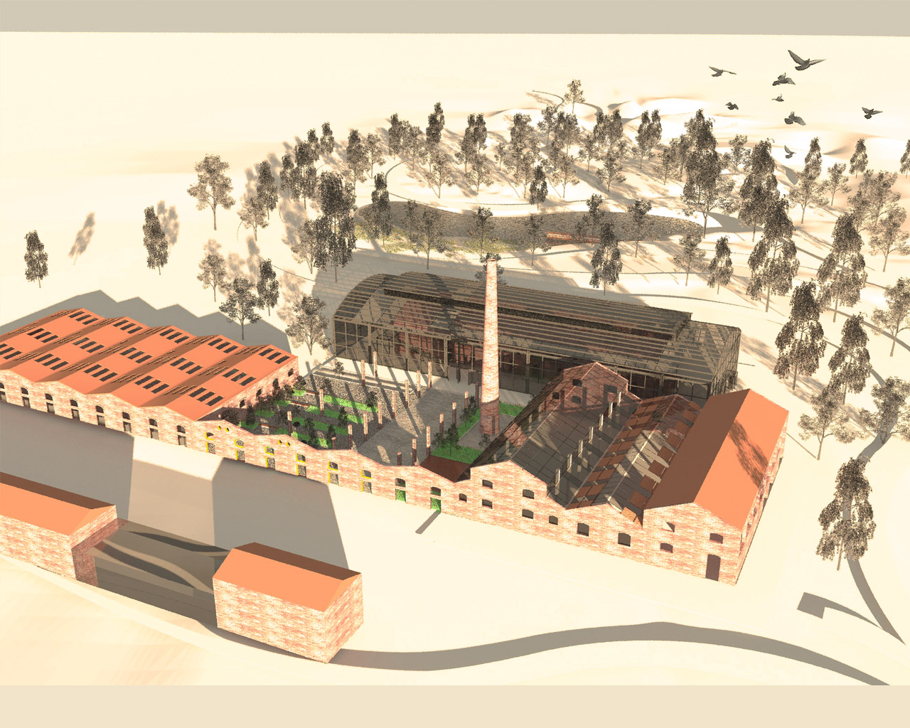
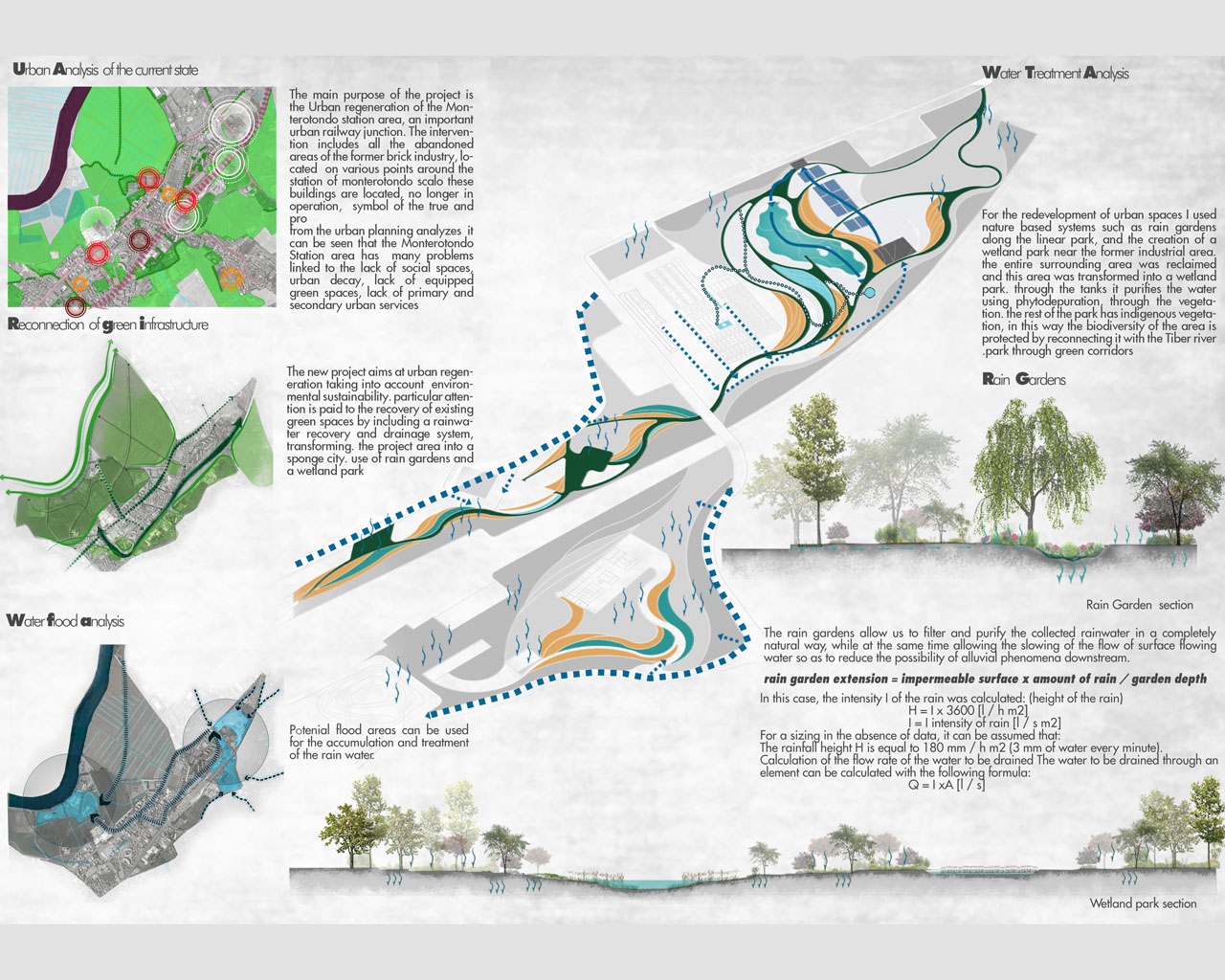
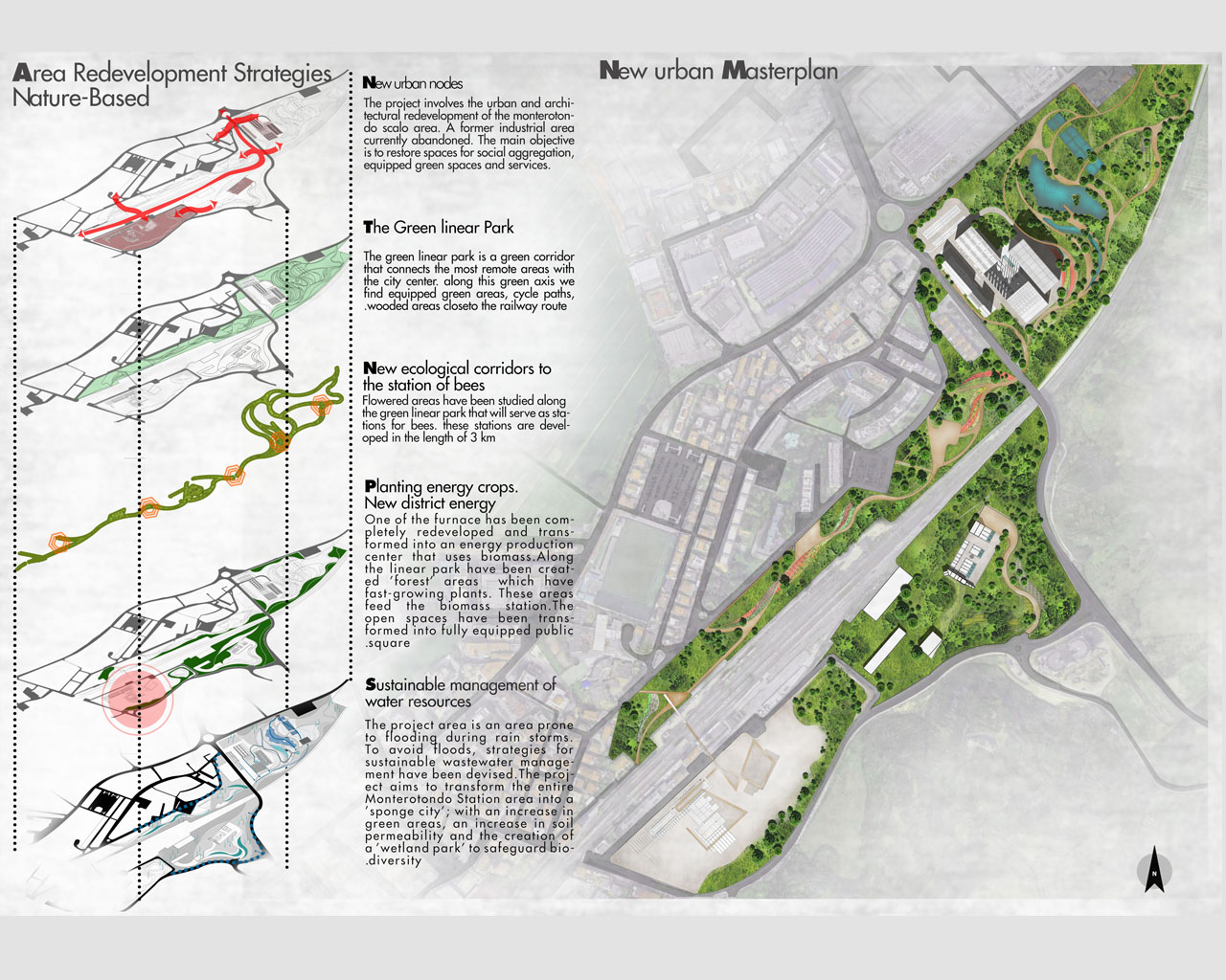
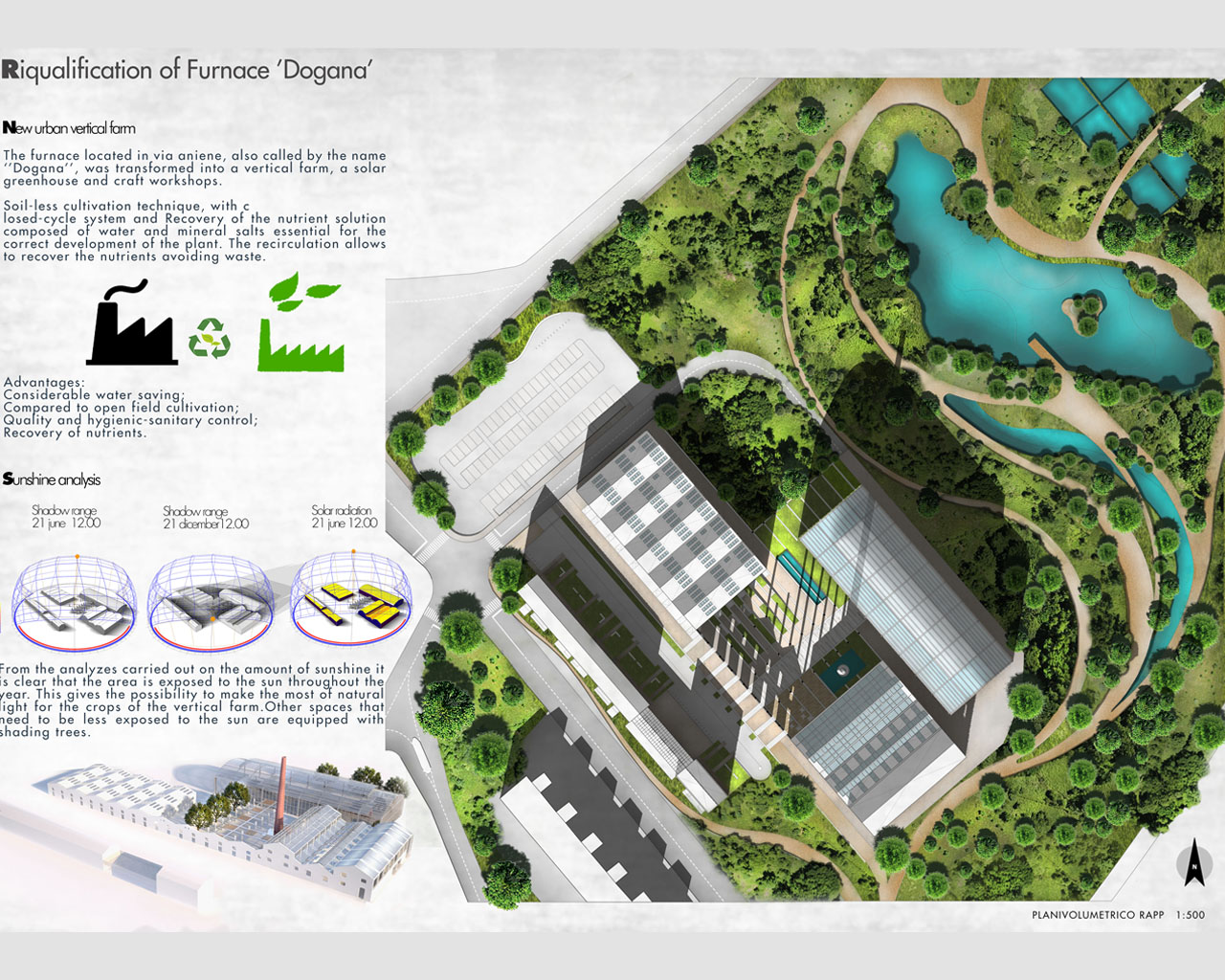
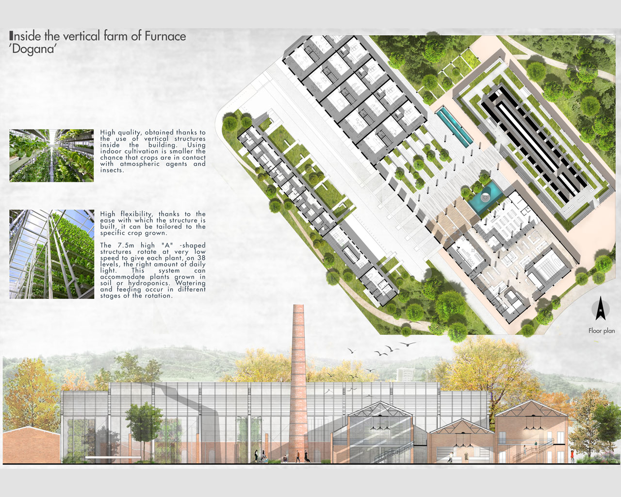
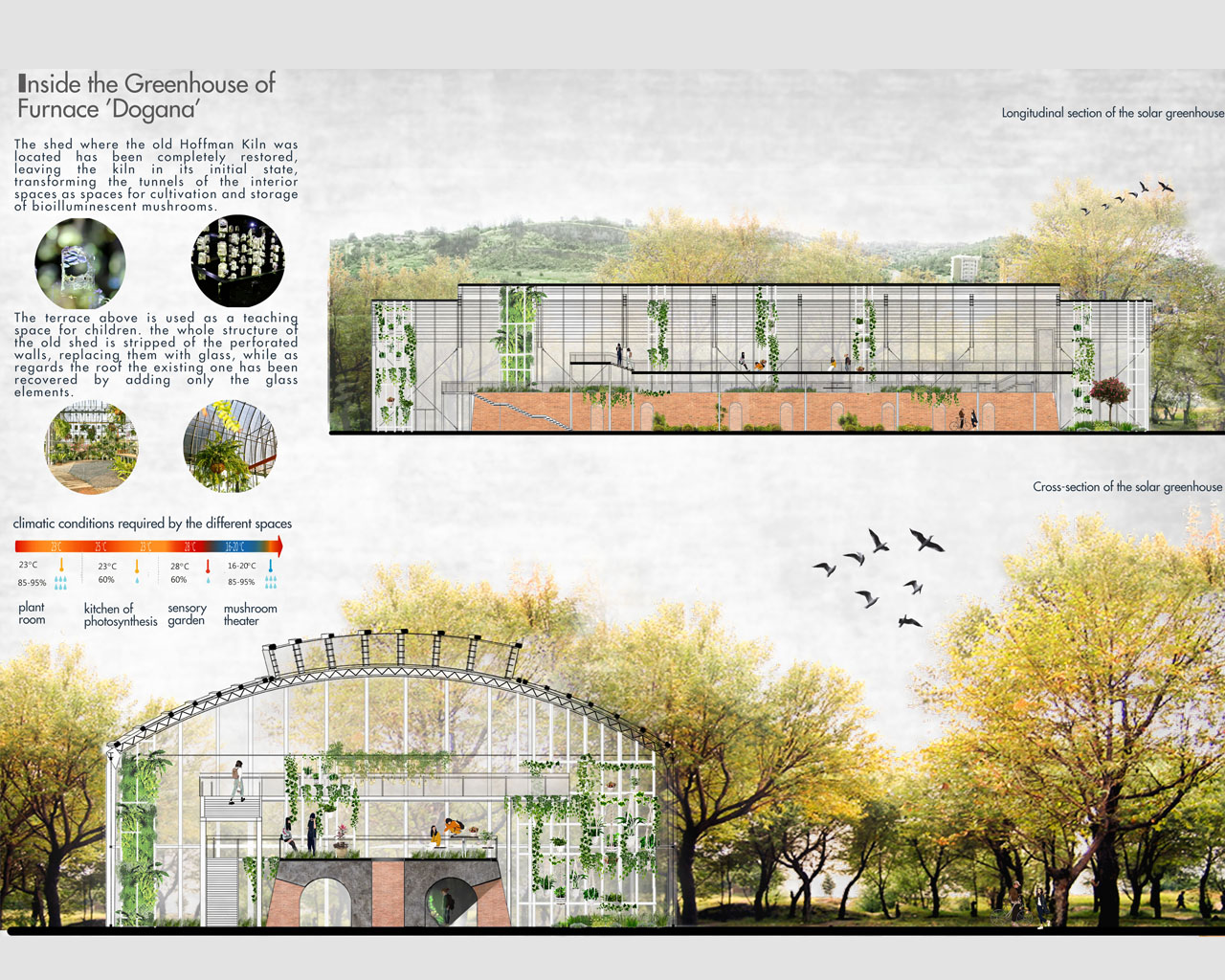
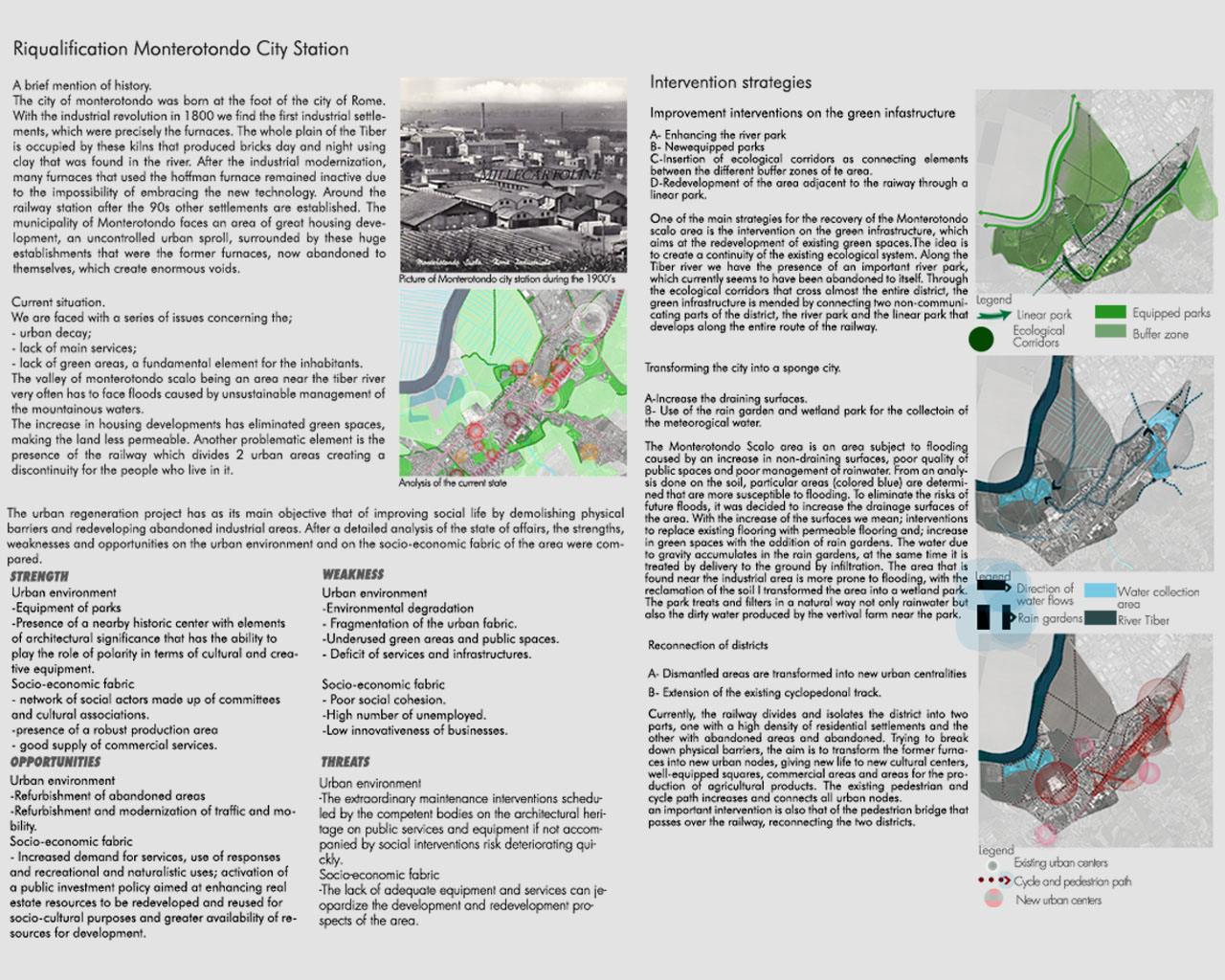
REASEARCH FINALIST PROJECTS
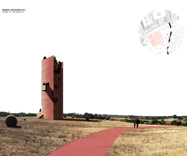
Alessandro Porcai
Name / Surname: Alessandro Porcai
Country:
Team:
Company: Porcai - Proietti
Project Description:
Rome is made up of a myriad of entities, not always clearly distinct, and is the result of the product of their coexistence. These heterogeneities, which originate from a series of autonomous stratifications, cause frictions and detachments that, analysed at different scales of observation, translate into a chaotic, but at the same time systematic, deflagration of its elements.
The indeterminateness of the relationships that make up the whole prevents a clear reading of the parts, and brings out a number of places excluded because they lack a defined role.
In this context, the thesis seeks to provide keys to understanding the public space of proximity, in order to reconstitute a unifying system that takes advantage of the revelation of its peculiarities. The study aims to construct a methodology capable of modifying and clarifying the perception of these places.
Hence the need for a conceptual device at the service of the project, capable of adapting to each context while maintaining the same unifying logic.
The genesis of the devices is based on an understanding of the latent and unexpressed values of these spaces, with the objective of making their spirit manifest through an iconic figuration and a coherent increase in existing or potential uses.
The correct interpretation of the present meanings is the necessary tool to allow the device to be a catalyst, in order to obtain a radical transfiguration through the minimal transformation of the existing.
Finally the research proposes case studies, structured in a starting analysis interpreted in an allegory of latent values and finally signified through projects, trying to solve a portion of the city in an attempt to verify the possible success and extension of the model.
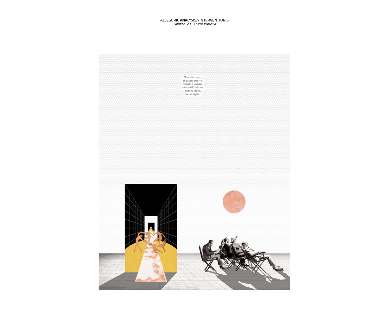
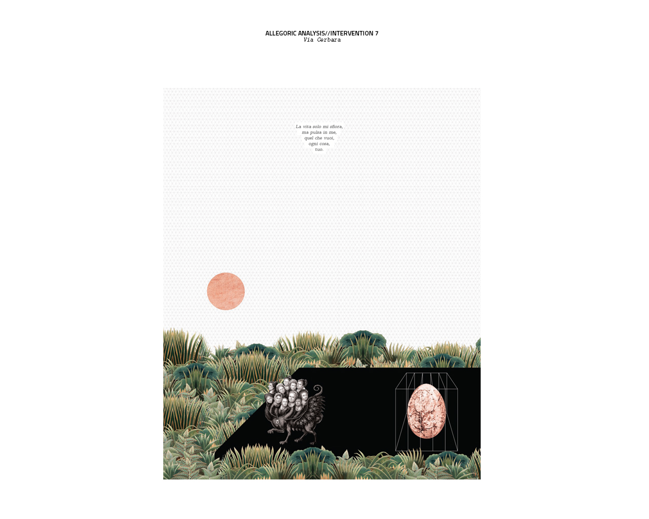
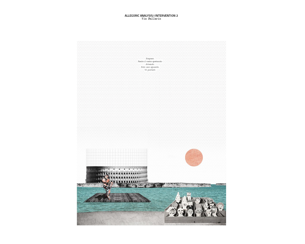
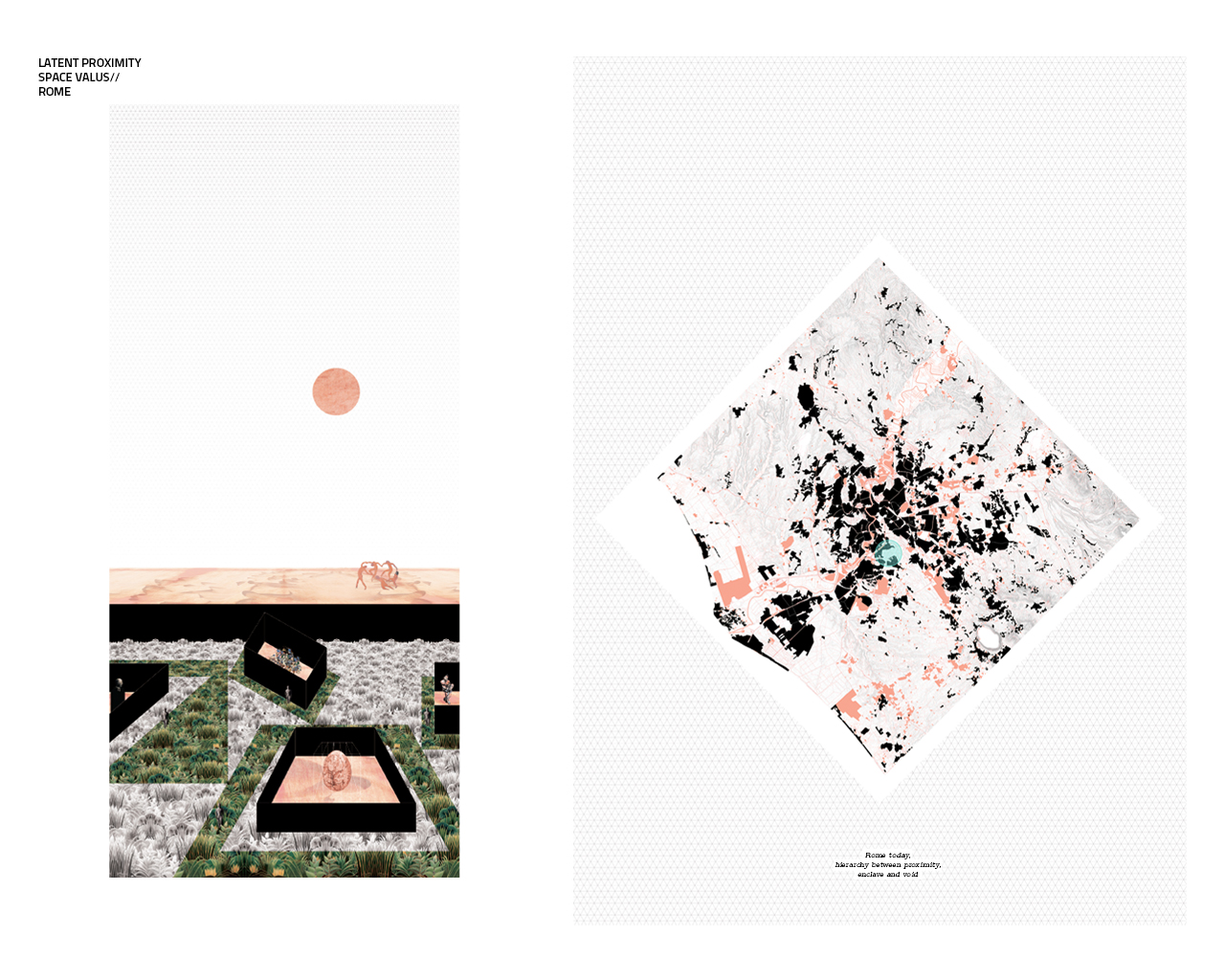
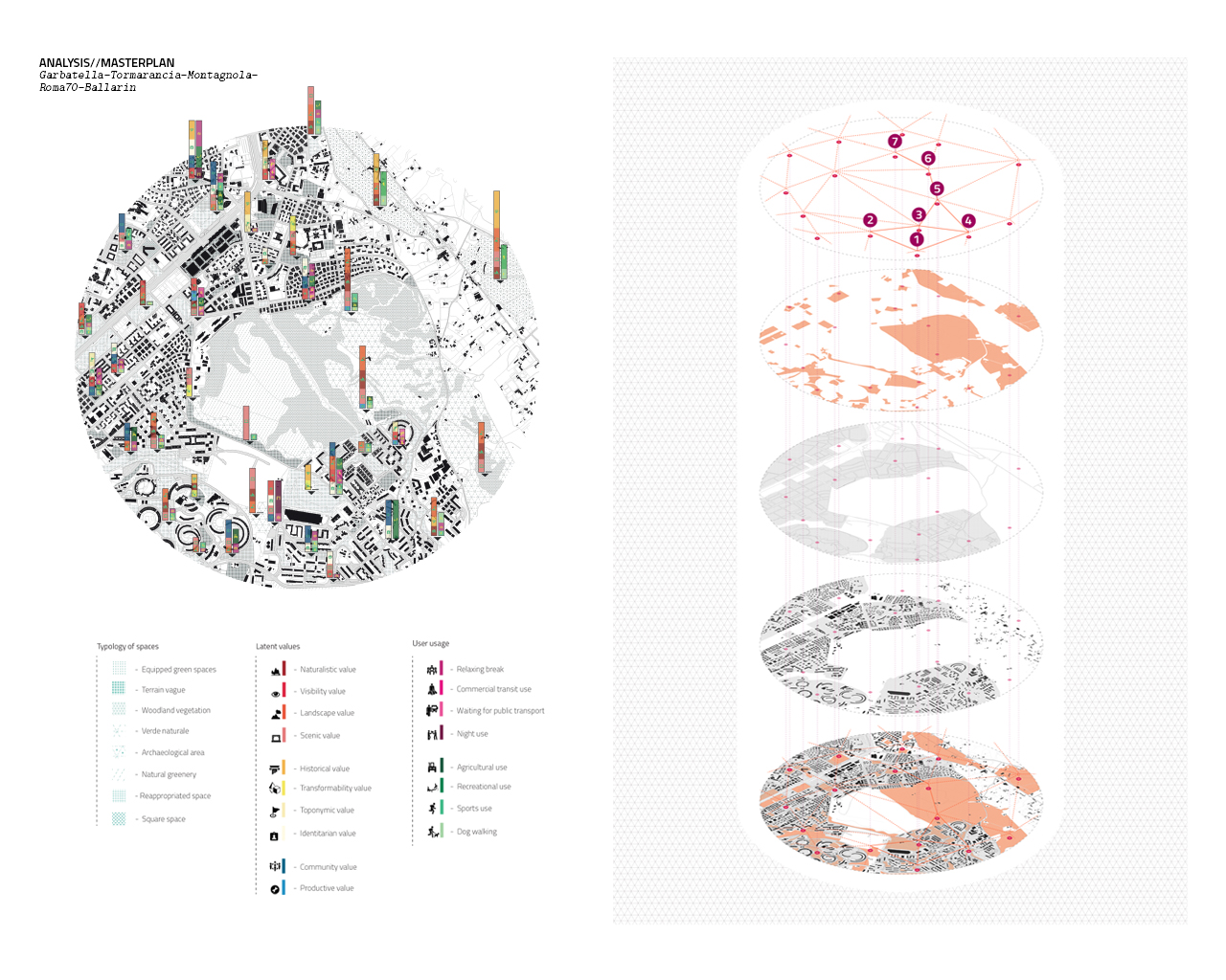
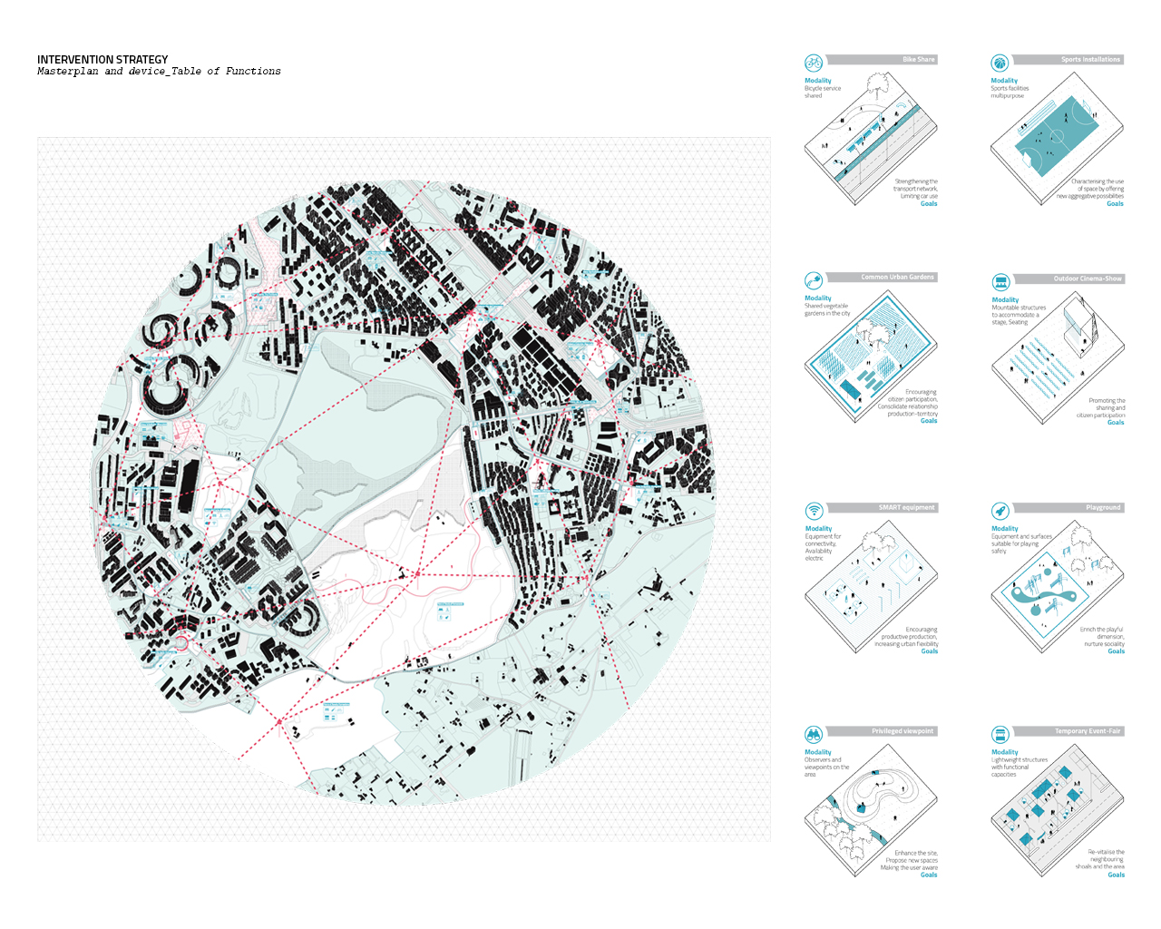
REASEARCH FINALIST PROJECTS
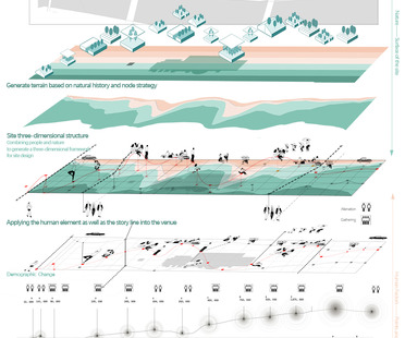
Liu MingPei
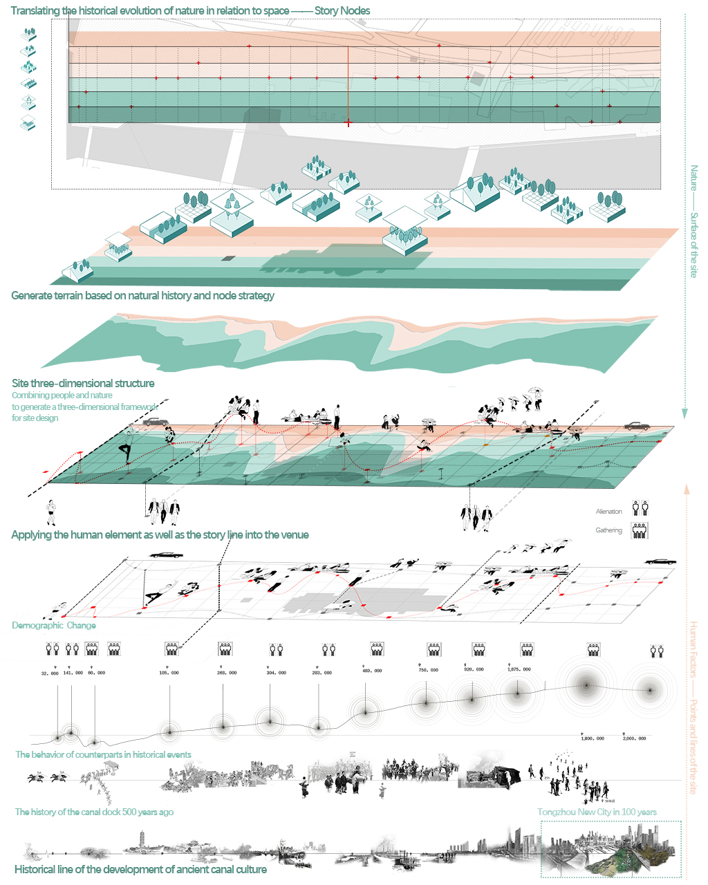
Name / Surname: Liu MingPei
Country:
Team:
Company: Academy of Arts & Design, Tsinghua University
Project Description:
How should we think about the relationship between humans and nature?
In today's rapidly urbanizing world, humans are encroaching on the territory of nature. But cities get old, and when people leave the land of the city, the city after desolation reverts to become nature again.
This site is the end of the Beijing-Hangzhou Grand Canal in China, the origin of the rise and fall of the canal culture, which is closely related to human activities, but at the same time we also notice that the natural environment plays an important role in it. Human and nature alternate in and out like the dancers, just as the relationship between human and nature in the history of canal development is constantly changing and moving forward.
Therefore, the relationship between man and nature in the history of the canal is extracted as the main story line, the points and lines in the site as man, the surfaces in the site as nature, and the relationship between the site and these man-made facilities in the close and far relationship form a three-dimensional framework to form this design.
At the same time this is also as our critical thinking about the relationship between urbanization and nature development, by building a nature-friendly landscape to provide enough space for nature to interfere with the city, in the future nature also encroaches on the living space of people, at this time, the landscape is no longer just a landscape for people, and people are just a role in nature.
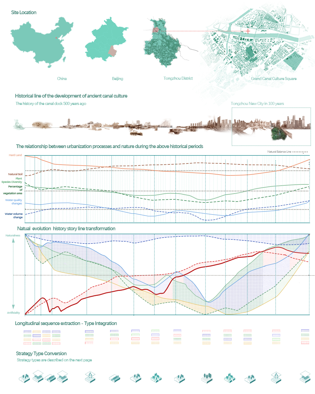
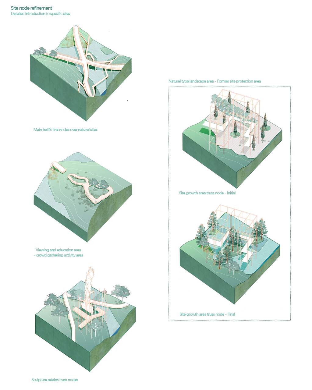
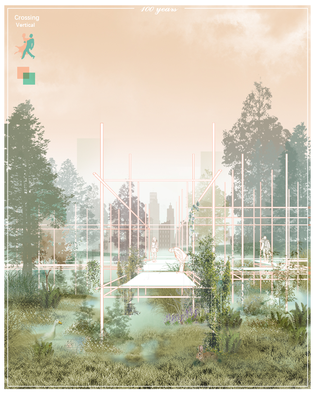
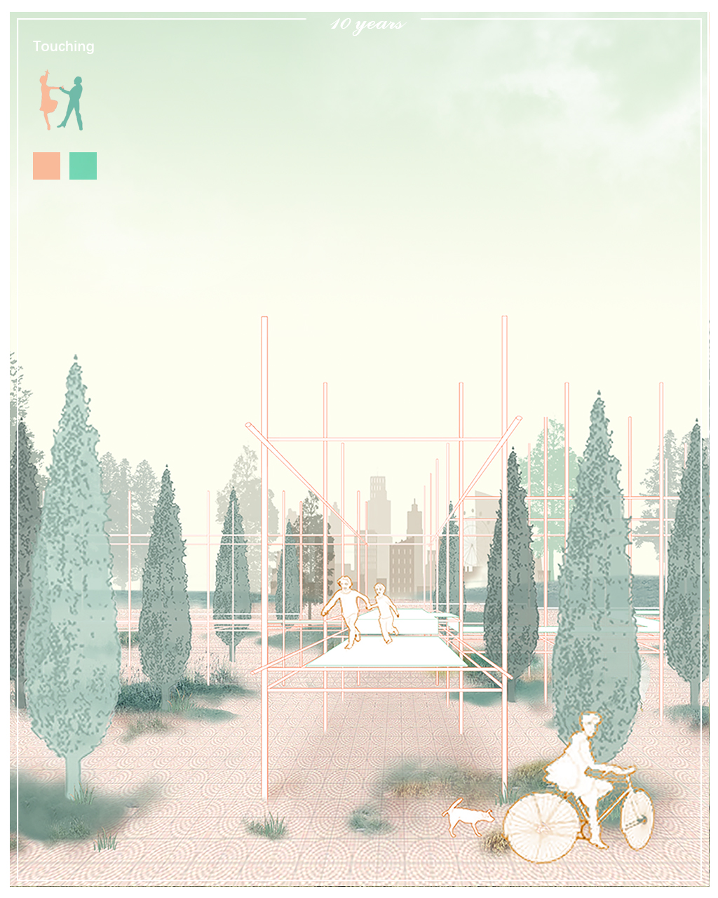
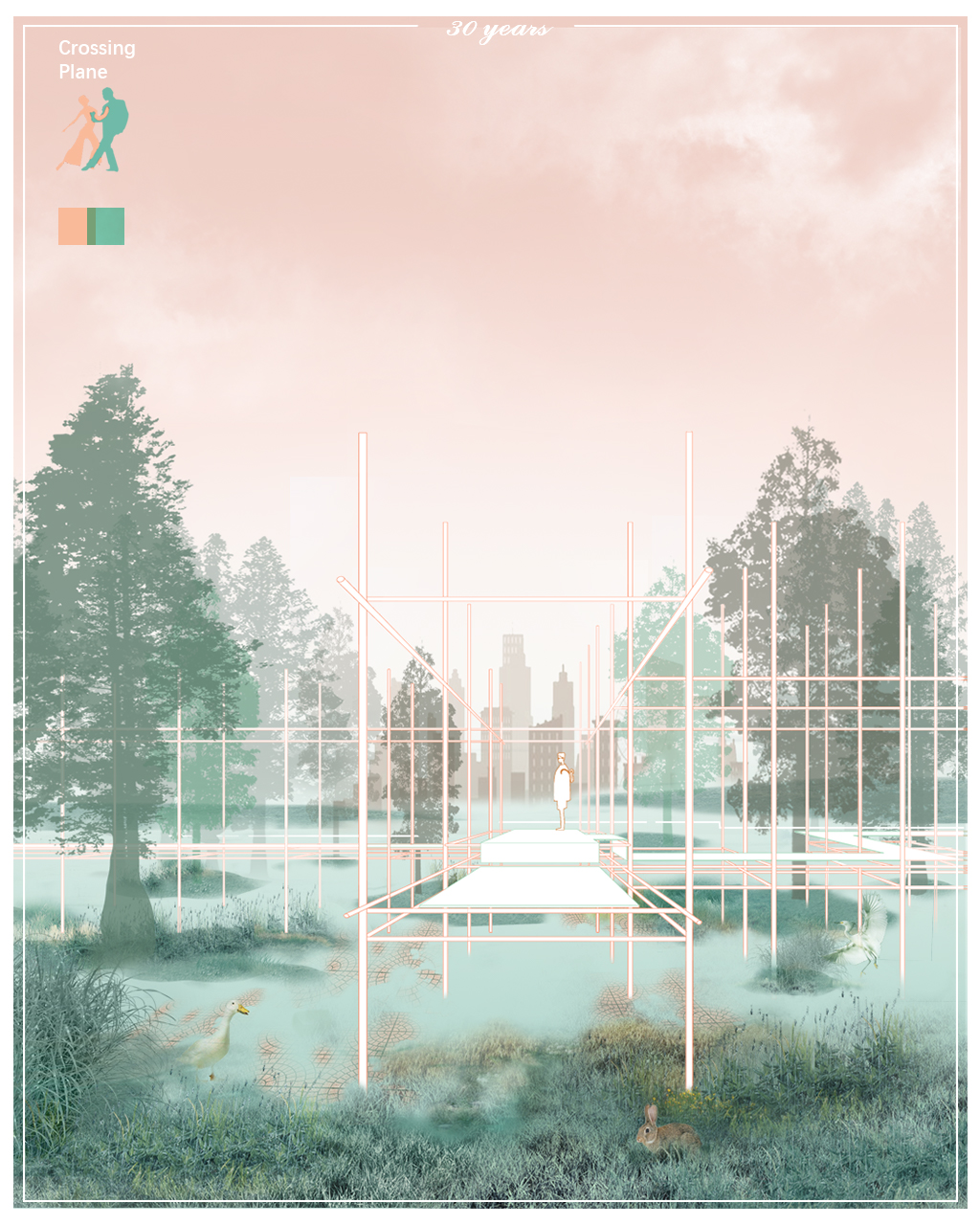
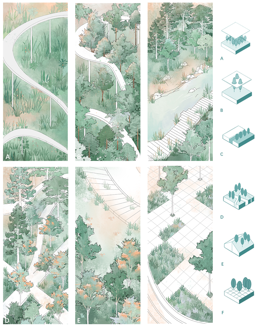
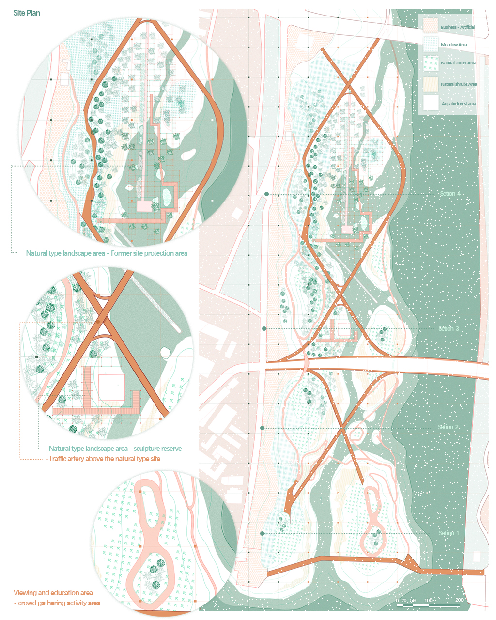
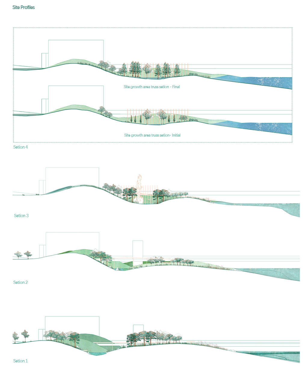
REASEARCH FINALIST PROJECTS
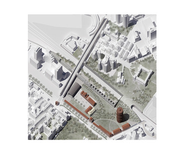
Cecilia Carrioli
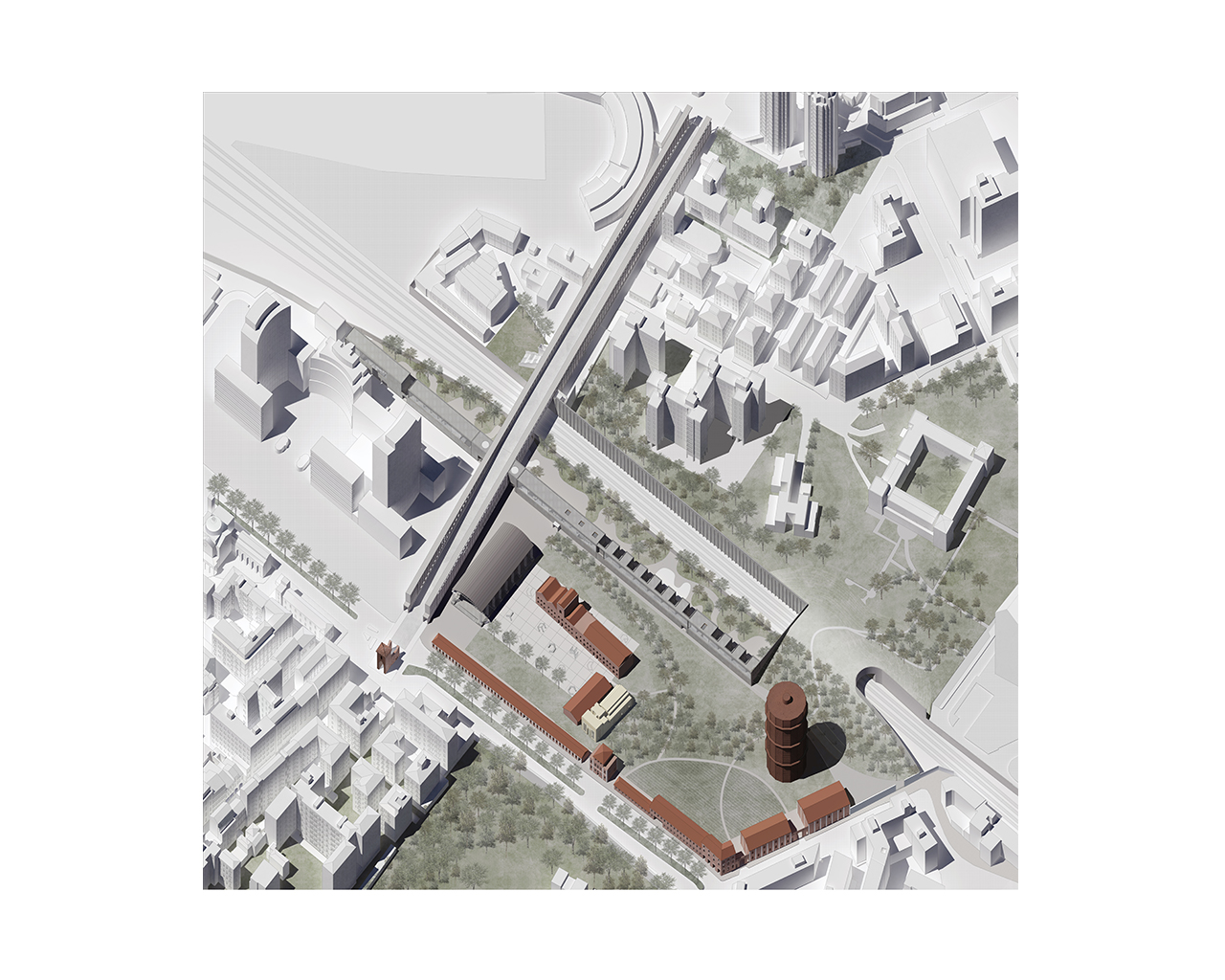
Name / Surname: Cecilia Carrioli
Country:
Team:
Company:
Project Description:
Redeveloping an area such as the former gas works in Bologna inevitably means dealing with
three antithetical systems that live in isolation within the urban fabric: the historic centre, the suburbs, the railway.
The main challenge of the project was to bring these three worlds together through a few signs that arise from reading the existing urban traces. Starting from that specific area the project underwent an almost natural planimetric extension incorporating other parts of the city. To the initial theme of urban redevelopment, which is very broad in itself, were added those of the inclusion of the railway within a wider architectural system, the strengthening of the connection between the historic centre and the suburbs and the redevelopment of Porta Mascarella. The project shows an attempt to order the chaos that characterises several 20th century blocks through an architectural system of inclusion of the railway. The character of this system is delineated by the composition of two urban architectures, conceived as scenic backdrops to the city, two fixed elements on which different situations in Bologna are based. The two project architectures are a cultural centre, running along the area in an east-west direction, and the upgrading of Stalingrad Bridge, north-south direction. In fact, a long portico is designed to stand on either side of the bridge and allow this part of the city to be used by everybody, by walking and bicycle, and not only by car, as it is now. The cultural centre incorporates a series of functions (exhibition hall, classrooms, dormitory for the homeless, conference hall, etc.) that this area lacked. The aim of the project is to bring life back to a part of the city that is now only experienced as a transit area.
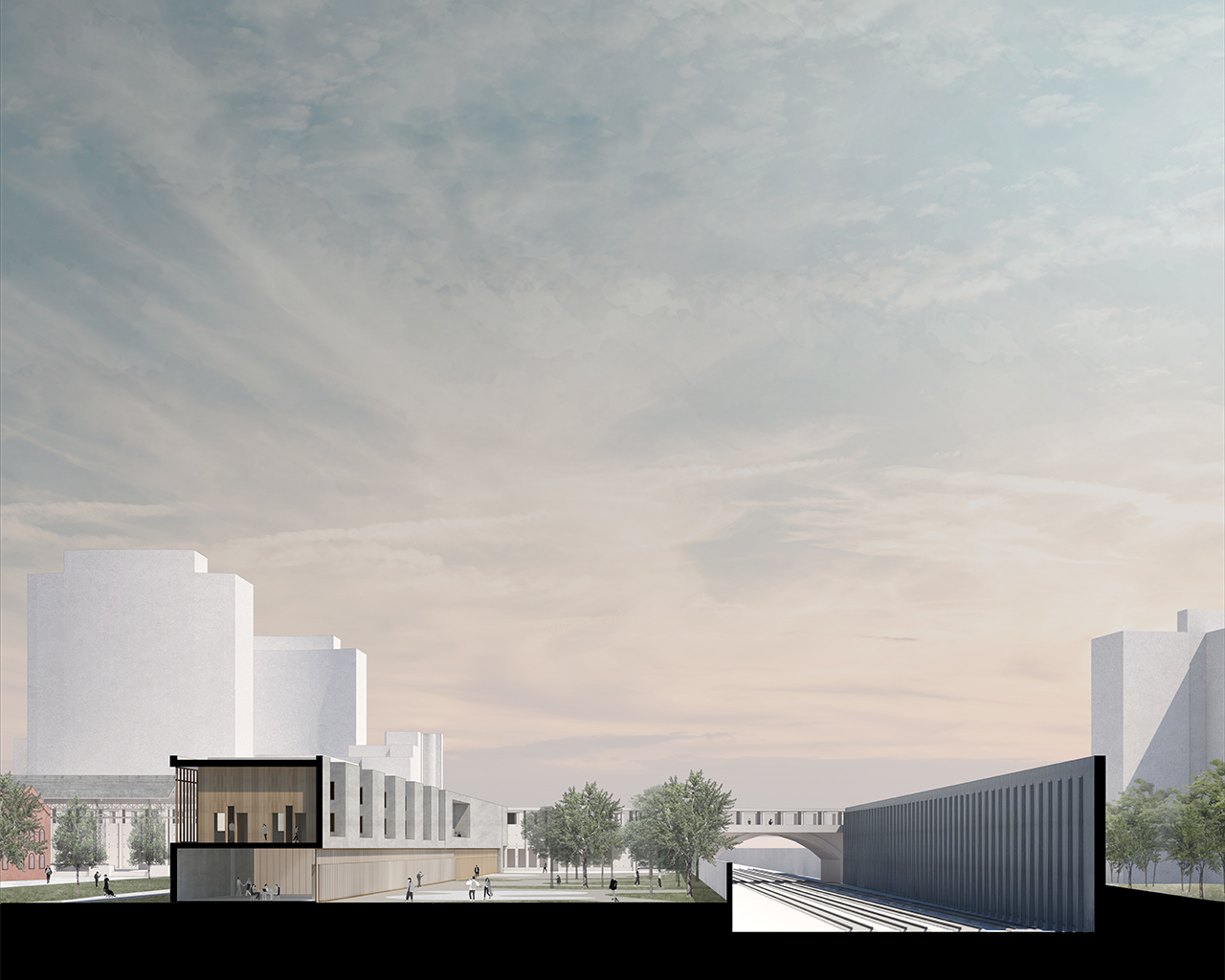
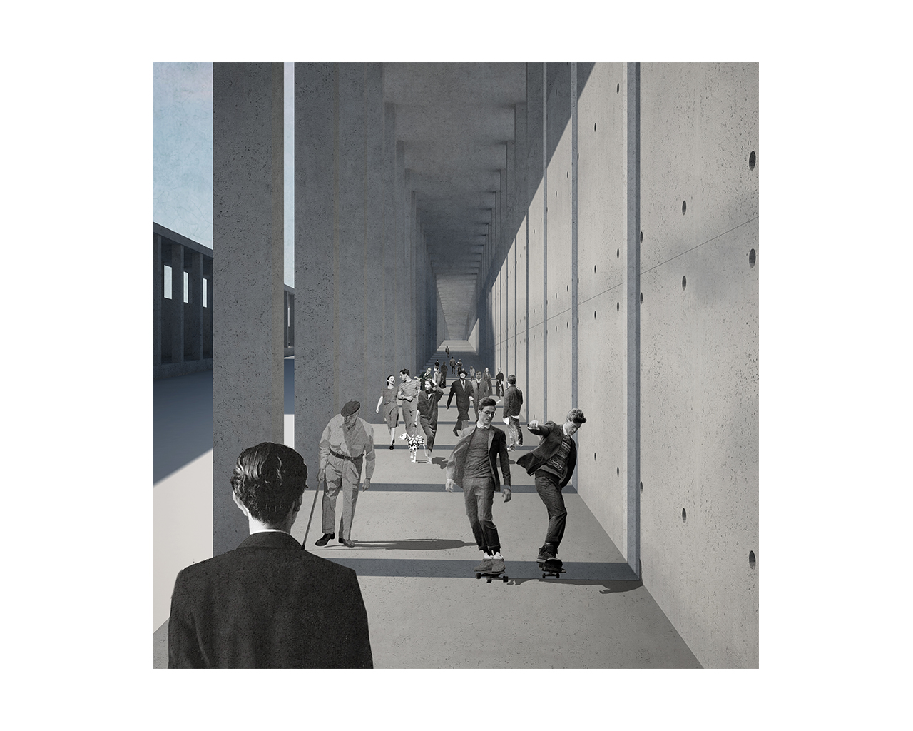
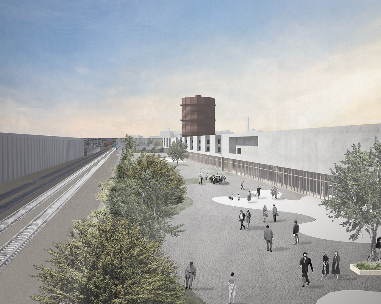
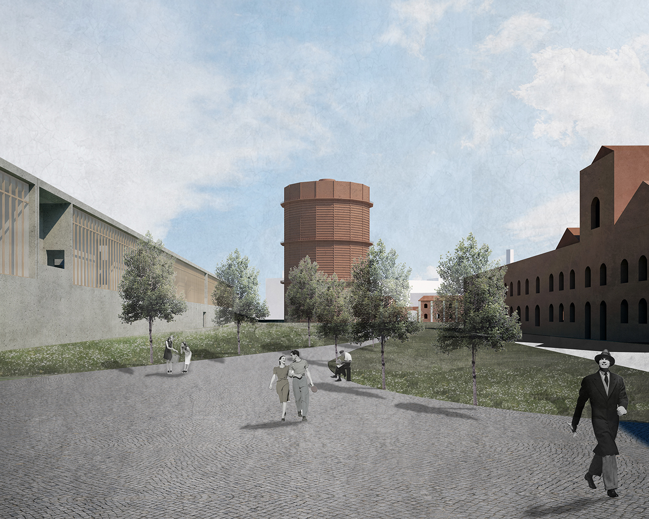
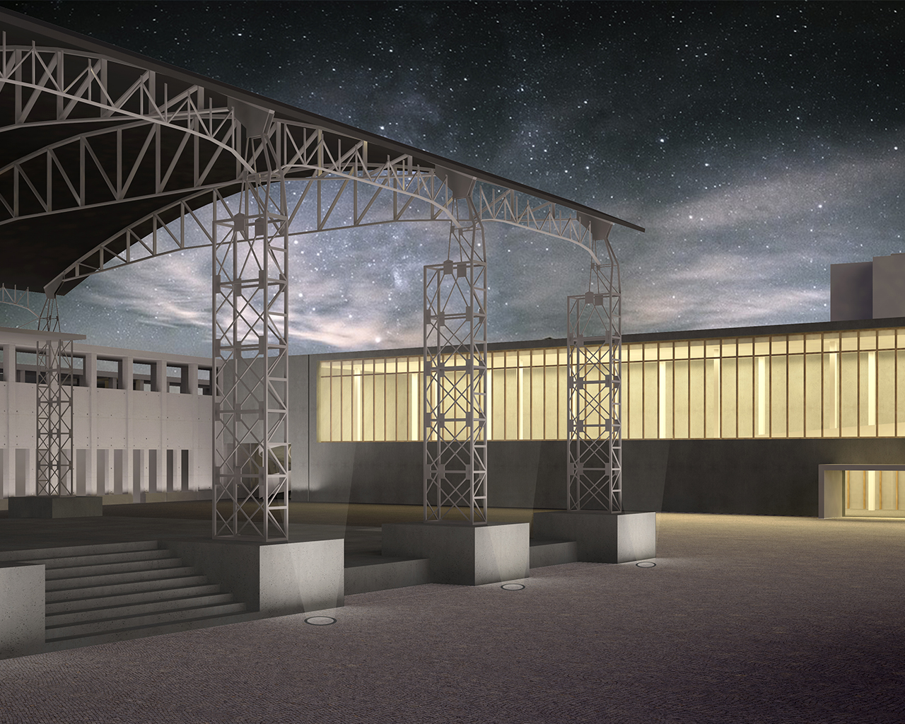
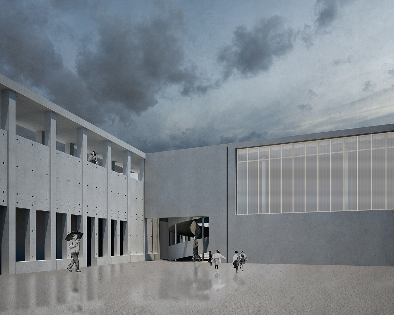
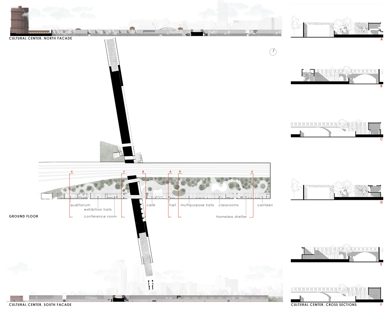
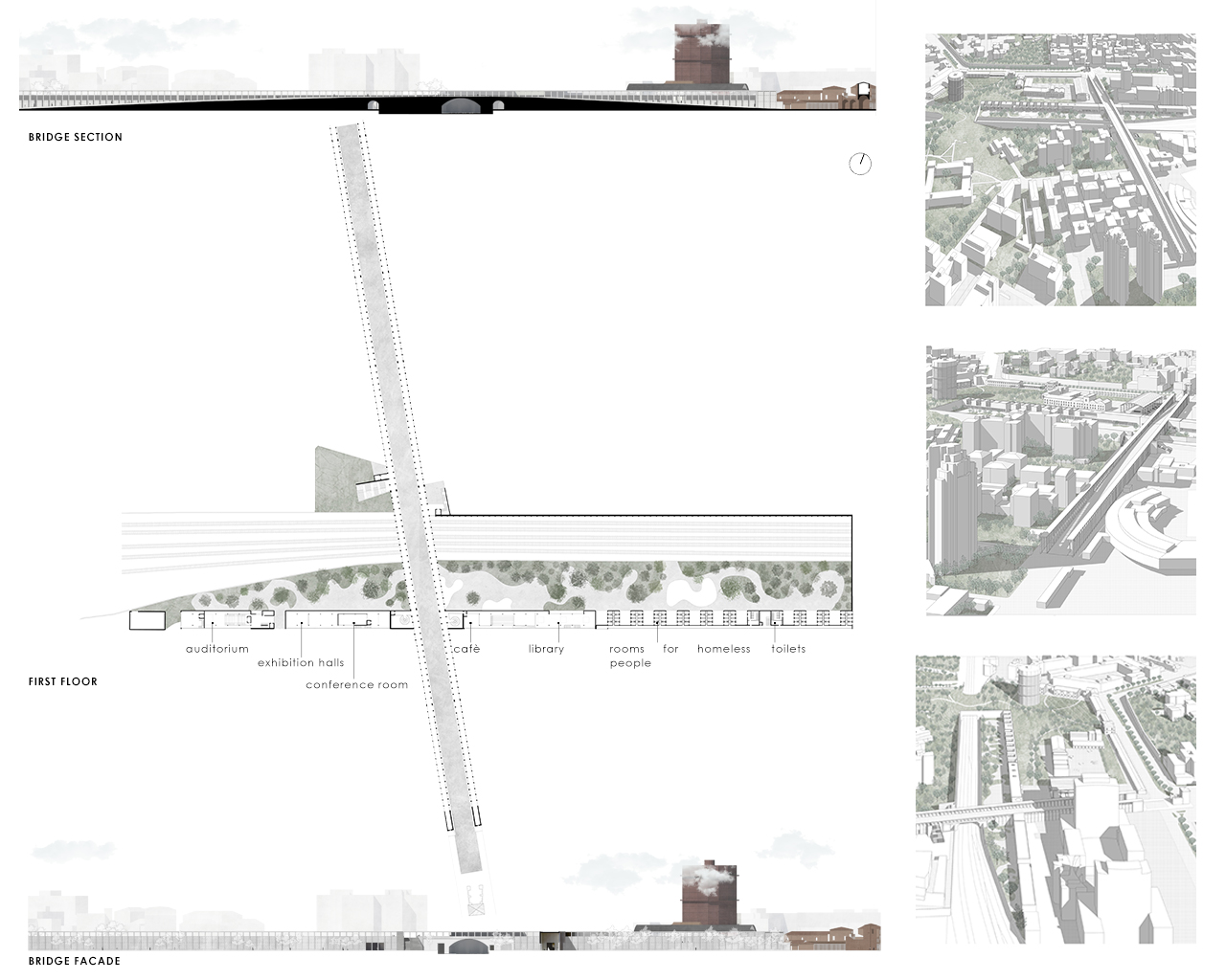
REASEARCH FINALIST PROJECTS
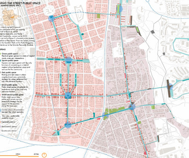
MARCO PROIETTI
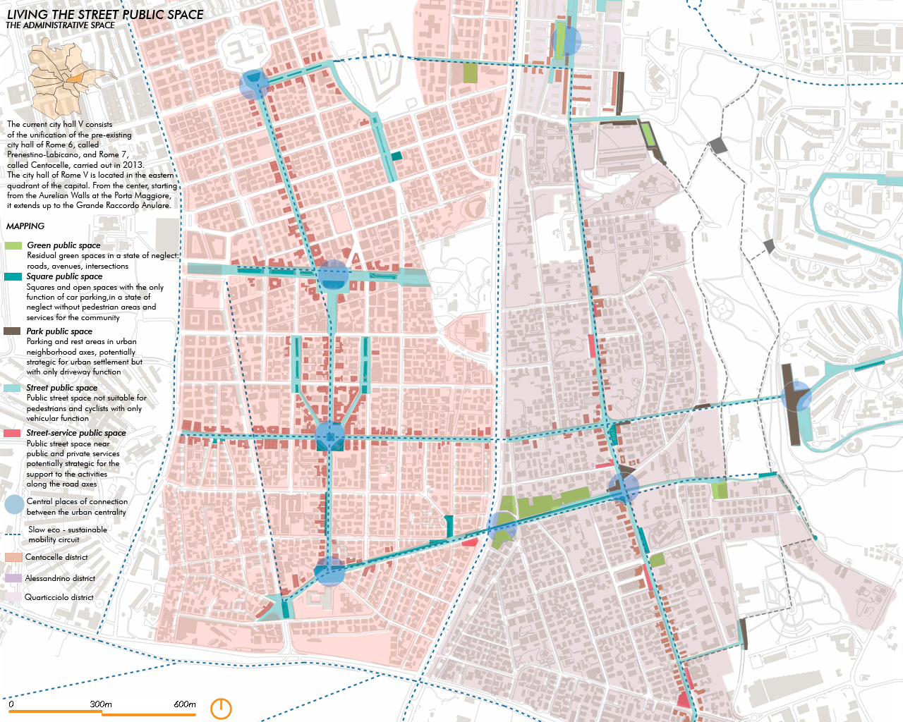
Name / Surname: MARCO PROIETTI
Country:
Team:
Company:
Project Description:
IN THE BOOK “LIFE AND DEATH OF THE GREAT CITIES , 1969”,
JANE JACOBS WRITTEN: "THE STREETS AND SIDEWALKS ARE THE MOST IMPORTANT PUBLIC PLACES OF A CITY AND ITS MOST VITAL ORGANS."
FROM THIS REFLECTION THE RESEARCH PROJECT, CARRIED OUT IN ROME, IS DEVELOPED AN URBAN REGENERATION OF THE STREET PUBLIC SPACE THROUGH TACTICAL URBANISM AND SPATIAL DESIGN INTERVENTIONS TO LIVE THE STREET AS A SOCIAL, DEMOCRATIC AND SUSTAINABLE PLACE FOR CITIZENS.
AT URBAN SCALE ON THE SMART CITY MODEL, THE PROPOSAL PRESENTS THREE MAIN STRATEGIES: “GREEN CONNECTION”, CONNECTION BETWEEN THE NATURALISTIC PARKS AND THE HISTORICAL CULTURAL VALUES OF THE PLACE; “CENTRALITY INTERACTION SISTEM”, INTERACTION BETWEEN DISTRICTS THROUGH THE RE-PROPRIATION OF THE PEDESTRIAN STREET SPACE; “SLOW EVOLUTION”, RE-MENDING OF URBAN FABRICS WITH THE STREET.
AT THE DISTRICT SCALE, THE PROJECT PROPOSES A STREET CONNECTION WITH A SMART ECO-SUSTAINABLE INFRASTRUCTURE SYSTEM, TO BE DISTRIBUTED ALONG THE MAIN PATHS.
THE PURPOSE OF THE STUDY IS TO DESIGN A MODEL-PROTOTYPE FOR MAPPING AND CATEGORIZATION OF THE STREET PUBLIC SPACE, WITH A METHODOLOGY THAT STARTS FROM A CLASSIFICATION OF FIVE POSSIBLE CATEGORIES OF PUBLIC SPACE LINKED TO THE STREET: GREEN PUBLIC SPACE , SQUARE PUBLIC SPACE , PARK(ING) PUBLIC SPACE ,STREET PUBLIC SPACE ,STREET-SERVICE PUBLIC SPACE.
THESE FIVE MACRO CATEGORIES CONTAIN MICRO CATEGORIES OF LOW ENVIRONMENTAL IMPACT INTERVENTIONS, WHICH ARE IN COMPLIANCE WITH THE PRINCIPLES OF NATURE BASED SOLUTIONS.
THE PURPOSE IS TO IDENTIFY PROJECT REFERENCES ON THE METHODOLOGICAL AND OPERATIONAL PLAN THAT CAN BE EXPORTED TO OTHER SIMILAR URBAN CONTEXTS DEVELOPING NEW WAYS TO LIVE THE URBAN STREET SPACE.
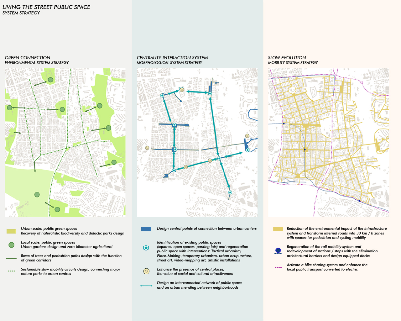
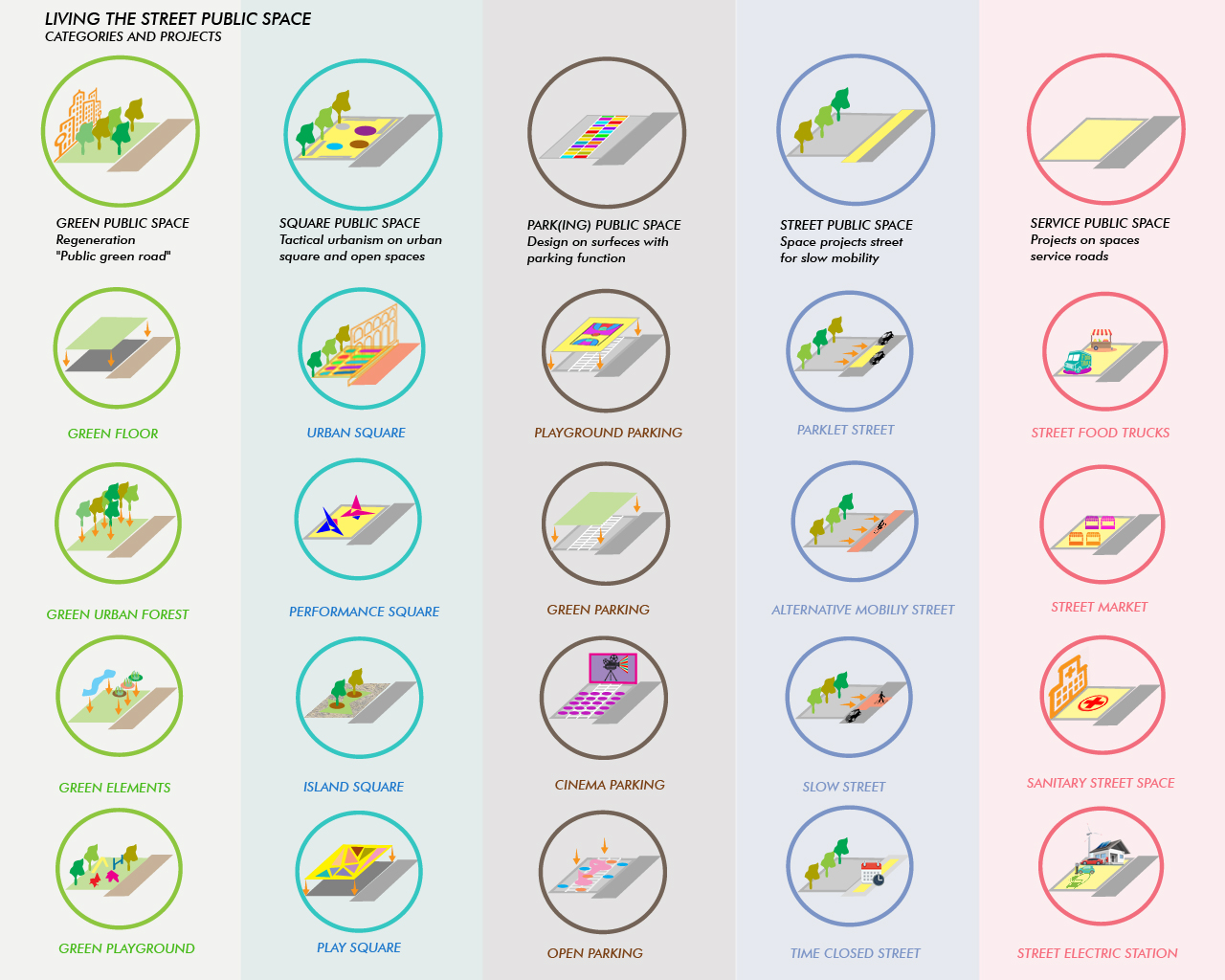
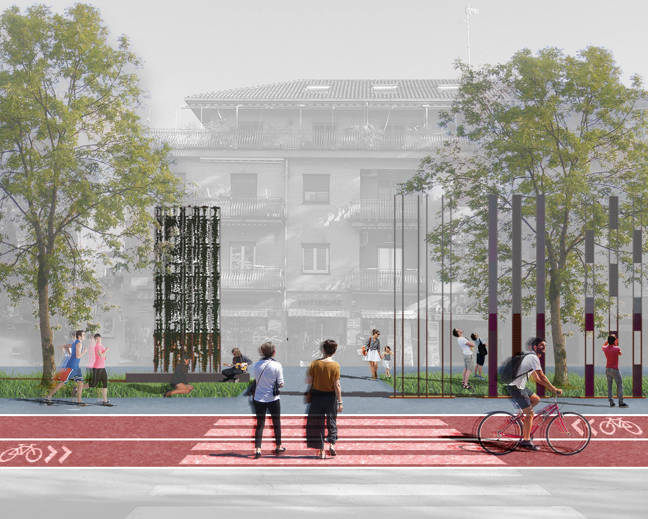
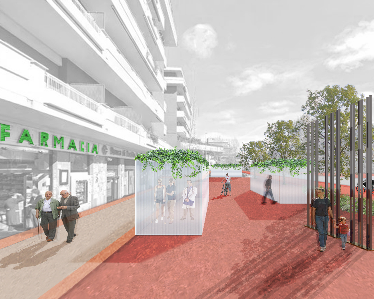
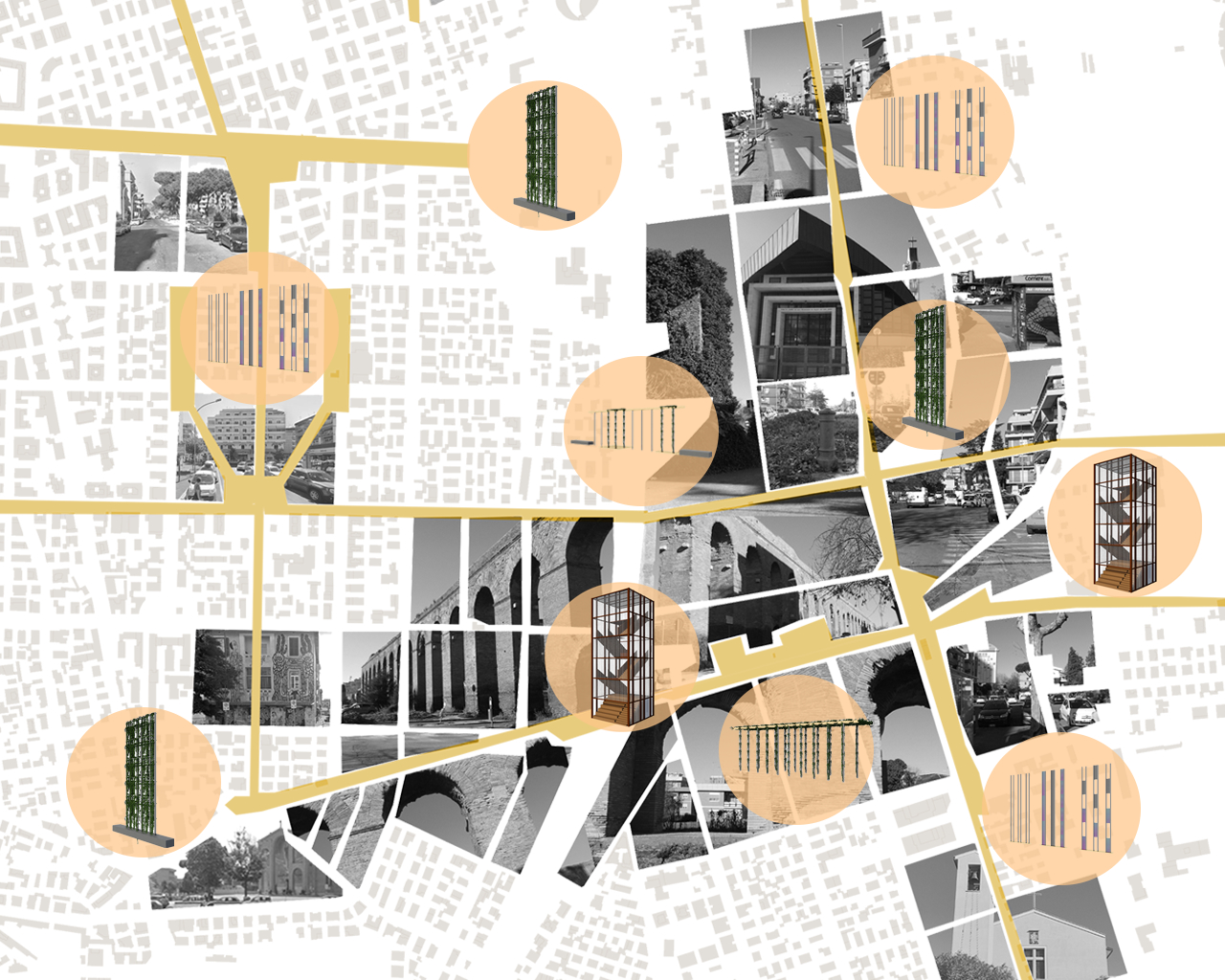
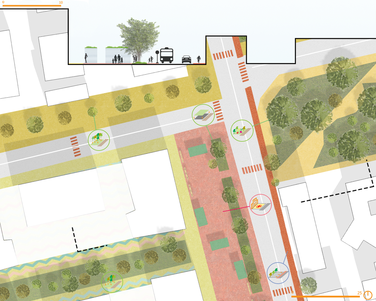
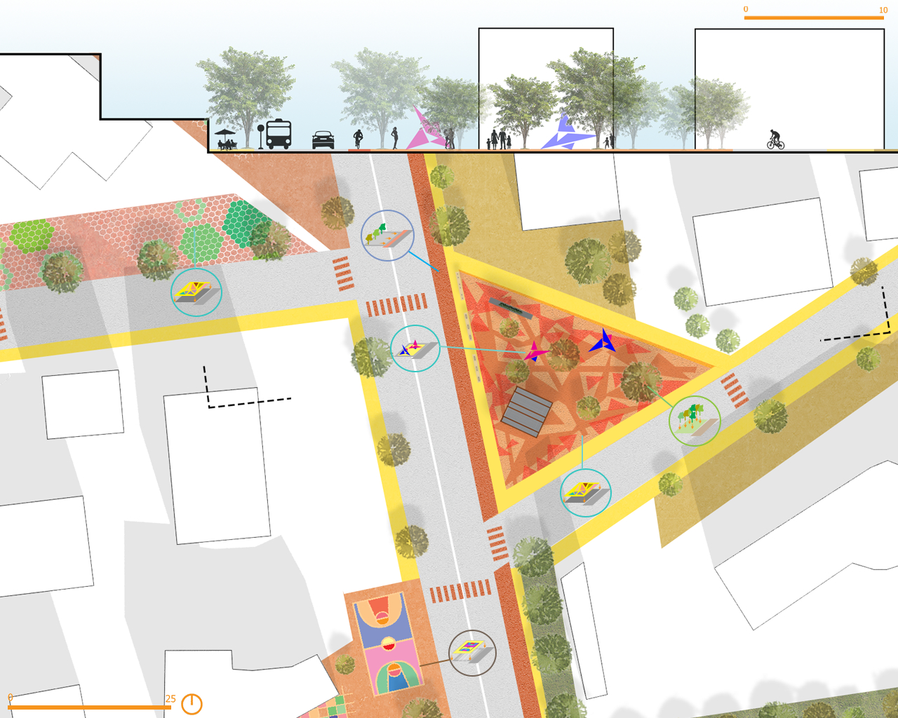
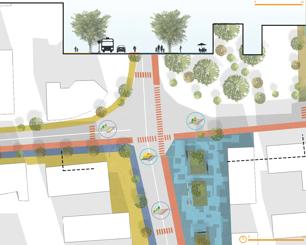
REASEARCH FINALIST PROJECTS
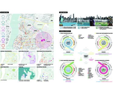
Yang Yang
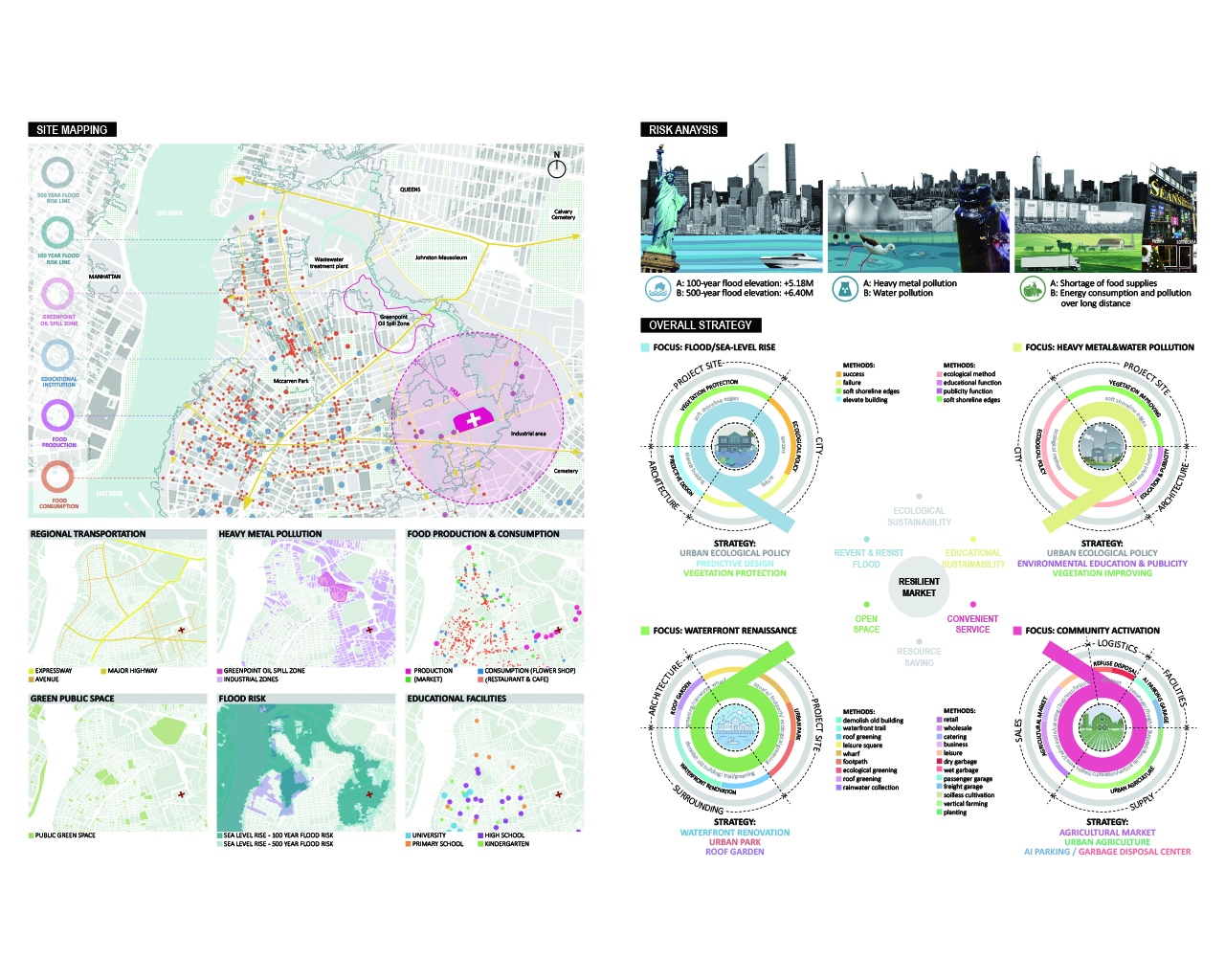
Name / Surname: Yang Yang
Country:
Team:
Company: SHANGHAI URBAN ARCHITECTURAL DESIGN COMPANY LTD
Project Description:
The site, at the end of Newtown Creek in New York, is surrounded by industrial areas and river contaminated with heavy metals, while the area is at risk from rising sea level to regional food shortages. These sturdy industrial buildings are as still as stones, and the water resources are unusable due to pollution. The whole area presents a closed, restrained and dull atmosphere. In addition to macro strategies, architecture also needs to adopt proactive design measures to deal with emergencies.
1. The market is capable of coping with future risks. The use of vegetation along the site and the overall elevation of the building form can avoid the damage caused by 100-year floods while returning the public space above ground to the citizens.
2. The market can accurately grasp part of the needs of the city and society, and create targeted architectural functions through multi-functional integration. The four major functions of modern vegetable market, urban farm, science & education exhibition and waterfront park are put into the project, respectively responding to the problems of site activation, food shortage, heavy metal pollution and lack of open space.
3. The market provides citizens with a variety of spaces, plane forms, situational traffic paths and open spaces to demonstrate an open, free and accessible architectural attitude.
Therefore, the building not only meets the needs of citizens for shopping and parking, but also is much like a porous sponge made up of multiple meridian and collateral channels. Cherishing the spirits of openness, freedom and enthusiasm, it is waiting for the arrival of citizens with open arms. In this place, people have the right to make a choice. Every pathway and space is supposed to have unexpected exchanges and encounters.
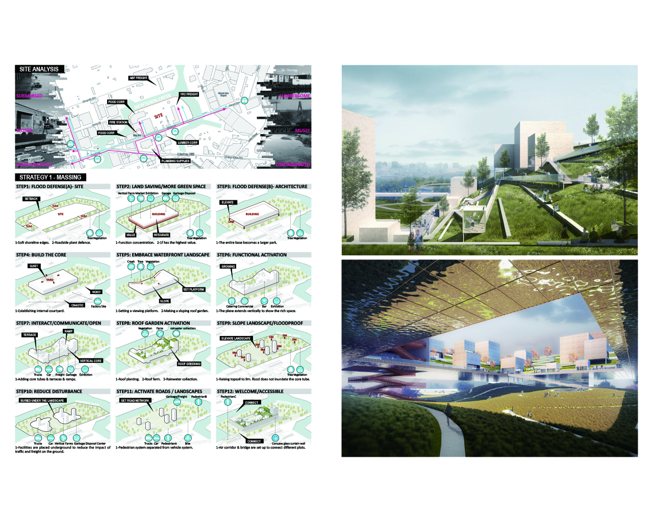
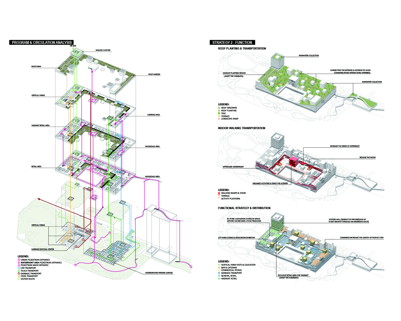
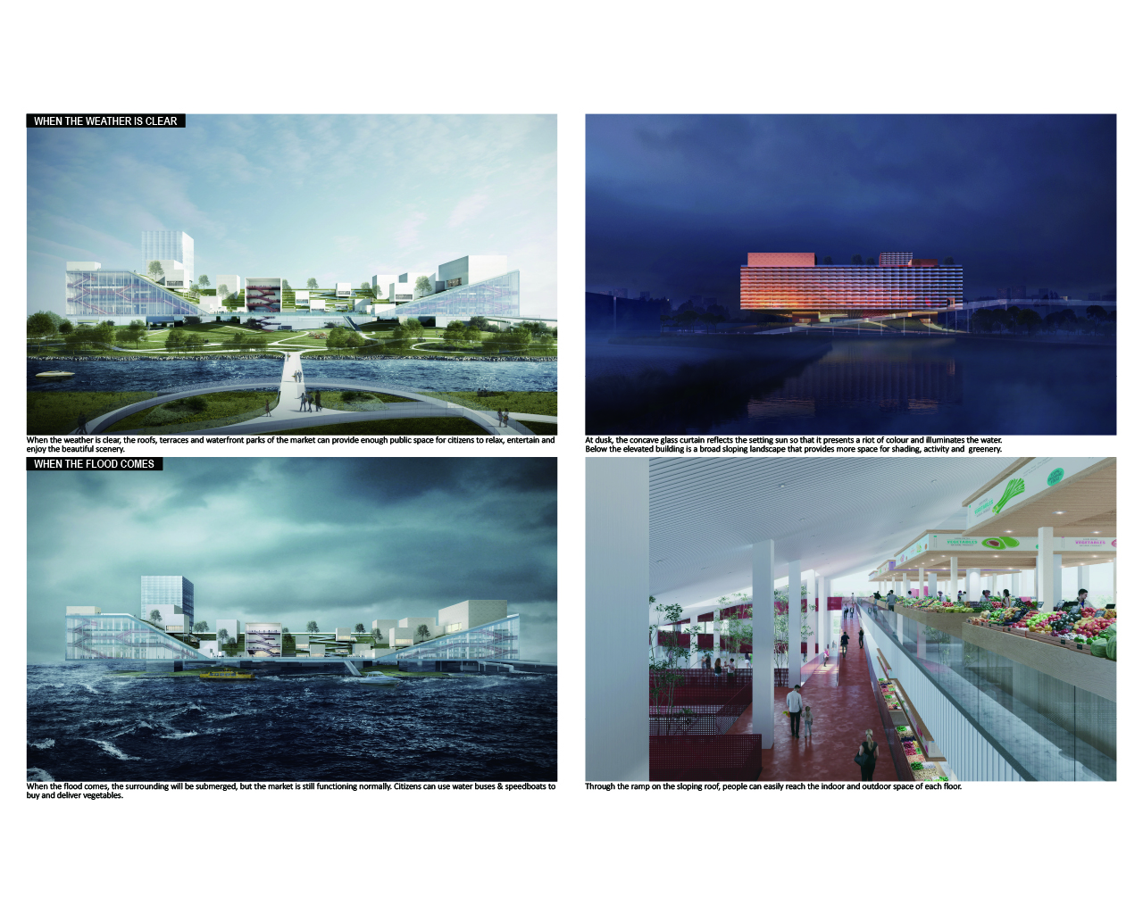
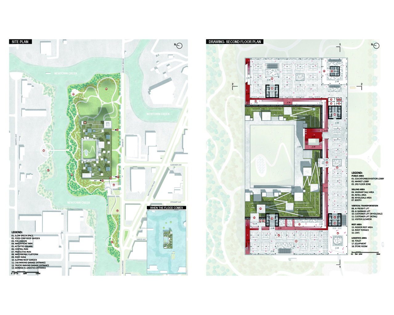
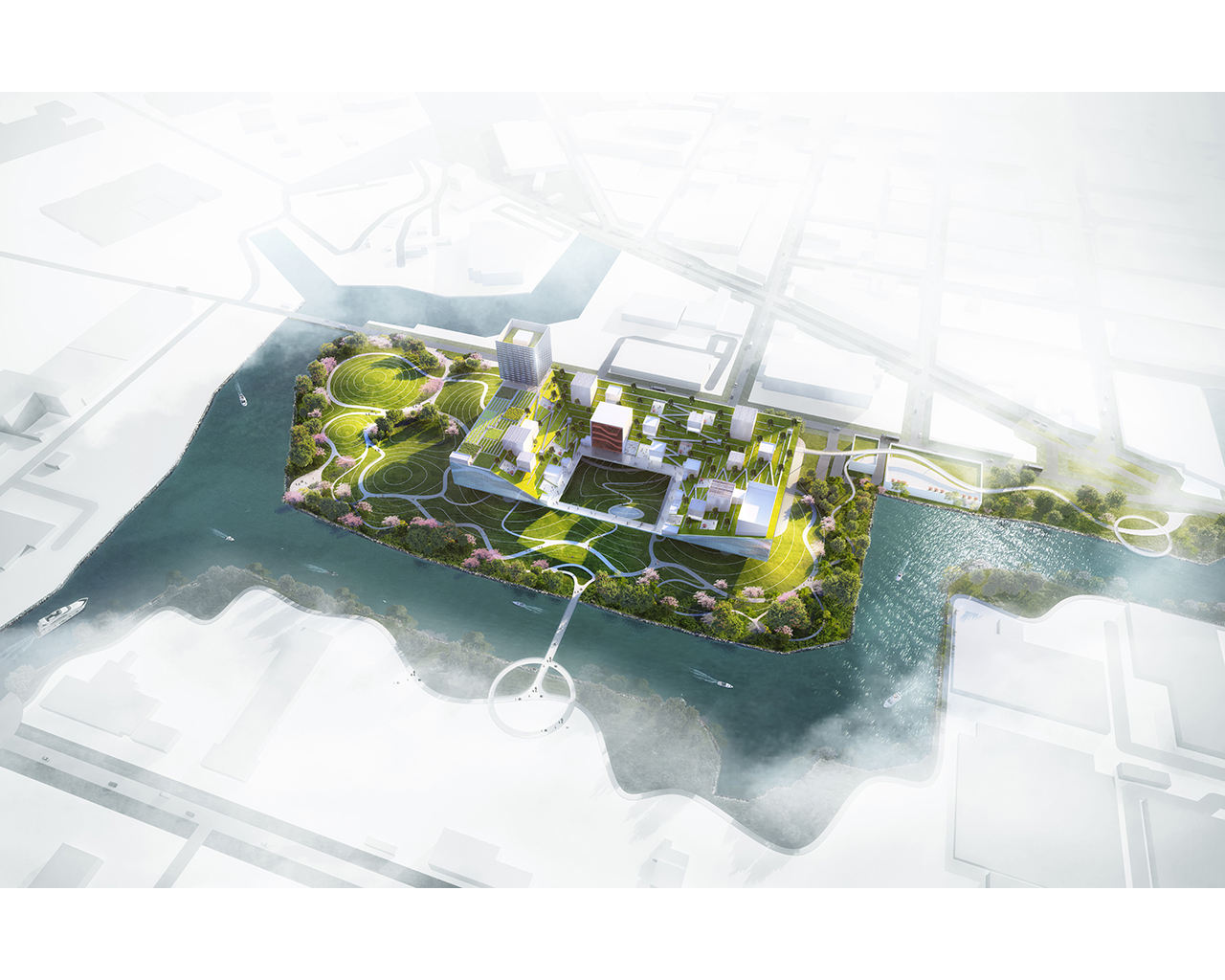
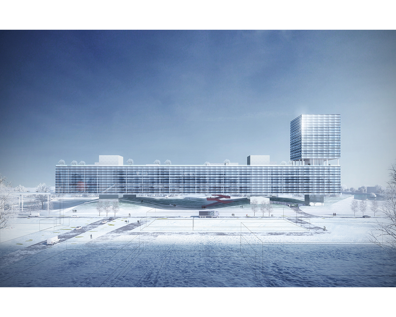
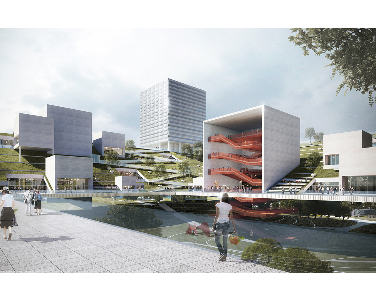
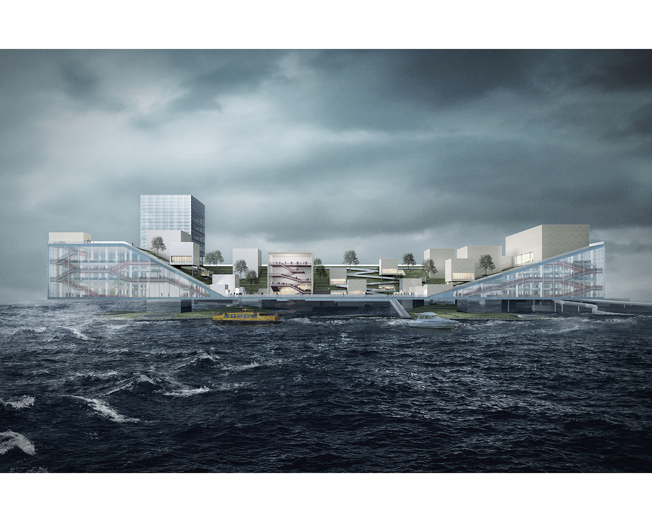
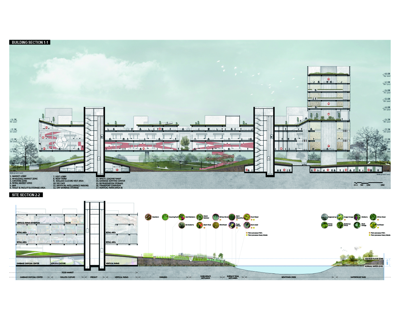
REASEARCH FINALIST PROJECTS
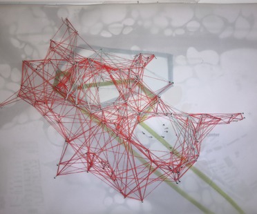
亚强 翟
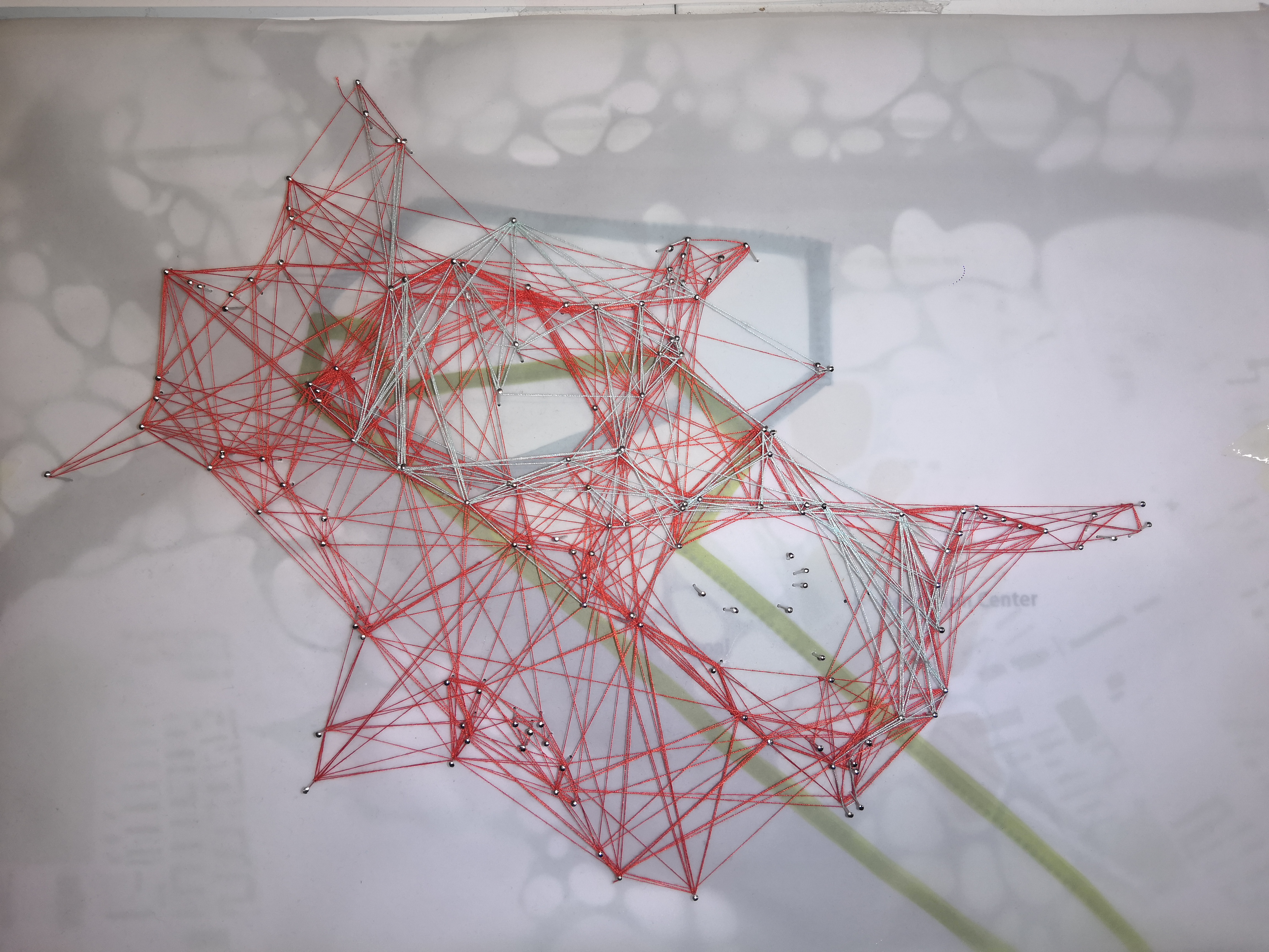
Name / Surname: 亚强 翟
Country:
Team:
Company: 清华大学
Project Description:
As one of the main streams in Beijing, the north canal carries many important functions. Therefore, this design is based on the urban artery.
Since the development of the North Canal, the land around the canal basin has been occupied by construction land, and the green area has been declining. The water quality of Beiyun river system is the worst among all the rivers in Beijing, because it is also the discharge place of domestic sewage in Beijing. With the hard pavement around the river, the original organisms in the canal basin have been persecuted due to the deterioration of the environment, resulting in the reduction of biodiversity in the basin. Bivalve, a kind of fish originally born in the North Canal, once bred a large number of fish in the North Canal as its model producing area. However, with the invasion of hard pavement, the living space of bivalve, the companion species of bivalve, has been continuously reduced and gradually disappeared. In recent years, Bivalve has also disappeared in the canal flow area. At the same time, as a satellite city of Beijing, Tongzhou's environmental carrying pressure is increasing. Tongzhou District carries a lot of heavy industry and chemical industry in Beijing, so the industrial pollution is serious, and the ecological damage is more and more serious.
In a word, the environmental problems in the North Canal basin are prominent, the artificial land is growing rapidly, the floodplain area is basically banned, and with the expansion of the scope of human activities, the scope of biological activities is constantly squeezed,
In view of the above problems, we hope to dredge the urban context, river context, and improve the environment of the North Canal,
Through the form of capillary channel to solve the above problems.
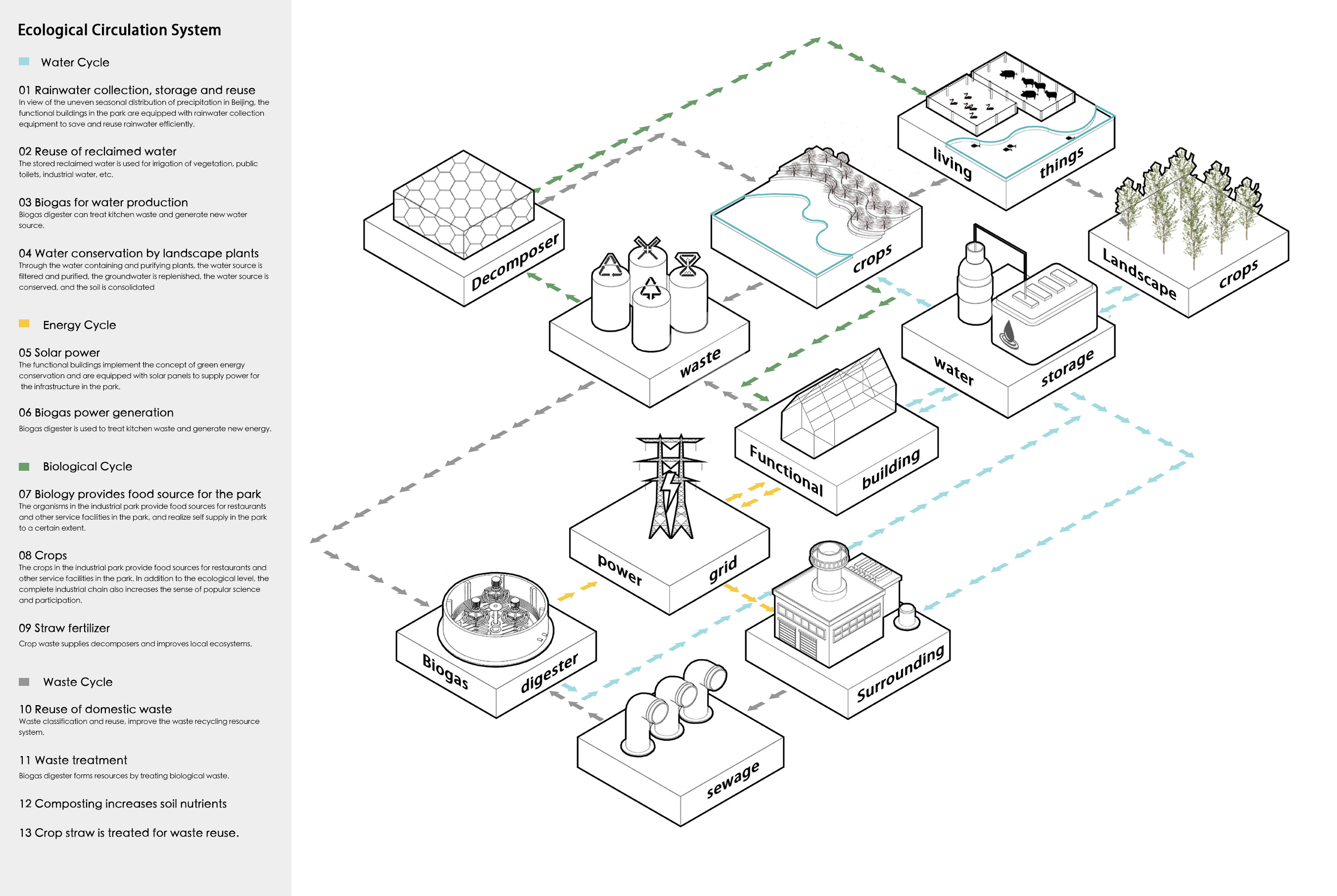
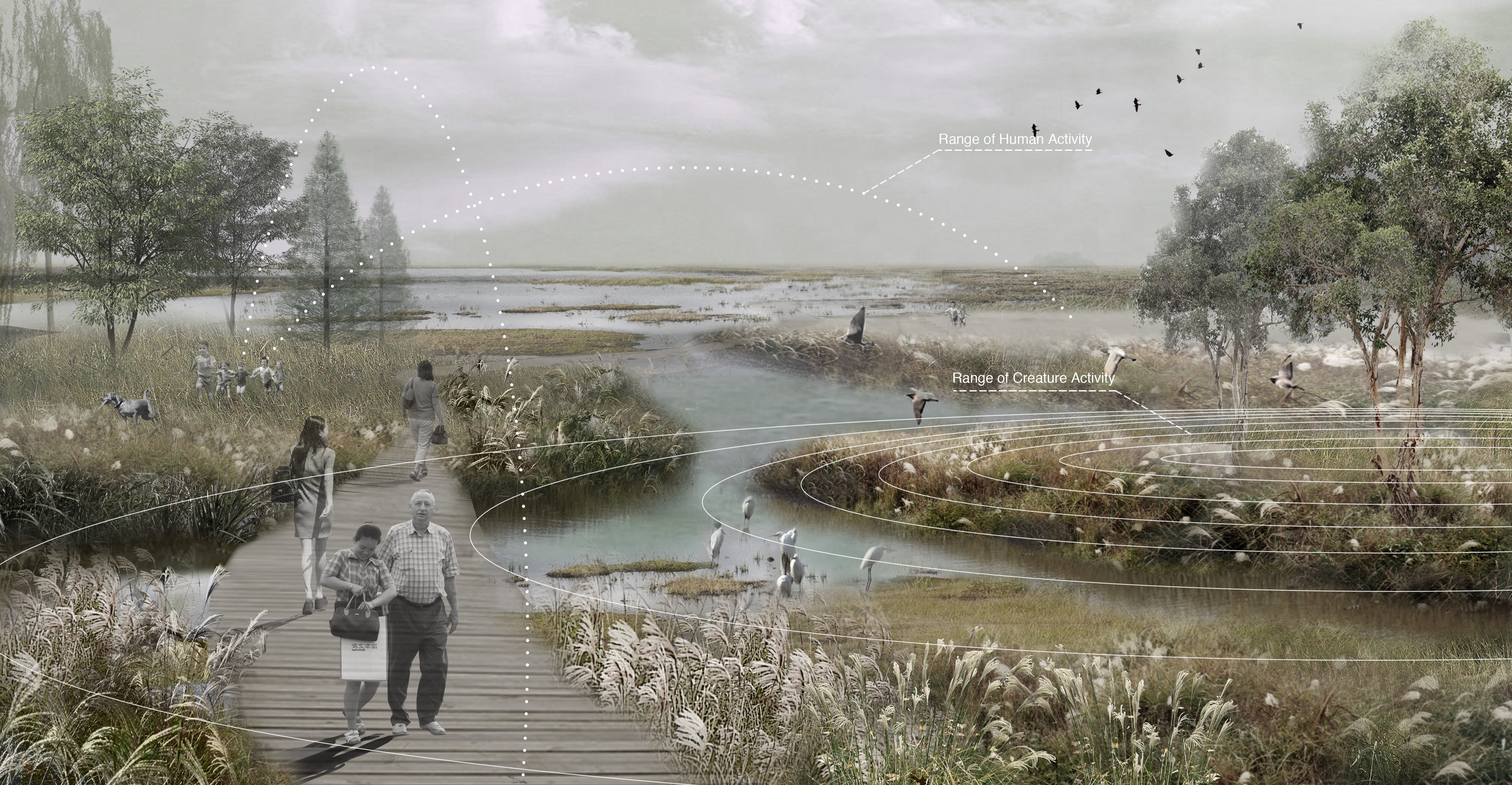
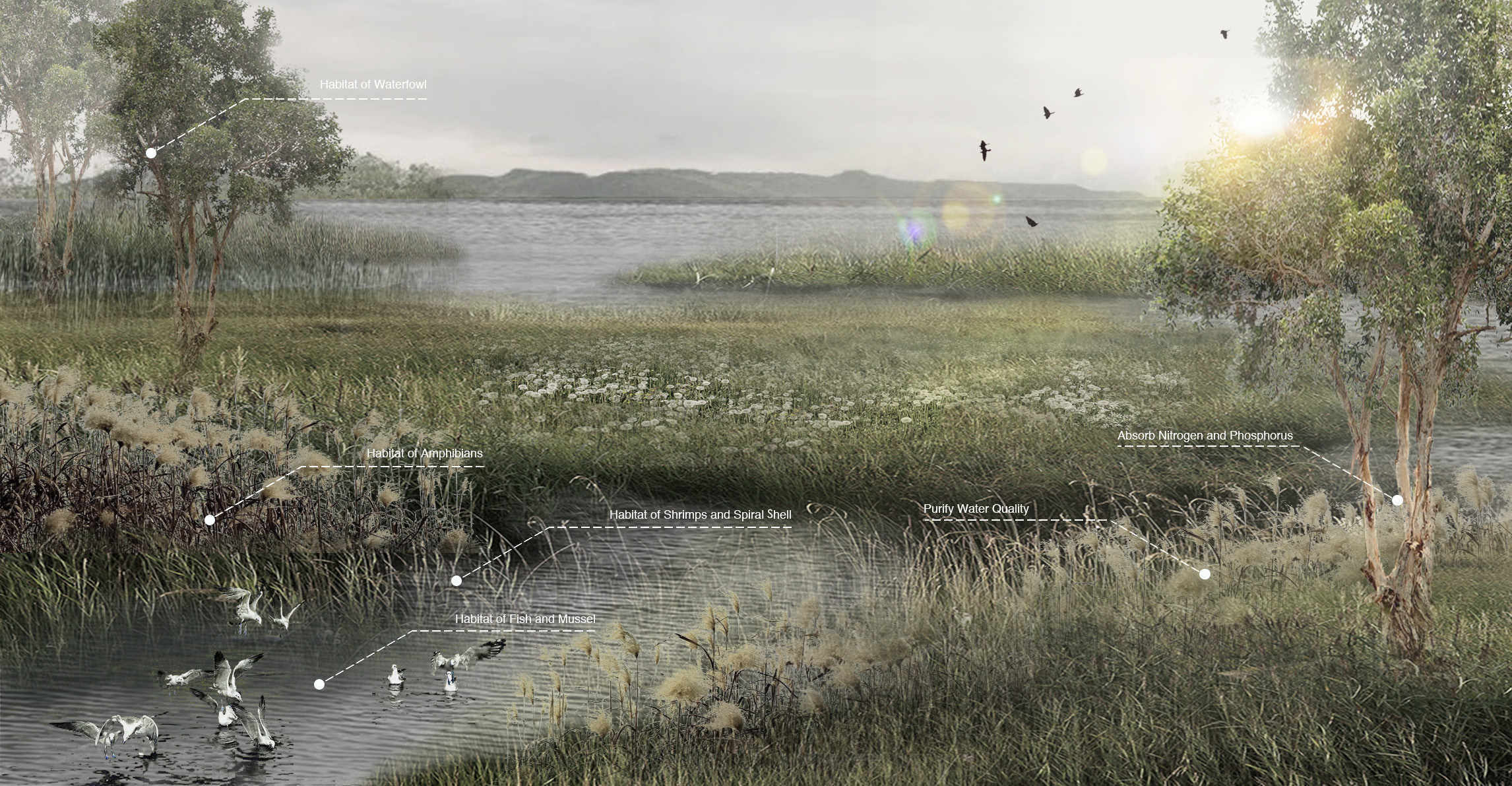
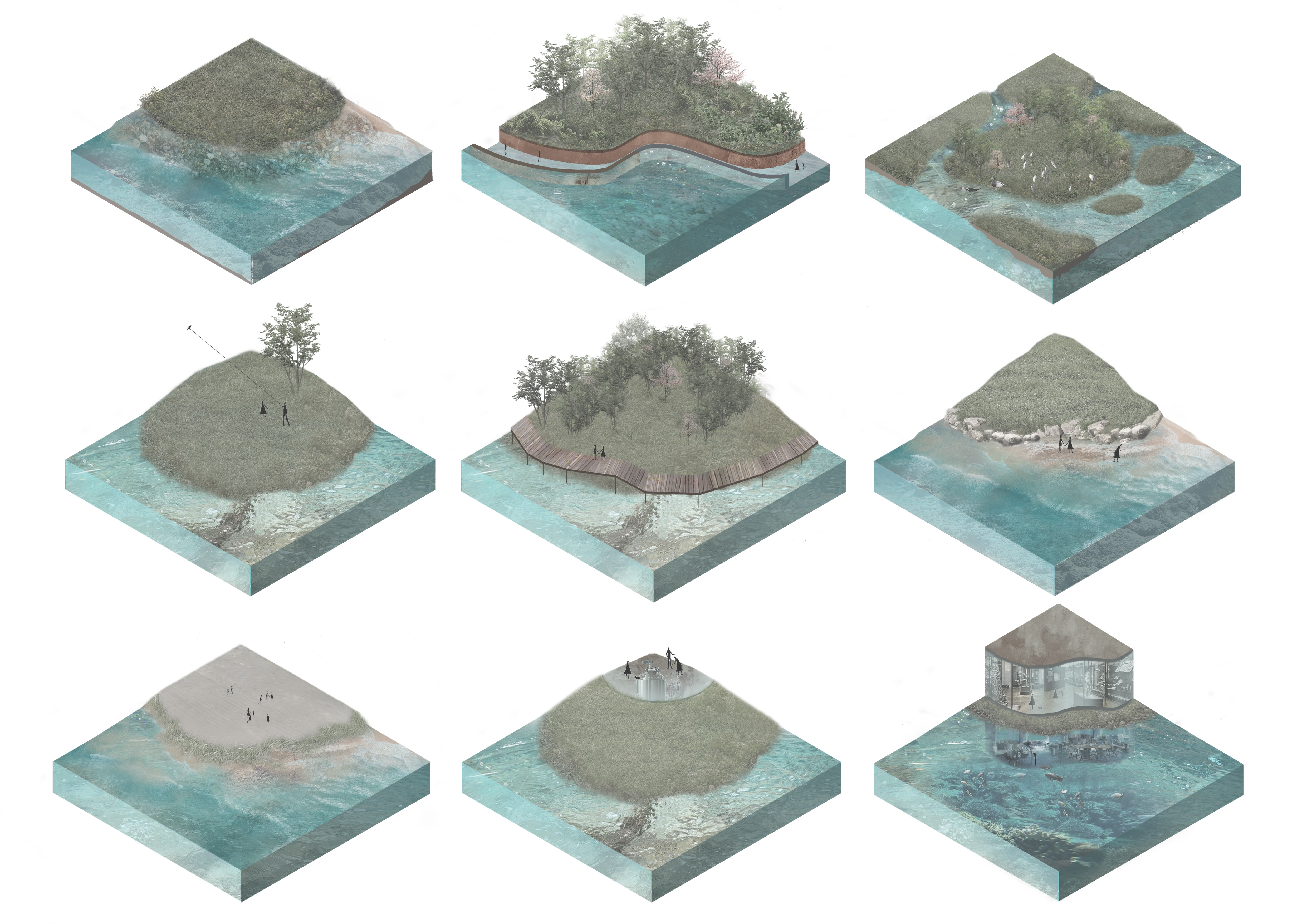
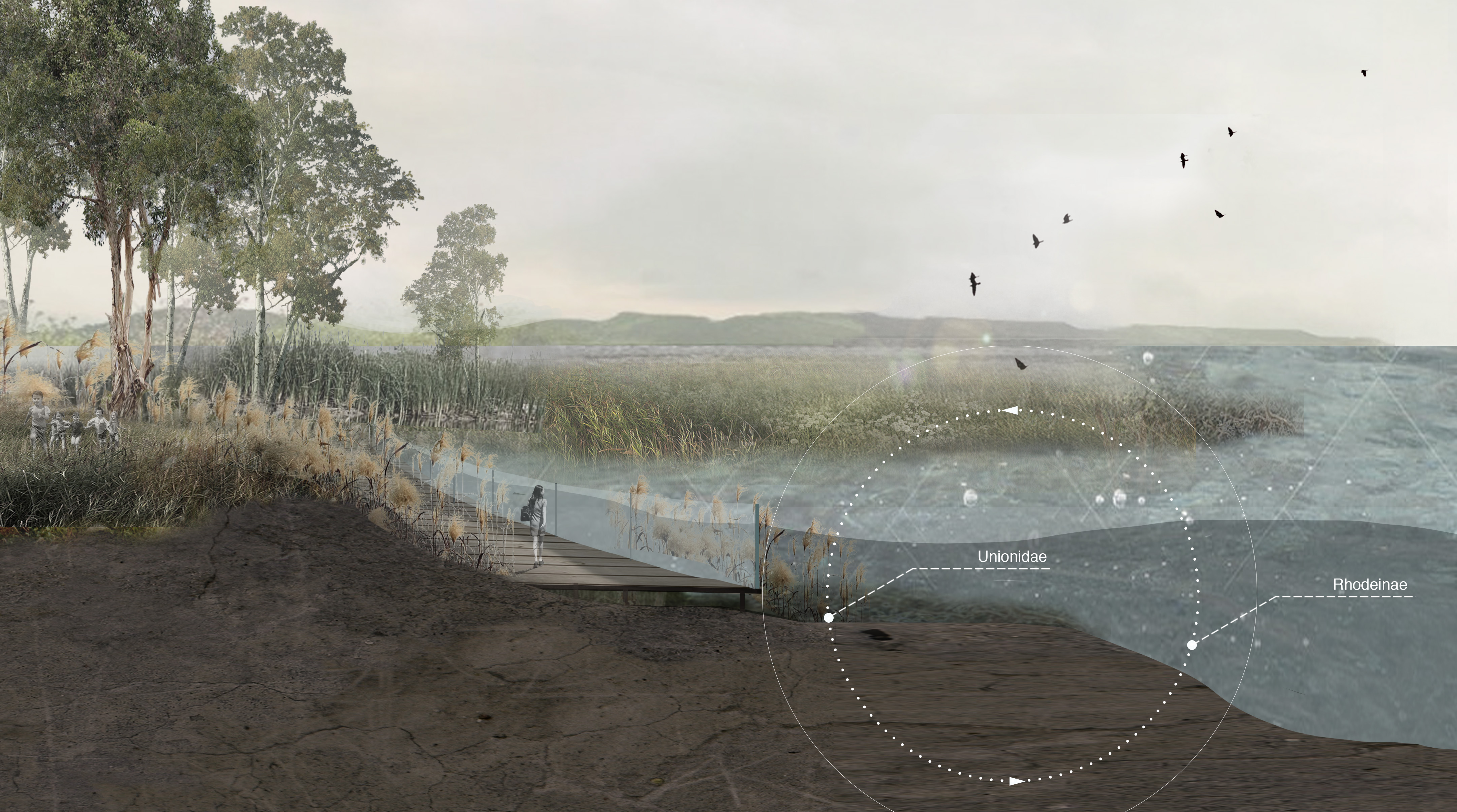
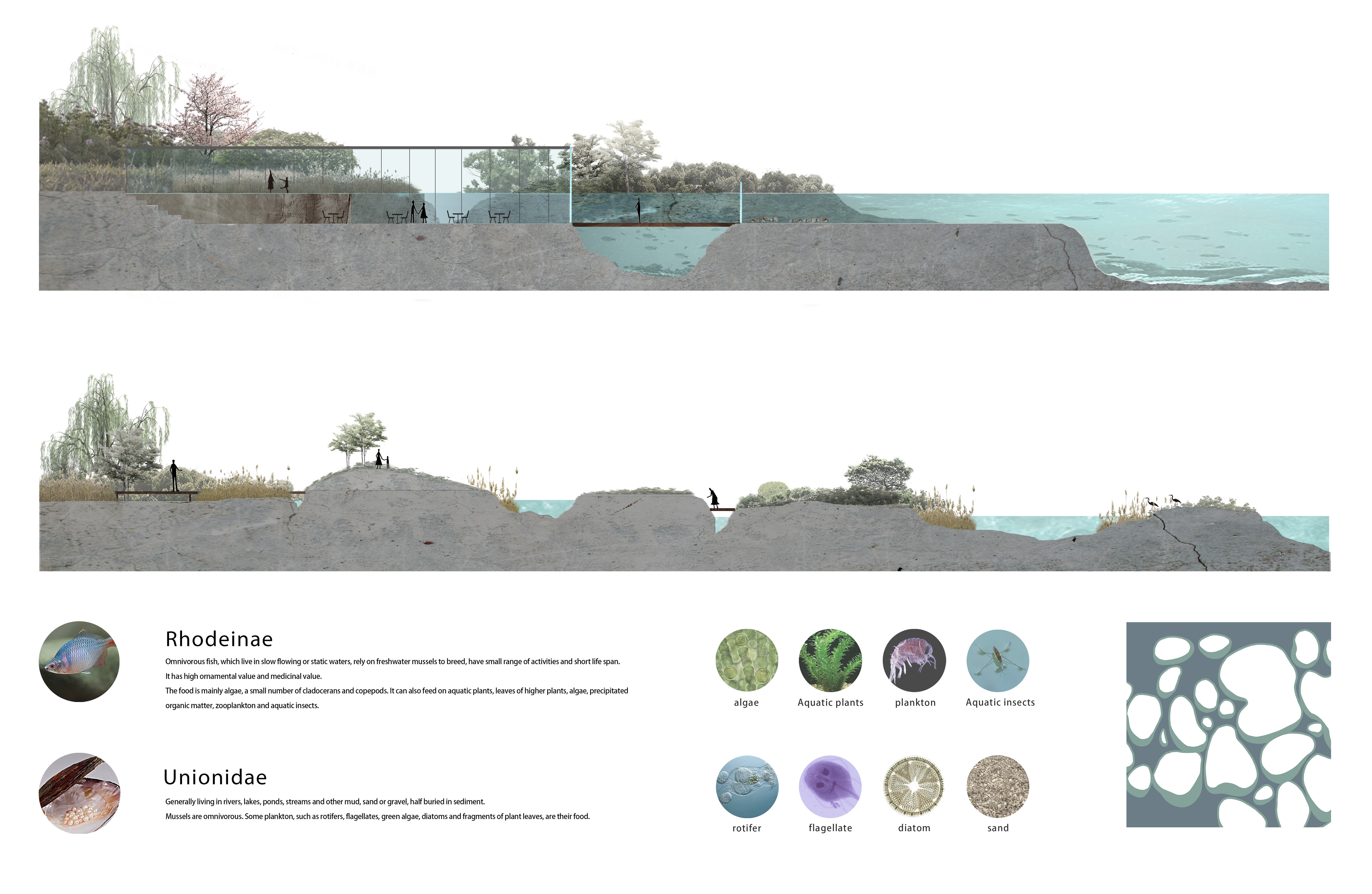
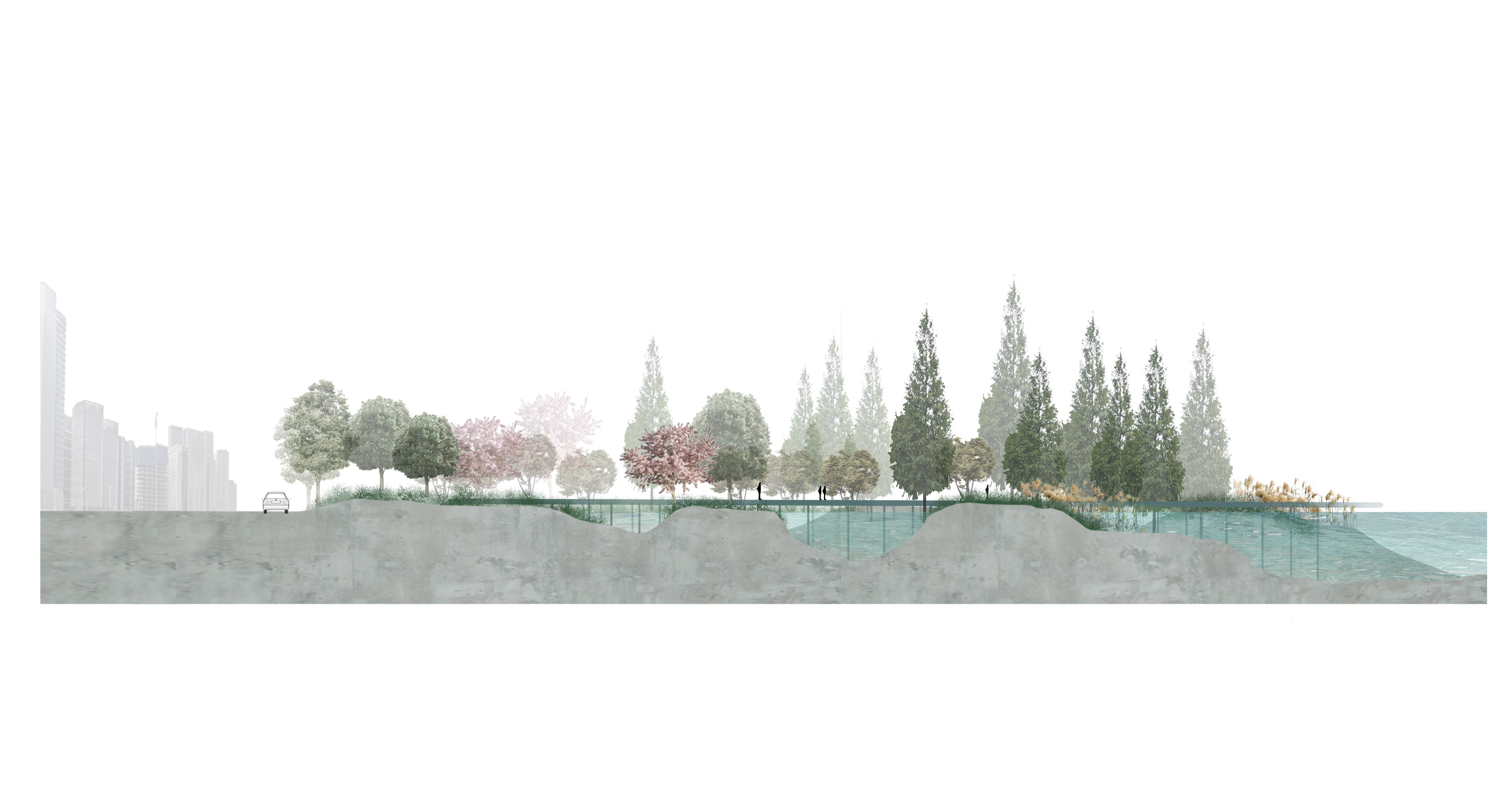
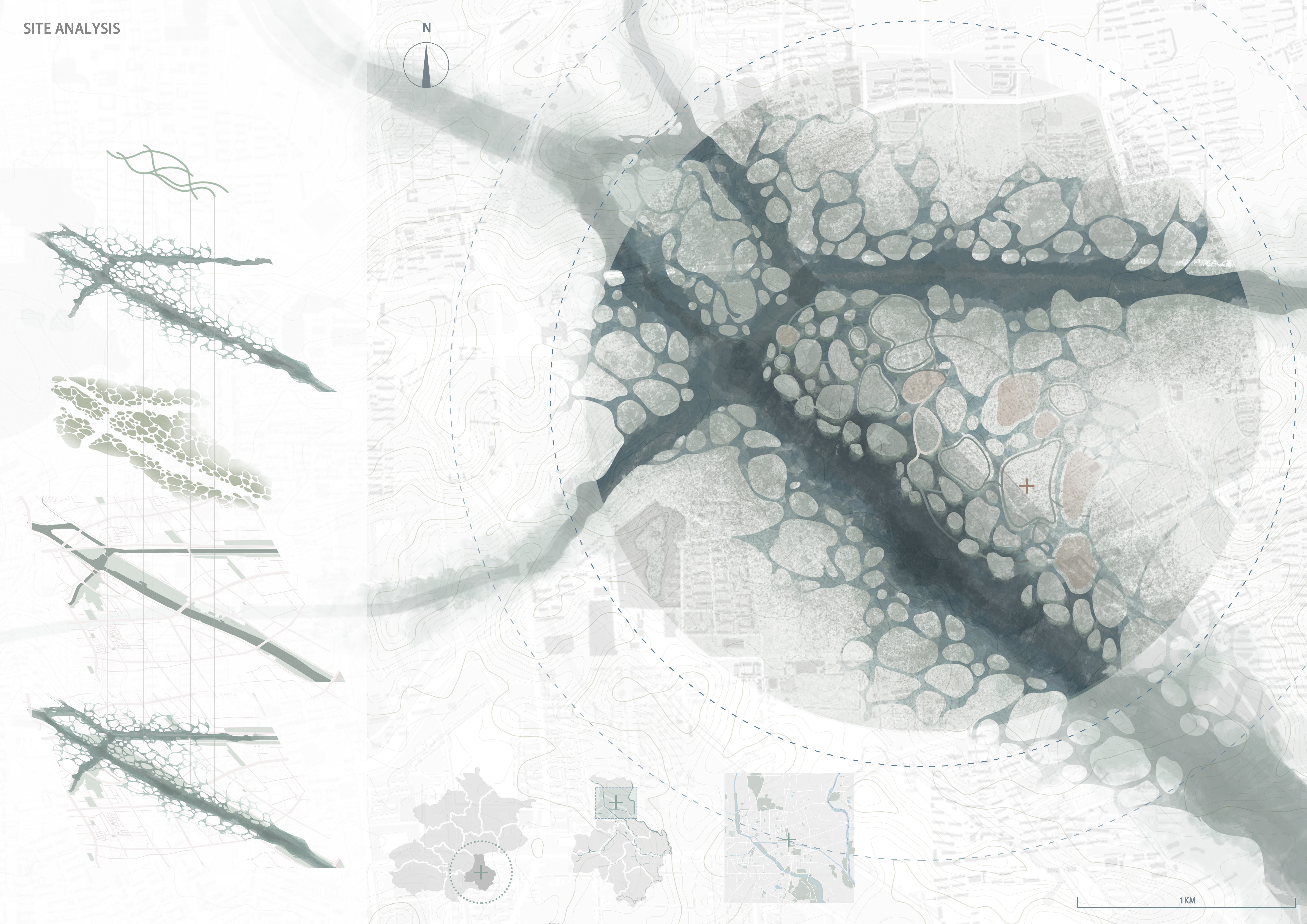


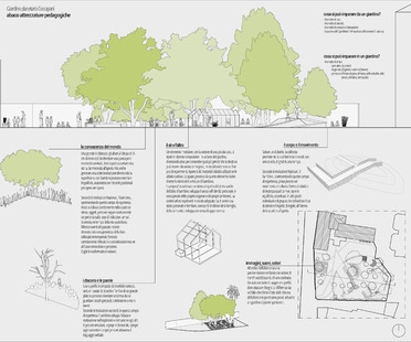
2020
Le projet Planetary Garden de Bruna Sigillo remporte le Next Landmark 2020
La neuvième édition de NextLandmark - le concours international pour architectes et designers organisé par la Fondation Iris Ceramica Group et par Floornature, le portail d’arch
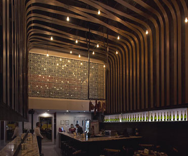
2018
Les lauréats de Next Landmark 2018
Les architectes Urbánika et Roland Baldi ont été récompensés dans l’amphithéâtre de FICo, le « plus grand parc agroalimentaire au monde &raq
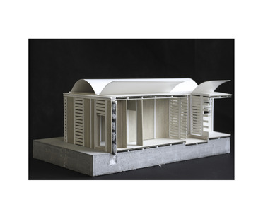
2019
A Common Line For The Reconstruction de Lorenzo Abate lauréat de Next Landmark 2019
Lorenzo Abate a remporté le concours Next Landmark 2019 avec un projet de reconstruction écologique d'après-guerre développé dans le contexte syrien qui constitue un
2017
Les lauréats de Next Landmark Architectural SKIN
Gregory Lacoua et ellevuelle Architetti, voilà les lauréats de la sixième édition de Next Landmark, le concours international organisé par Floornature, le portail d'
2018
Les lauréats de Next Landmark 2018
Les architectes Urbánika et Roland Baldi ont été récompensés dans l’amphithéâtre de FICo, le « plus grand parc agroalimentaire au monde &raq
2016
Giancarlo Mazzanti: Marinilla Educational Park, Colombie
Avec le Marinilla Educational Park, Giancarlo Mazzanti remporte le prix Next Landmark 2016. Mazzanti poursuit sa recherche consacrée à la valorisation du lieu public comme lieu social. M
2017
Les lauréats de Next Landmark Architectural SKIN
Gregory Lacoua et ellevuelle Architetti, voilà les lauréats de la sixième édition de Next Landmark, le concours international organisé par Floornature, le portail d'
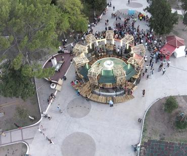
2015
Urban Spa : un atelier de PKMN en collaboration avec les étudiants de Chihuahua
Lauréat du concours Next Landmark 2015 (catégorie Landmark of the Year), le projet Urban Spa est le fruit de l’atelier du cabinet PKMN avec les étudiants de l’ISAD de Chihuahu
2016
Giancarlo Mazzanti: Marinilla Educational Park, Colombie
Avec le Marinilla Educational Park, Giancarlo Mazzanti remporte le prix Next Landmark 2016. Mazzanti poursuit sa recherche consacrée à la valorisation du lieu public comme lieu social. M
2014
La Casa Esse d’Ellevuelle architetti remporte le Next Landmark 2014
La troisième édition du concours international d’architecture organisé par Floornature, Next Landmark, vient d’être remportée par les Italiens d’Ellevuelle arch